
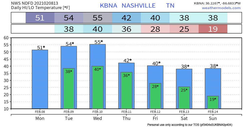
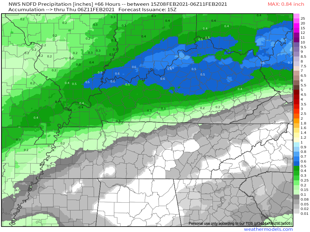
A drizzle or two is possible Tuesday and Wednesday but most of the precip should pass north and northwest of us. Below is the forecast for total rainfall Tuesday through Wednesday night at midnight:
Cold, Steady Rain Thursday
A heavier, steady rain event is expected here Thursday, pushed along by a cold front. It’ll be a cold rain.
Probably a cold rain.
“Probably.”
What about wintry chances?
In northern zones, temps will cool near or below freezing , bringing chances not only for a rain/snow mix but even some freezing rain/sleet if the GFS pans out.
NWS Discussion 02-08-2021
Models have been all over the place with this system. Rain, snow, sleet, ice, nothing, leprechauns, shape-shifters, and twelve toes lemurs among model output over the past several days. Clickbaiters delight!
The GFS model referenced above has a rain to wintry mix transition Thursday.
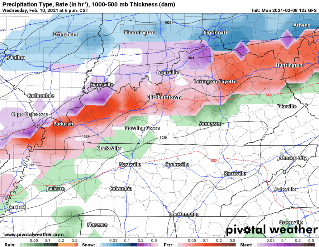
The Euro model disagrees. Look at the thin blue line in NW Middle Tennessee. That line represents surface freezing temps. There we may see freezing rain or sleet. But locally, only a really cold rain.
Current thinking (as always subject to change) is that we just get a cold rain. Forecasters are leaning toward the Euro model.
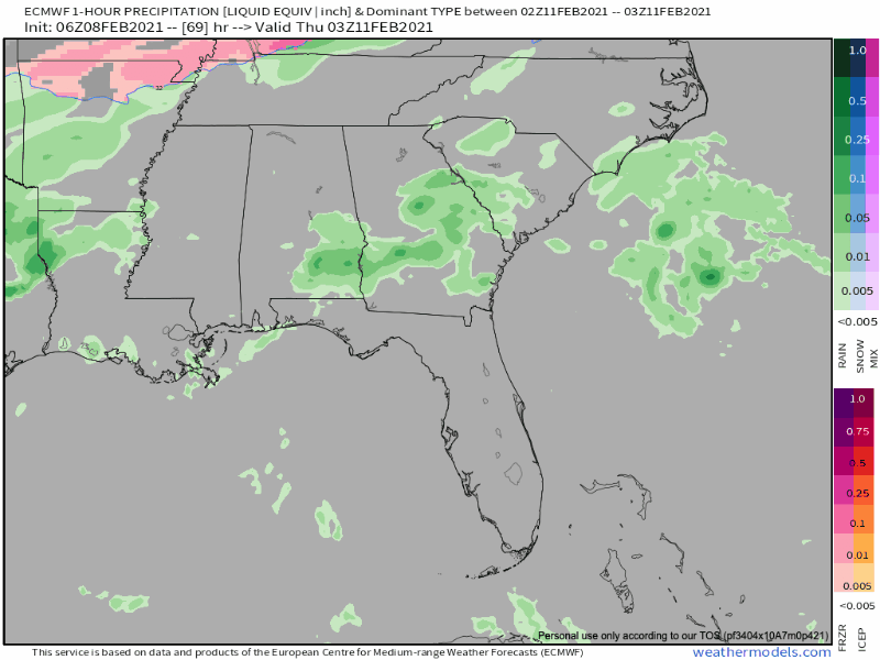
The NBM (National Blend of Models) seems to resolve the GFS and Euro models by taking some of the GFS, some of the Euro, plus other data, to generate a compromise solution:

Draw few conclusions. Models love changing their minds, especially these medium range global models that run at a lower spatial and temporal resolution than shorter range models. Global models only outline events, they don’t detail them, like the difference between reading the cover of the book and reading the book itself.
We are always be a bit leery of any potential ice accumulation: even 5 hundredths of an inch can cause travel problems.
Now, that said, we are not worried about anything just yet. A few degrees on the surface and aloft can switch an event from a relatively harmless rain to a snow, sleet, or freezing rain event. To get the worst possible result — ice — very specific ingredients need to line up exactly right. Ice happens, but it’s rare, and there is no data right now to sound alarms.
Suppose the worst happens — rain falls through warmer air aloft, and hits subfreezing air at the surface and freezes late Thursday night into the early morning hours Friday — that ice would be expected to melt as temps again rebound above freezing Friday around late morning.
The weekend is also interesting. The Euro Model thinks we will be much warmer than the much colder GFS model. The GFS brings in a bonafide accumulating snowstorm Saturday night, whereas the Euro model is bone dry. Place your bets. The smart money is usually on the Euro.
Categories: Forecast Blogs (Legacy)
You must be logged in to post a comment.