I know crap apps train us to see clipart snowflakes and nebulous percentages and draw conclusions; you're better served by reading discussions, understanding nuance, possibility, and ranges, and not blowing past important qualifiers like "right now" the forecast "could be" etc. pic.twitter.com/WLNVfETind
Month: January 2018
Showery Stretch Ahead, Updated Info For Snow Potential Fri. PM-Sat
Showers Ending This Afternoon, Drier and Warmer Tuesday
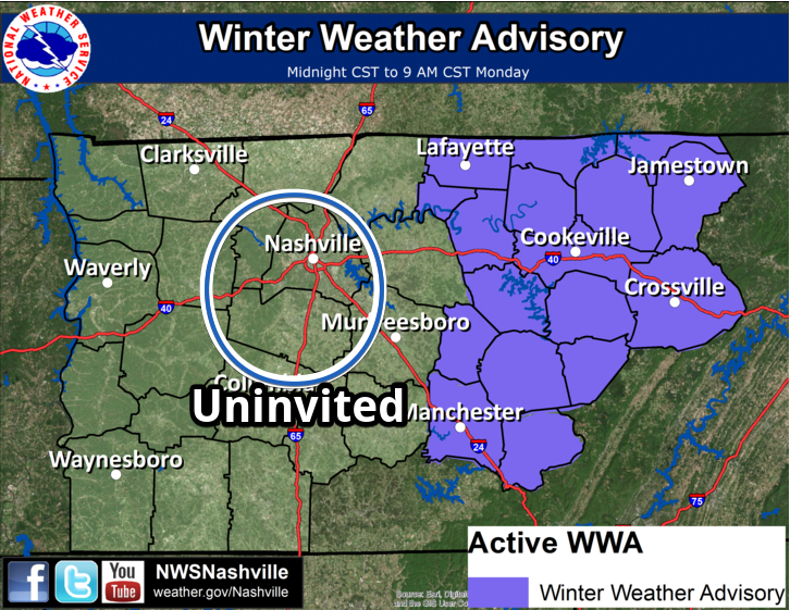
Excluded from the Winter Weather Advisory. Cold Rain Most Likely, Only A Small Chance of Wintry Precip
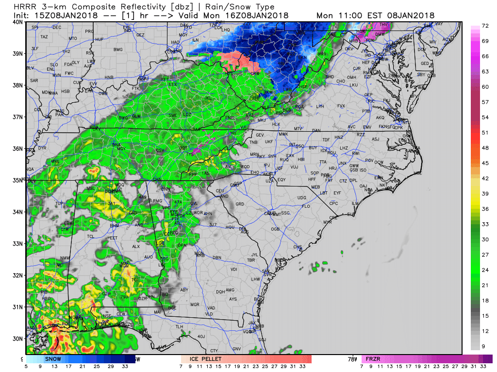
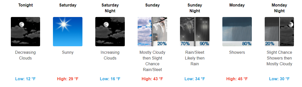
Sleet, Freezing Rain, or Just Rain Tonight/Overnight?
There is no “one size fits all” forecast for Middle Tennessee tonight.
1. For Davidson and Williamson Counties, the NWS-Nashville forecast from 9 PM to midnight includes a chance we will get all rain, a chance it’ll be a sleet and rain mix, or a chance of all sleet; however, the most likely result will be rain. Freezing rain is not mentioned because temps are expected in the upper 30°s. There is no mention of snow.
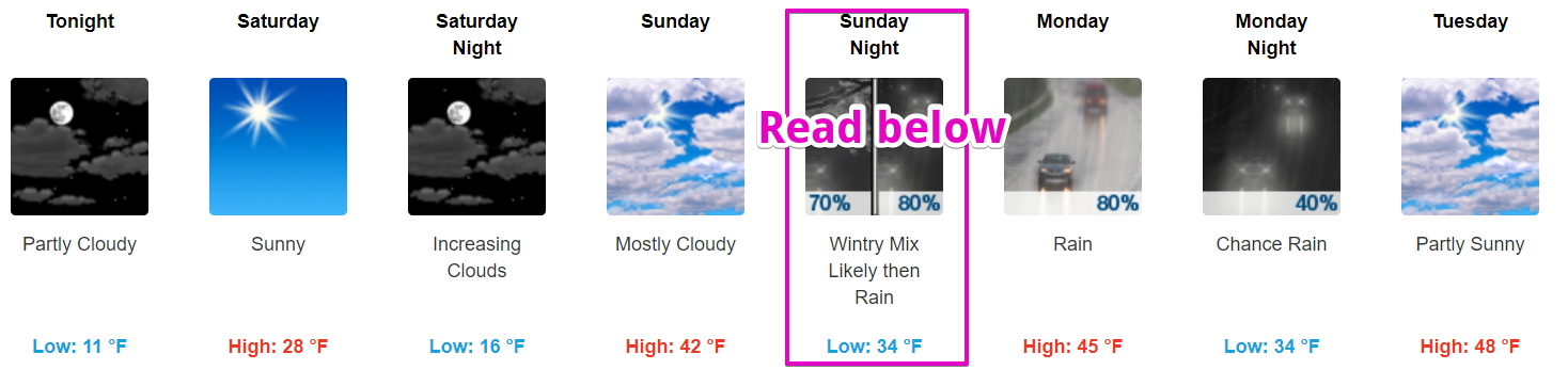
Brisk Day/Night, Then Wintry Mix and Warmer Temps
Below 32ºF Today, Above 32ºF Tomorrow…Wintry Precip. Possible
Cloud cover will be intermittent today, with cold temperatures being the main story. Most places around Davidson/Williamson Counties will struggle to reach the upper 20s!
One last, brisk night is in store with forecasted lows in the teens, followed by a “warm up” Sunday and beyond. There’s just one speed bump in the way…
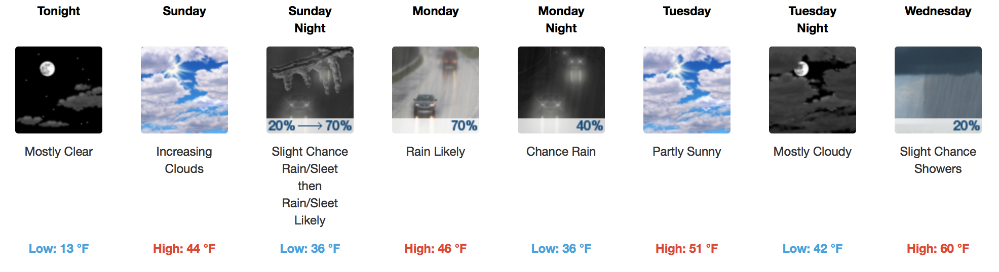
Rain..Freezing Rain..Sleet Sunday Night? Probably Just Rain, But Stay Tuned!
Chilly Chilly Temps Continue. Somewhat “Warmer” Next Week
Still Cold, Slight “Warm-Up” Coming
“Heat Wave” Today Followed By More Brrrr
Temps Are The Story Today
Ok. Let’s get above freezing today. What do you say?

Our low of 16° this morning should warm to 34° at BNA today, breaking our streak of temps below freezing…but only for a few hours. Remember, our temp has been below 32° since Saturday evening. But, I don’t think I have to tell you that.