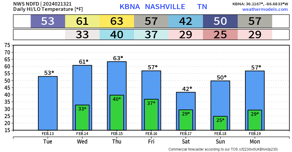
After quite the interesting night, today turned out nicely with high temps getting up into the low to mid 50s.
Wednesday and Thursday will be lovely with high temps reaching into the low 60s. Cold mornings to deal with tho.

After quite the interesting night, today turned out nicely with high temps getting up into the low to mid 50s.
Wednesday and Thursday will be lovely with high temps reaching into the low 60s. Cold mornings to deal with tho.
Changeover from rain to a mix of rain/sleet/snow currently happening in some areas.
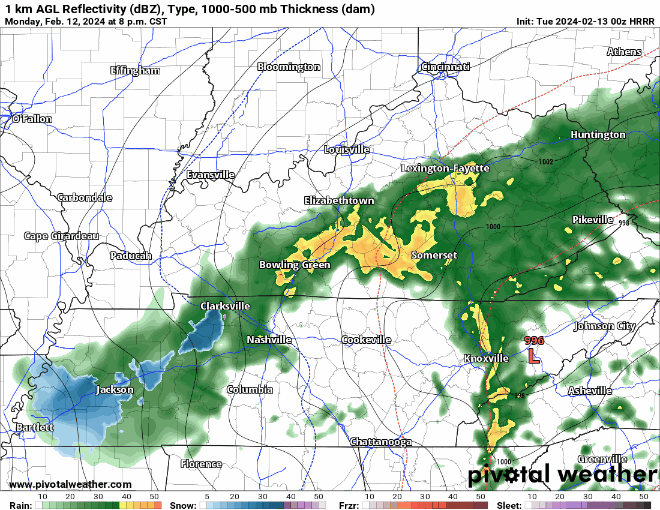
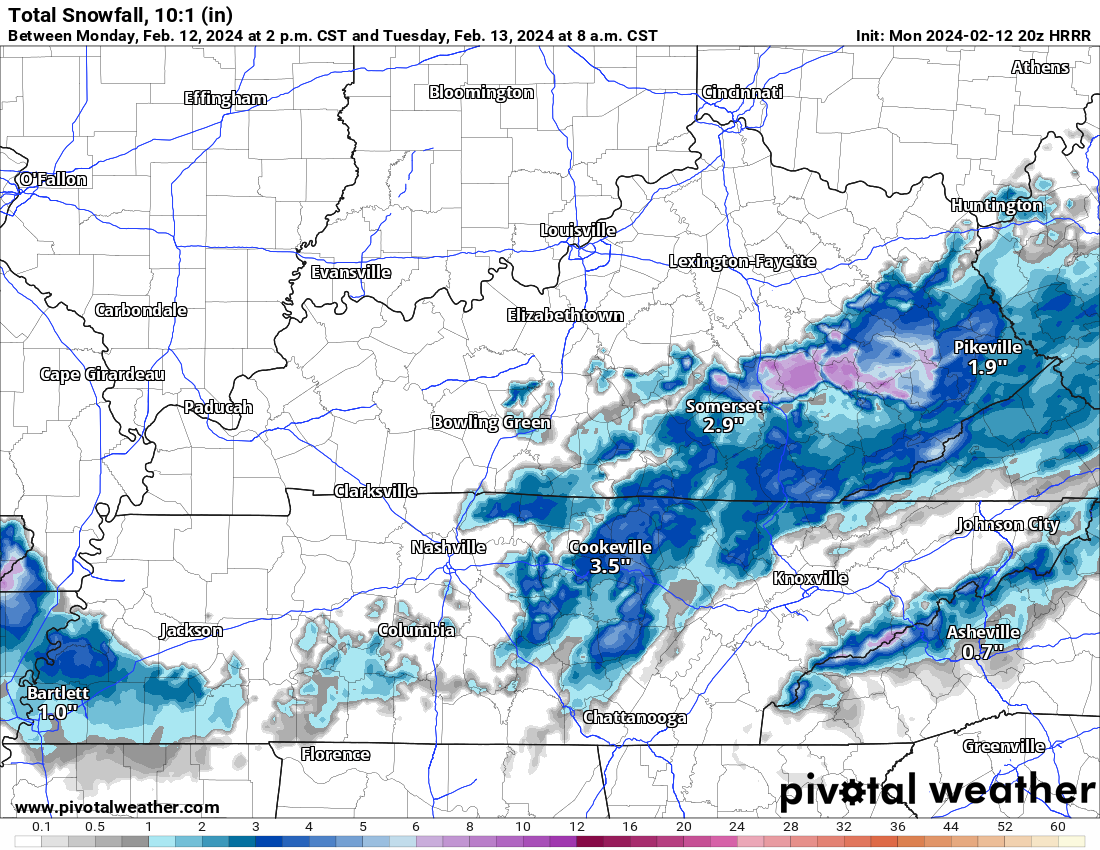
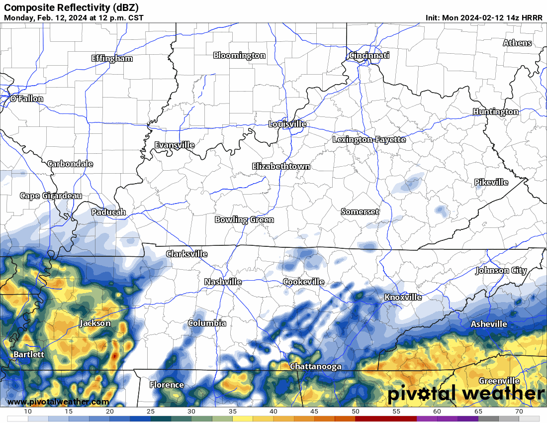
HRRR model (above) suggests that a mixture of frozen precipitation may fall for a few hours tonight, but we have reason to believe that very little, if any of it will stick.
For many of us the wind is picking up and the change over to some kind of freezing precip is occurring. Temps dropping. Careful on bridges and overpasses tonight.
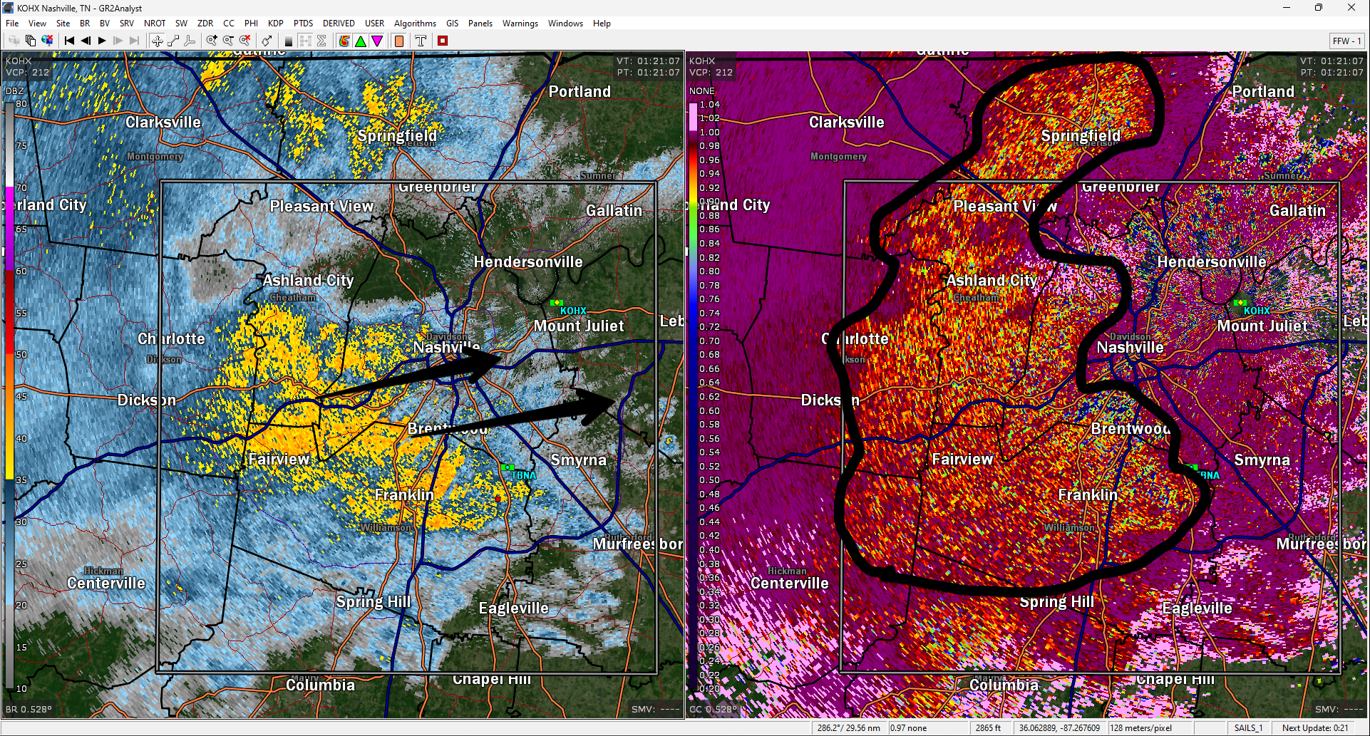
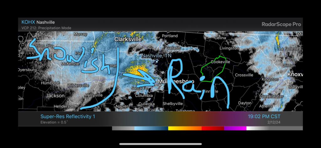
Rain and Snow(ish) moving in. Currently 45°. Not much hope for sticking south of I 40. Radar as of 702pm.
Very little/no snow expected locally tonight.
Deets: Notice the surface low (the red L below) that’s now just passed to our south. It’s racing to Knoxville then Carolina mtns.

This means:
High elevations may get dusted. 99% of us nah.
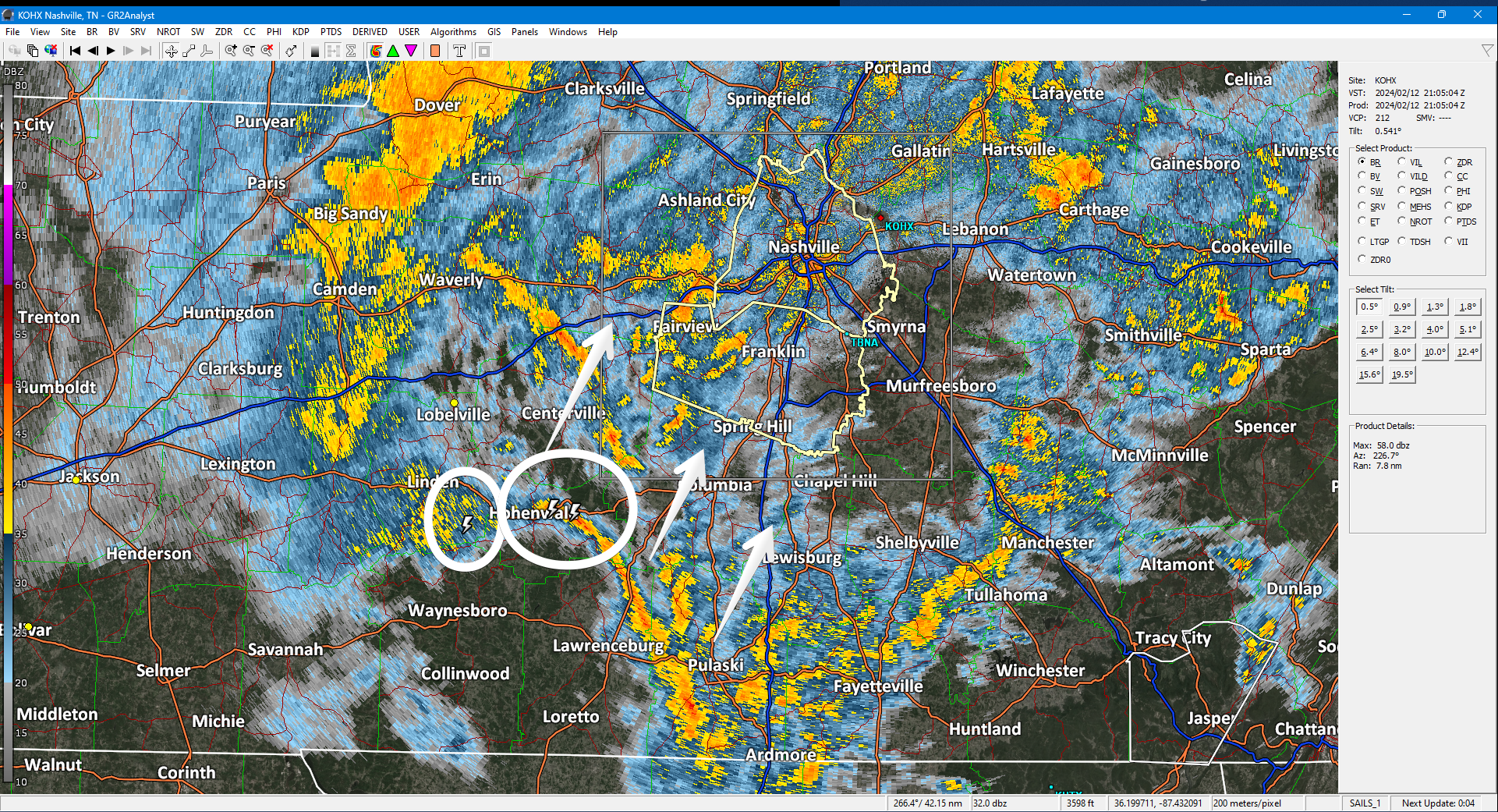
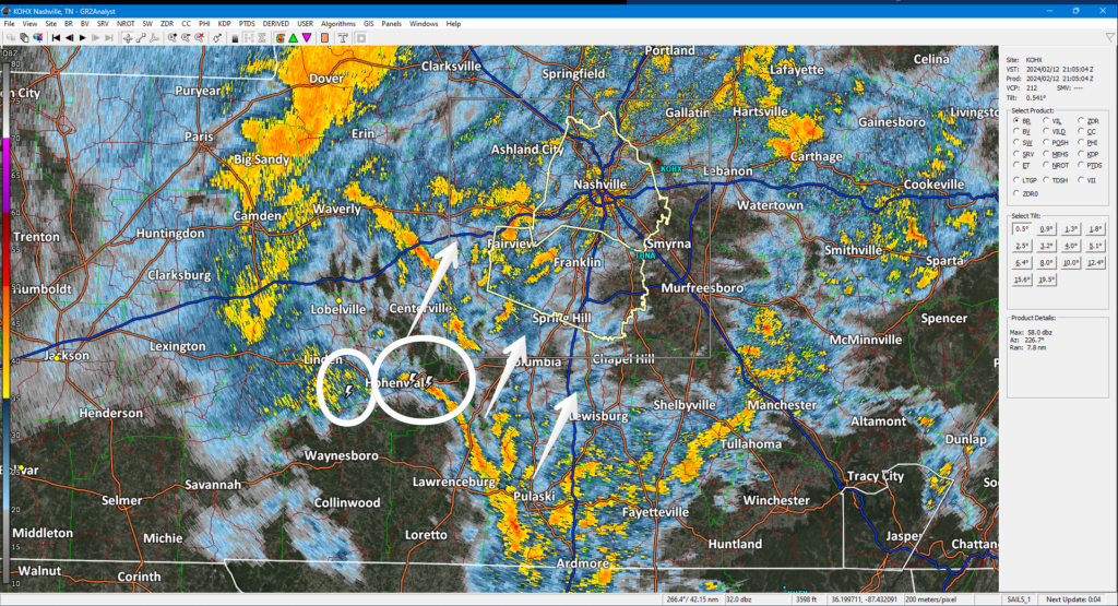
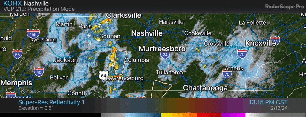
Off/On downpours. Storm center remains south. Some lightning there. Radar below at 305 PM.
Precip will continue tonight. Mix of rain/snow. Few/No impacts locally. Higher elevations may see a dusting — those up a big hill, Fairview, SE Will Co, and other high spots. HRRR model thinks rain/snow gone by midnight.
Heavy rain, lightning, approaching. Low probability of strong winds and small hail. No tornado.
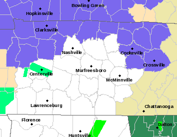
New Winter Weather Advisory does NOT include Nashville or Will Co. Advisory in blue counties below.
Deets: For those in the WWA
There is a lot of uncertainty about snow amounts. If cold air moves in quickly, snow totals could increase above 2 inches for some spots north of I-40. But, since temperatures have been warm, much of the falling snow may melt resulting in little or no accumulation. Either way, any travel impacts are expected to be limited to elevated surfaces like bridges and overpasses.
TLDR: Downpouring during school dismissal thru PM rush hour. Tonight rain/snow mix, very little accumulation. Deets:
HRRR model has the rain coming through late this afternoon. Severe unlikely with expected southern track of the low pressure center.
You must be logged in to post a comment.