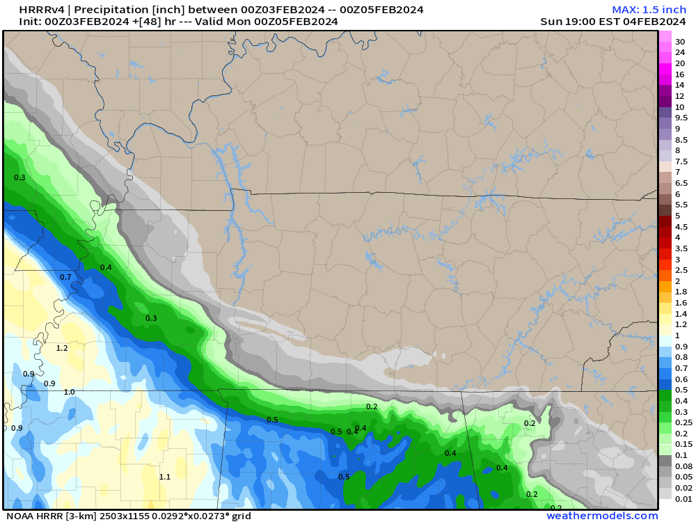
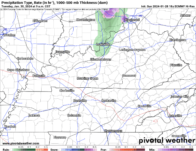
Latest HRRR model run keeps the rain Sunday to our SW. This’ll need an update tomorrow – rain gonna be pretty close.

Latest HRRR model run keeps the rain Sunday to our SW. This’ll need an update tomorrow – rain gonna be pretty close.
Bless our mess. New website may be wonky as we debug it. Please report failures and bugs. We’ll squash them. We want this to work great for you.

The groundhog did not see his shadow today, well duh because it was cloudy? Based off tradition, that means we are in for an early spring.
Today it sure seems like he nailed it. Plenty of sun got our high temps all the way up into the low 70s. Feels more like 4/2 instead of 2/2. Either way, I’d give today a 10/10.

TL/DR
* As of a few hours ago you can find all our weather info – blogs, tweets, all of it – on NashSevereWx.com. You won’t need Twitter/X .
* NashSevereWx.com will be one continuous, chronological feed. All our information will originate here, then go out to various social networks.
* Our Twitter/X will remain the same for those who want to stay there.
* Save our website to your phone. It’ll function similar to Twitter/X. Mobile optimized. No login, no password needed. It auto refreshes.
* You can comment/reply on NashSevereWx.com if you are Facebook authenticated.
* Our feed will instapost first to Twitter/X at launch. Soon, we’ll explore the same with Facebook, Threads, Instagram, etc. as long as its API is open.
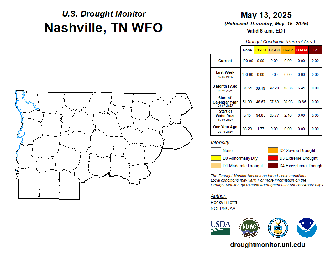
New drought monitor came out today – shoutout last weeks rain!
All of Davidson Co. and a chunk of WillCo. have been downgraded to Abnormally Dry, so congratulations to those folks, you are technically no longer in a drought.
Twas a chilly day, but at least it was a dry one.
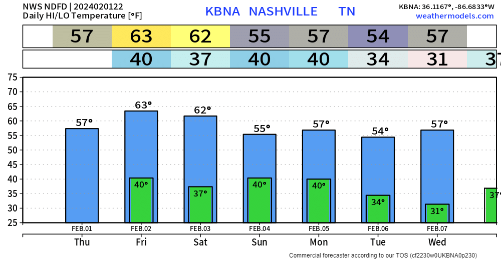
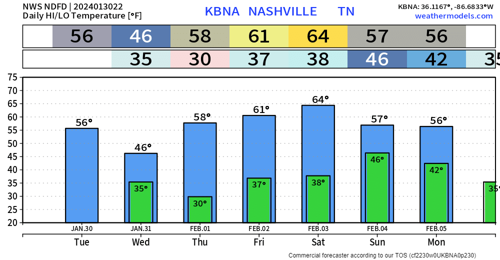
As we turn the page to February, we’ll be greeted with mild high temperatures and dry weather. High temps near 60° tomorrow and getting into the low 60s Friday and Saturday. Kinda weather when you’ll need a jacket in the morning, then have to carry it in the afternoon.
A “cold” front pushed thru earlier and brought some of us a few quick, light showers. A few more showers are possible the remainder of the night, but we’ll be dry for the most part.
Rest of the work week will be dry, gradually warming up throughout the week. Even getting up into the low to mid 60s by Friday + Saturday.

In this sense, no news is good news, and this week there is not a lot of news.
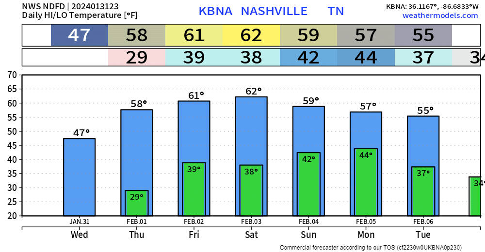
Chilly day today, we did not make it to the 40° mark.

Tomorrow we’ll be a bit warmer with high temps in the mid 50s. A quick shower is possible Tuesday evening/night.
Pretty bland day today. Temps stayed in the low 40s all day. Perfect chili night in my humble opinion.

This will be a common theme throughout the week. Only rain chances to talk about would be maybe Tuesday.
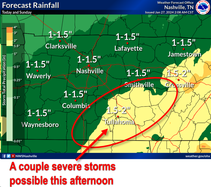
Some showers currently moving thru, looks like we may get a small break before some more rain and maybe a strong storm?
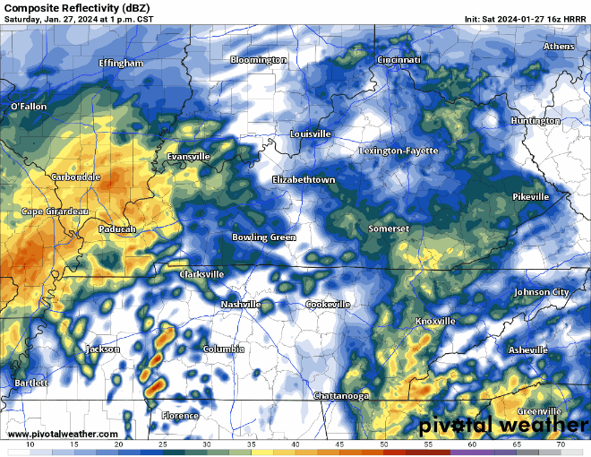
HRRR model (above) shows an ETA of ~3 or 4 pm for some heavier rain, and maybe some storms. One or two storms could be on the stronger side with some gusty winds. We’ll keep an eye out, stay connected this afternoon.
You must be logged in to post a comment.