
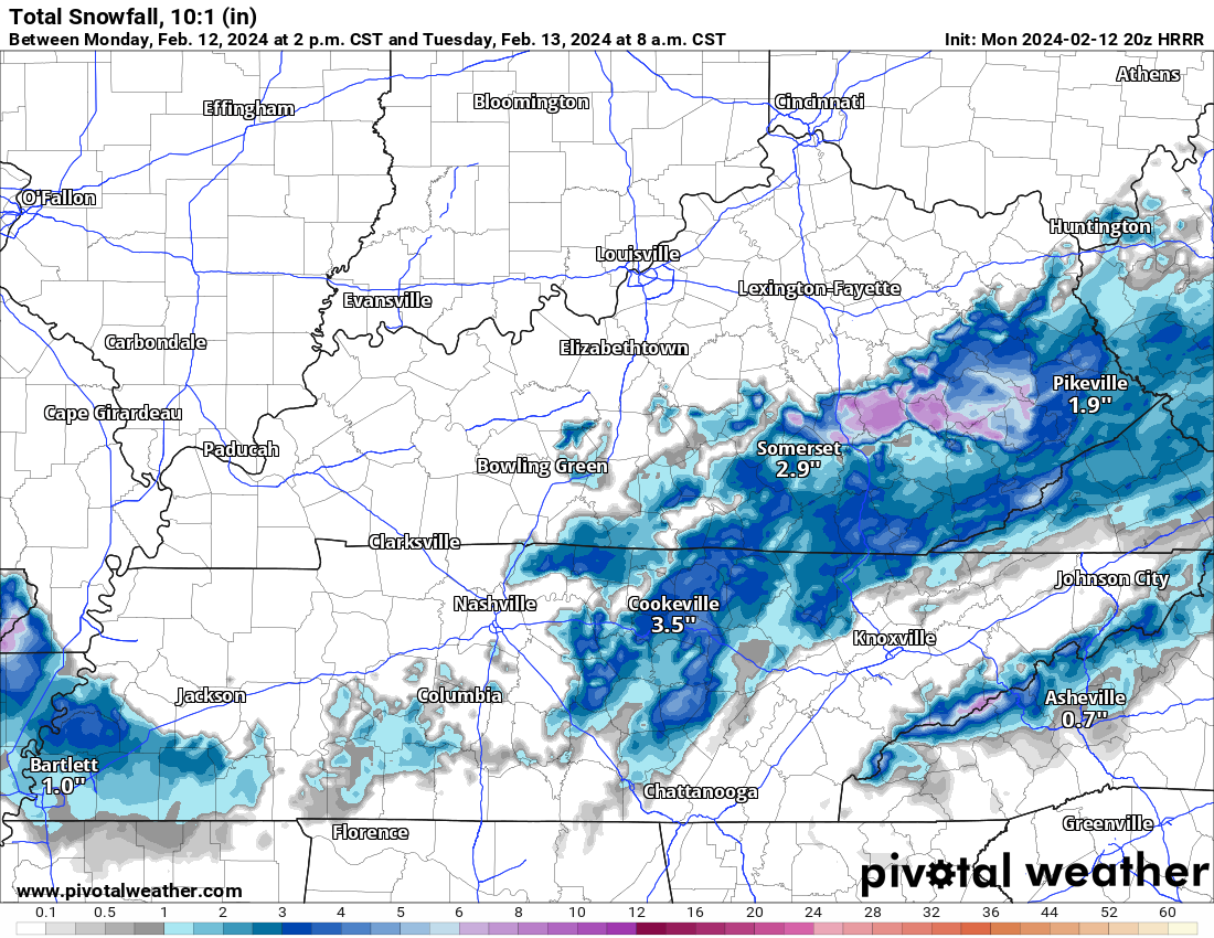
Very little/no snow expected locally tonight.
Deets: Notice the surface low (the red L below) that’s now just passed to our south. It’s racing to Knoxville then Carolina mtns.

This means:
- Temps are about to drop fast.
- But precip will pull east and away from us quick.
- The 700 MB chart shows the base of the trough getting here late, delaying local rain/snow transition.
- While flakes may fly, surface temps should be too warm for accumulation.
High elevations may get dusted. 99% of us nah.

Precip gone by midnight.
Tue AM lows near freezing, warming rapidly after sunrise.
This may change. Looks like a wet event, non snow event right now.
More updates thru the night.
Categories: Tweet