
Changeover from rain to a mix of rain/sleet/snow currently happening in some areas.
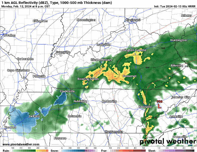
HRRR model (above) suggests that a mixture of frozen precipitation may fall for a few hours tonight, but we have reason to believe that very little, if any of it will stick.
Why?
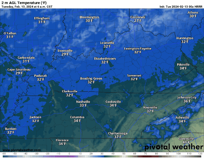
- Air temperatures at the surface are expected to stay above freezing, in the mid 30s
- Road surface temperatures will be even warmer
- Best chance to see a dusting will be higher elevations, grassy areas and elevated surfaces
- Don’t foresee any major travel issues in the AM, I suppose a couple bridges/overpasses could be slick but…
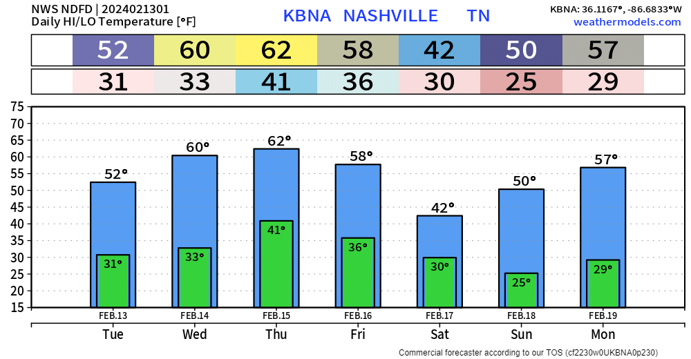
Temperatures will quickly recover tomorrow, getting into the upper 40s, melting any snow that makes a miracle run and accumulates.

Rest of the work week will be dry with mild afternoons. Cooler temperatures and rain chances come back around Friday/Saturday.
Categories: Featured Blog