
Just one more day of nice weather. Cloudy start to this morning, but the sun should peek out soon. High temps in the mid 80s but low humidity so not too shabby. A few sprinkles can’t be ruled out tonight but most of us will be dry.
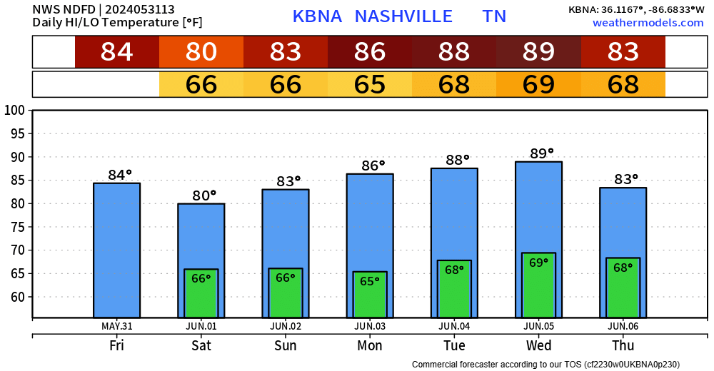
On and off rain/storm chances will arrive Saturday morning and stick around all day long.
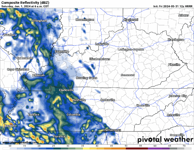
HRRR model above shows the general story. The occasional downpour with some lightning + gusty winds will be possible throughout the day tomorrow. The Storm Predicition center has also outlooked our counties with a 5% chance of damaging straight-line winds within 25 miles. Although chances are quite low, some gusty winds are possible. No concerns about hail or tornadoes.
Those with outdoor plans, good news is that it won’t rain the entire day. Bad news is that you’ll need a place to head inside if a storm does decide to swing on by. When thunder roars, go indoors.
A summer-like pattern will stick with us thru at least the middle of next week, with high temps in the mid to upper 80s, and daily rain/storm chances in the afternoon/evening. Fitting for the beginning of June. No severe weather currently in the forecast, but a storm or two could be strong. More specific deets in the coming days.
Categories: Featured Blog