Afternoon Crazy Ivans (Rain) + Rest of the Week + Steeplechase Update

Today

Although the morning rain moved out, models redevelop showers to our east this afternoon and early evening, and spin them in here. These isolated/scattered showers are approaching in an usual direction: east-to-west. We call these “Crazy Ivans,” a reference to The Hunt for Red October (where a Russian nuclear submarine – from the east – almost started a war by defecting to the west). If you don’t get it, relax, you’re better off for it (for those who’ve seen the movie or read the book, we know it’s also not a technically accurate phrase).  It’s nerd humor. read more

Sit & Spin Rain Monday; Premature Steeplechase Forecast

Monday

The weather version of the

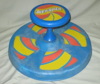
is a low pressure center.  A few important differences between the Sit-n-Spin and a low pressure sit and spin include:

  • The Sit-n-Spin rotates clockwise and counterclockwise. A weather sit and spin only rotates counterclockwise.
  • The Sit-n-Spin rotates small children. A weather sit and spin rotates clouds and rain.

Similarities:

  • Both may induce vomiting.
  • Both can sit – for days – in one place without being picked up, until someone/someOne decides to pick them and place them where they belong (the toy closet or garage; Atlantic Ocean).
  • A mature, tropical sit and spin / low pressure system can become a hurricane which generates winds up to 200+ mph. My childhood friend Frankie Vanderburg could accomplish a similar feat. He could sit on that thing and generate centrifugal force sufficient to vaporize Star Wars figures (or at least warp them into the bushes). Fathers attempting to stop Frankie by stepping on that thing risked a torn meniscus or severed cruciate ligament. Their strategy was to wait him out until the bearings in the sit-n-spin vaporized, or he tired himself out. I don’t know what came of Frankie, but $5 says he’s piloting fighter jets somewhere.

For the last several days, this particular low pressure center has been cut off from the winds which would push it into the Atlantic Ocean. Yesterday it was around Memphis. Today it crawled to E MS and N AL, which is around where all the models think it’ll be tomorrow as it drifts further east and spins light rain showers into middle Tennessee.  Here’s the NAM model, which is a fair representation of the rest of the models: read more

The Fifth Day of May

Today

Happy Cinco de Mayo everyone!

We are sitting pretty right now, between the core of low pressure and the bands of rain wrapping around the system. Keeping us dry for now…

Infrared Satellite Imagery (yellow and blue high cold cloud tops usually rain): read more

Saturday Night Showers. Light Rain Sunday (ETA ~ 4pm).

This afternoon we thought the rain — which moved east — was going to stay east. It hasn’t.

At 7:27pm, light rain showers crept northwest across both counties:

Why is this happening? This satellite image (from 7:15pm) explains: read more

Dramatic Improvement: Dry Afternoon + (Maybe) Sun

April postcards from Old Man Winter are common, but this May postcard has been waaaay out of bounds.

That said, you’ll like what we have to say about the rest of the day.

Today

At 11am the rain rope (“rain shield”) was sitting along I-65 and very, very slowly moving east at around 15 mph. It’s also way too chilly for May: 46 at 11am. read more

Updated Weekend Outlook: Wet, Dreary, & Cold. Indoor Sports Advised.

Flood Watch

A Flood Watch is in effect until 7 am Sunday. Here’s an official graphic:

Tonight

It’s going to rain tonight and into the overnight hours. The ETA for Williamson, then Davidson, Counties is between 8pm and 9pm tonight. Follow along on Twitter for more frequent and detailed updates (@NashSevereWx). read more

Who’s Doing the Rain Dance? Flood Watch In Effect. Weekend Wash-Out.

The Setup

Whoever is doing the rain dance, did it right! Blame a “cutoff low” spinning in the middle of the country. It should rain out most – if not all – of the entire weekend.

So what is a cutoff low? It’s a low pressure system that has been “cutoff” from the flow of the jet stream (upper level winds) which push weather systems around.  Since the low pressure system is cutoff from what steers it, it will just meander over the next few days, sending waves of rain our way.  Until another system comes along and shoves it into the Atlantic Ocean, we are stuck dealing with it. read more

Tough it Out or Head to California

They say when it rains, it pours, and that is exactly what we have in the forecast. Rainy day after rainy day.

Today

Rain chances increase, starting this afternoon.

The Hi-Res NAM has spotty showers as early as today. Here it is Thursday 4 PM: read more

Little/No Hope for a Dry Weekend

Today

There’s a very small – almost unmentionable – chance of a stray shower tonight. If we get one, it shouldn’t be enough to rain us out. We’ll make it to 80.

Thursday

A slightly better chance of a shower or thunderstorm. The best chance will be in the afternoon.  Rain-out chances are low. High of 78. read more

Not Again! Rain Threatening Our Weekend

After a dry and warm week, rain threatens to return this weekend.

A chance of rain is in Thursday’s forecast, but the better chances are Friday and Saturday. Looks like a very slow rain system.

The Hi-Res NAM delivers showers Friday. Here it is Friday night at 7pm: read more