Search Results for:

Few Showers Tonight + Friday Morning, Looking at Marathon/Preds Weather.
Light Rain Possible Friday AM, Nice Weekend Weather
Nice weather during the day Thursday, high temps in the mid 70s. Some may say that it’s fantastic.
A warm front is to blame for some scattered rain chances Friday morning.
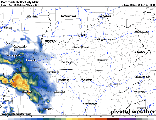
HRRR model shows the mostly light rain moving thru Friday morning. Rain jacket may be needed for the walk into school or work. Most of the rain should be gone by lunchtime.
Light Showers Possible Tomorrow AM + Friday AM, A Look at Marathon Weather
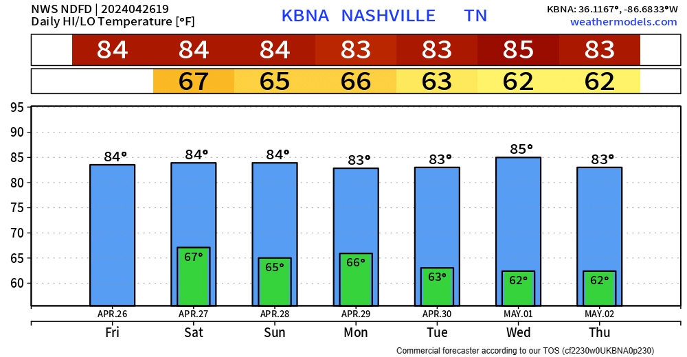
Warming Trend + Mostly Dry This Week.
After some frost this morning, there are no more chances for the foreseeable future. I don’t want to guarantee we are done for the Spring, but long-term models suggest that just might be the case. There aren’t any historical records on latest frost, but the latest freeze recorded in Nashville was April 25, 1910.
Frost Advisory Tonight, Fairly Quiet Week Ahead.
Calm and Cool Weekend, Warming Back Up Next Week
“Cooler” + Mostly Dry Weekend.
Maybe a few sprinkles this evening, but nothing more. A little chill as the sun goes down as temps will make it down to around 50° tonight.
Maybe a stray shower or two Saturday morning, but that’ll be it as we are left with a dry rest of the day. Highs only making it to the mid 60s.
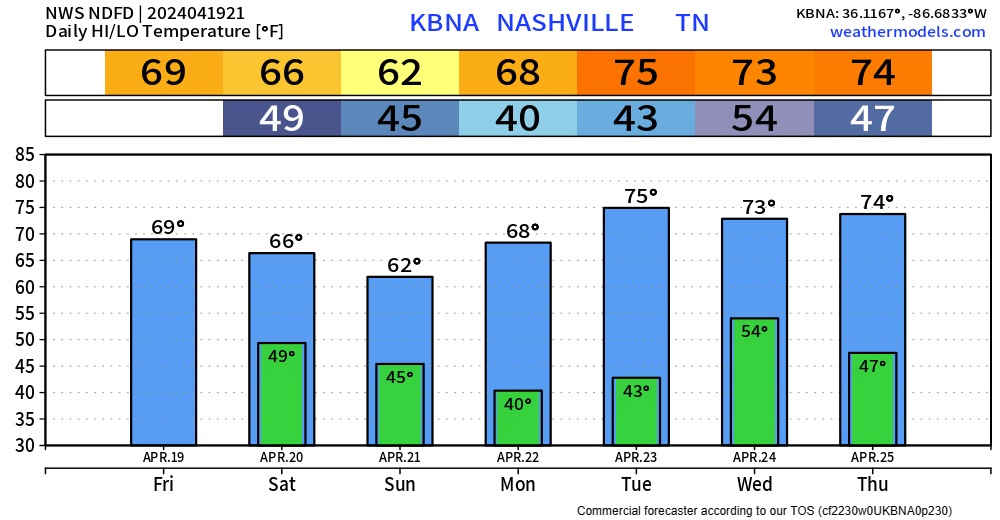
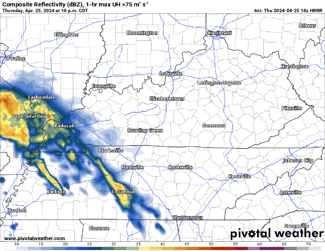
Sunday is the coolest day of the upcoming forecast, with some light rain possible in the morning. Doesn’t look like a rainout tho.
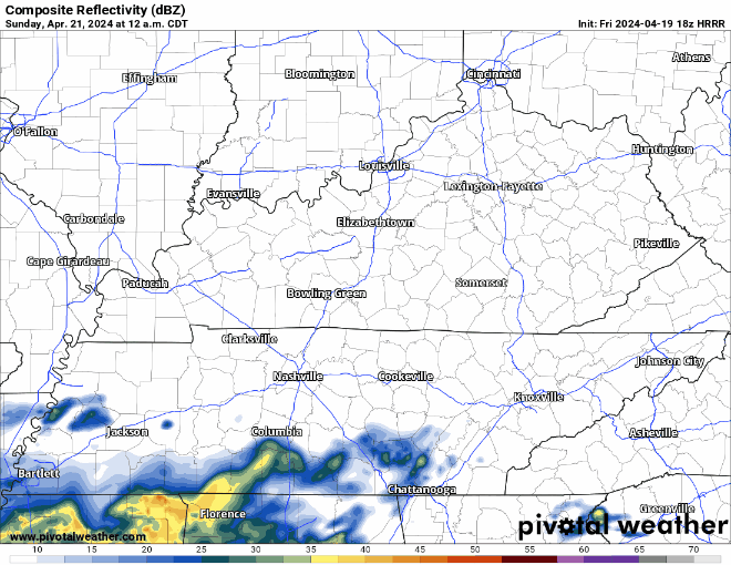
HRRR model (above) shows some light, NBD showers quickly moving in and out early Sunday morning.
Monday will be a nice sunny start to the week with highs in the upper 60s.
"A weak front will bring a small chance
for showers late Tuesday and Tuesday night. The next significant
rain chance will come late in the week. It looks like an active,
stormy pattern may form for next weekend." - NWS Nashville AFD