Until 10p tonight we will have a Wind Advisory for wind gusts up to 45 mph possible. With winds coming out of the south, travel on W-E roads (like I-40 and 840) may be difficult, especially for high-profile vehicles. Winds should relax tonight.

Until 10p tonight we will have a Wind Advisory for wind gusts up to 45 mph possible. With winds coming out of the south, travel on W-E roads (like I-40 and 840) may be difficult, especially for high-profile vehicles. Winds should relax tonight.
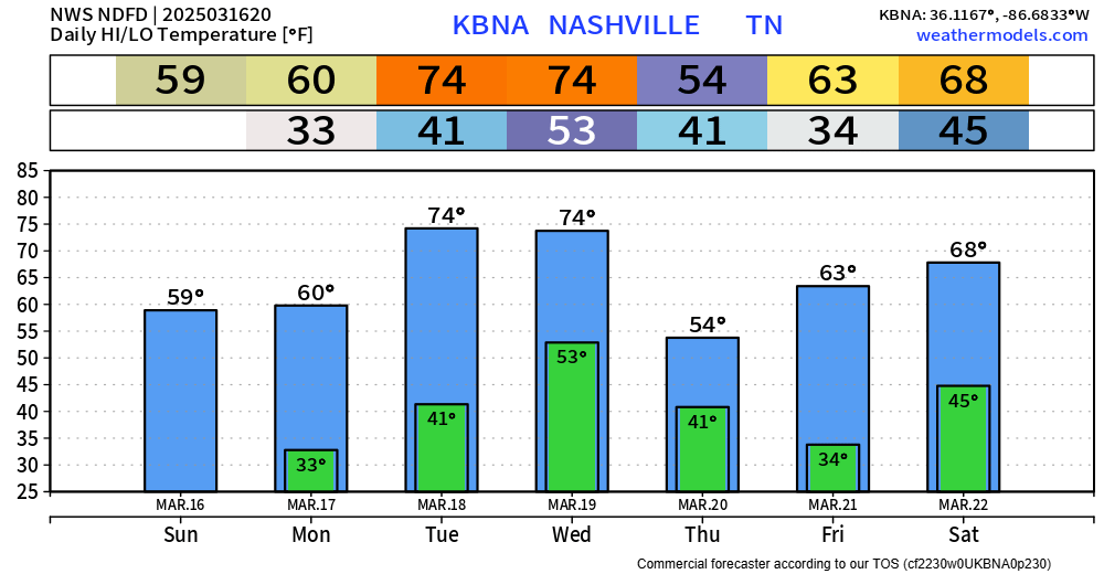
Another seasonally warm day is on tap for Wednesday – highs getting all the way up into the mid 70s – roughly 15° above average.
Part of the reason for the warm temps will be strong southerly winds, gusting up to 45 mph. This is the reason for our Wind Advisory valid tomorrow (Wednesday) from 10a to 10p. With the winds coming out of the south, travel on W-E oriented roads (such as I-40, 840) may be difficult for high-profile vehicles. Secure any outdoor furniture and bring in trash cans.
We’ll wake up with temps in the upper 30s/low 40s on Tuesday but quickly get up into the mid 70s by the afternoon.
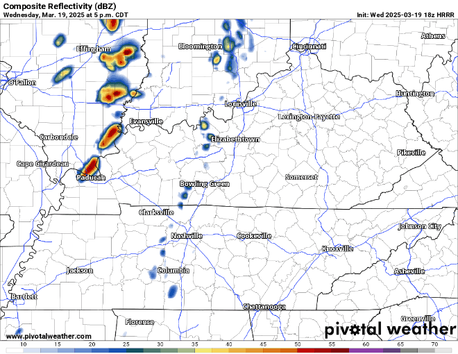
Similar temps for Wednesday, but with chances for some showers/storms as a cold front pushes thru sometime in the afternoon/evening. Before, the rain, wind gusts up to 40 – 45 mph will be possible throughout the day – a Wind Advisory may be needed.
A few rivers/creeks are still running high – if you come across a flooded road, turn around, don’t drown.
Temps to get down near freezing tonight. If we do get below freezing, it will likely be short-lived.

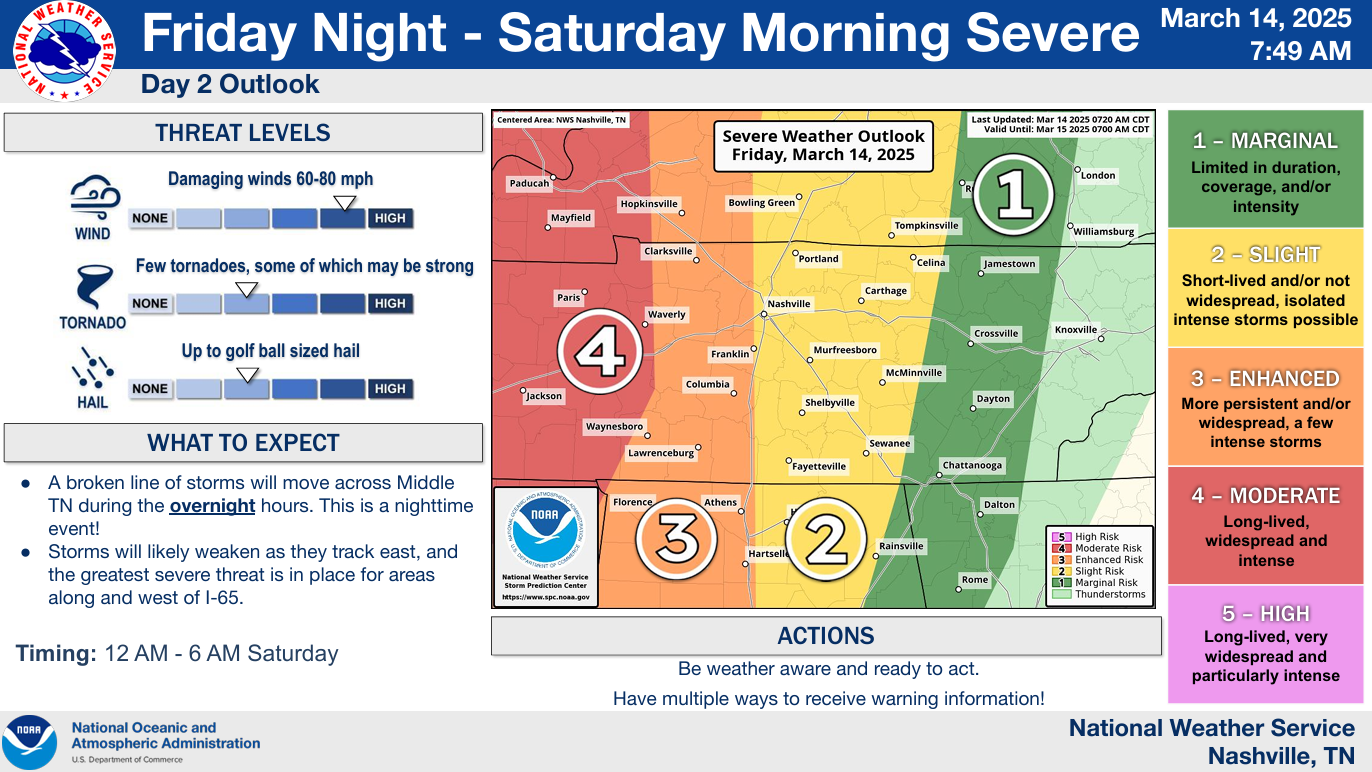
I’ve just been on a conference call hosted by NWS-Nashville for emergency management and media for tonight and tomorrow. I started NSWX in 2010 and can count on one hand the times I’ve heard briefings and seen model data like this. I hope none of it materializes. This is your classic “low probability of a high impact event” x 2.
Update as of 11:15 am:
Previous Update from 10:15 am: Overall, the forecast remains on track. We are still looking at two possible rounds of severe weather. While both still have some uncertainty, both rounds are well-worth watching. Continue to stay connected for updates.
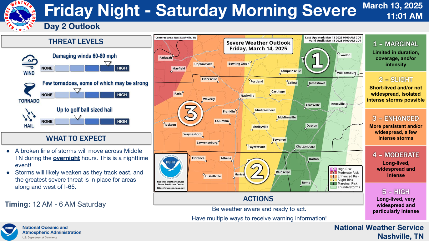
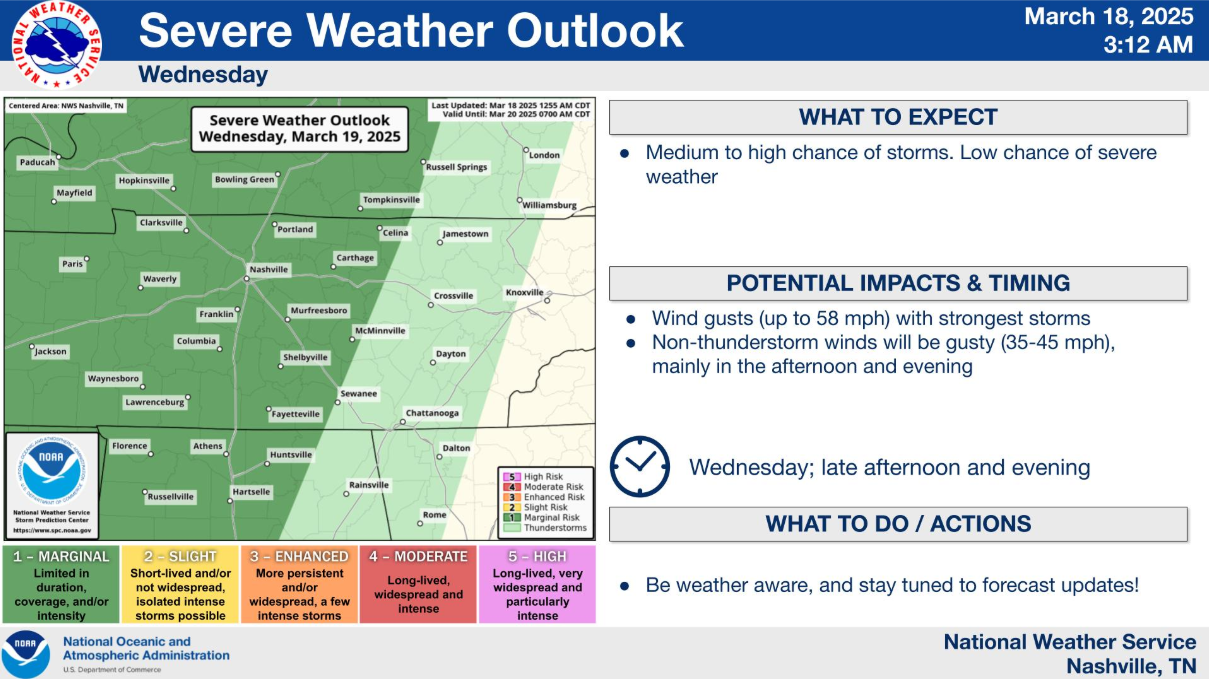
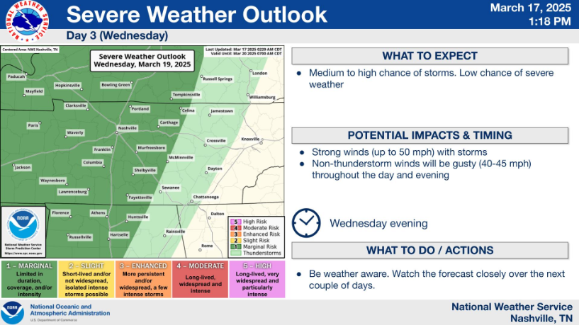
We’re looking at two potential rounds of severe weather, while both are conditional, both rounds bear watching.
From now until Saturday night, it will be important to be weather aware and stay connected for updates/changes to the forecast.

Beautiful Spring-like day ongoing.
Similar temperatures expected Thursday but can’t rule out a shower or thunderstorm during the afternoon/evening. No severe weather expected – can’t totally rule out some heavy downpours or even some pea-sized hail with a thunderstorm or two. Some of us will stay totally dry.


Before we discuss our active weekend, it is absolutely beautiful outside. High temp at BNA today was 79° – twenty degrees above average. Not a cloud in the sky.
Wednesday will be a copy and paste of today. Highs in the mid to upper 70s. Another great day to be outside.

Before we get into this weekend, we do have a warm and mostly dry work week in front of us.
High temps will be well above average all week long, in the 70s until Sunday.
First rain chances this week will be on Thursday. Although rain chances have increased since yesterday, totals still look relatively low.
You must be logged in to post a comment.