

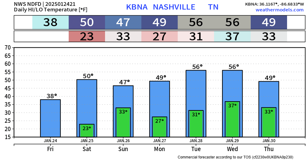
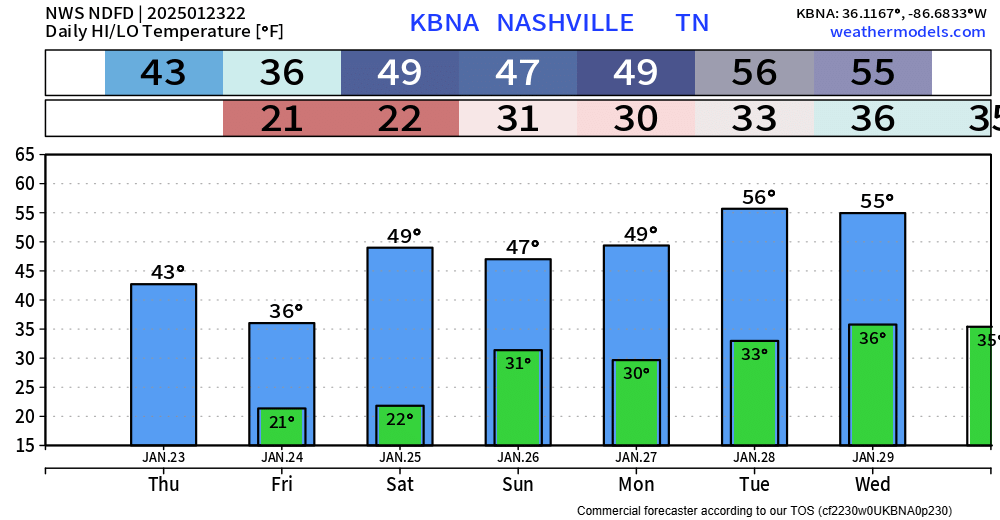
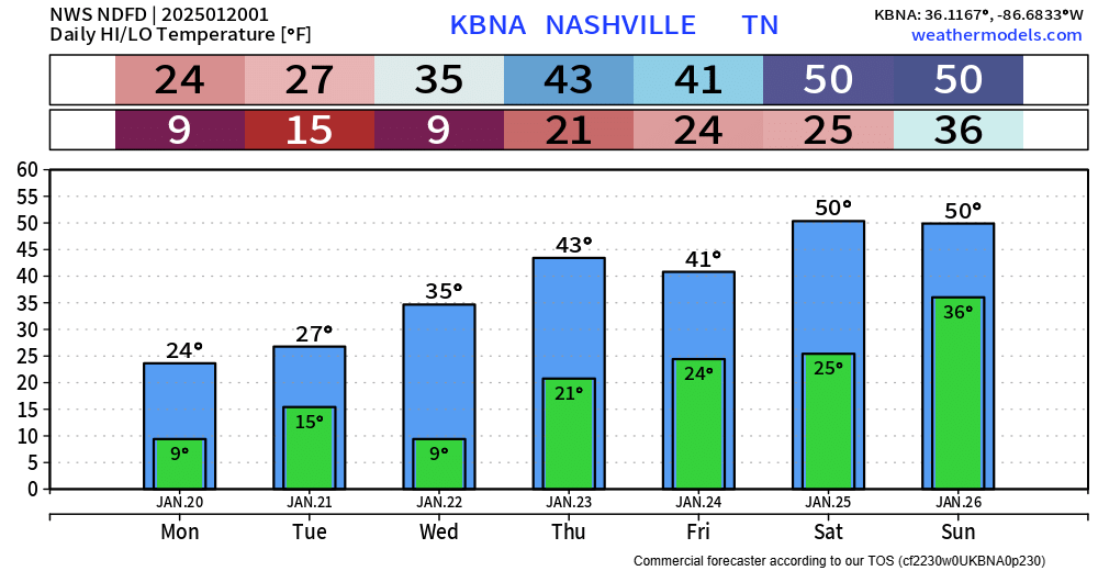
Most of us reached the upper 50s today, and we’ll continue the warmer trend throughout the week. Highs sticking close to average, if not a little above average.
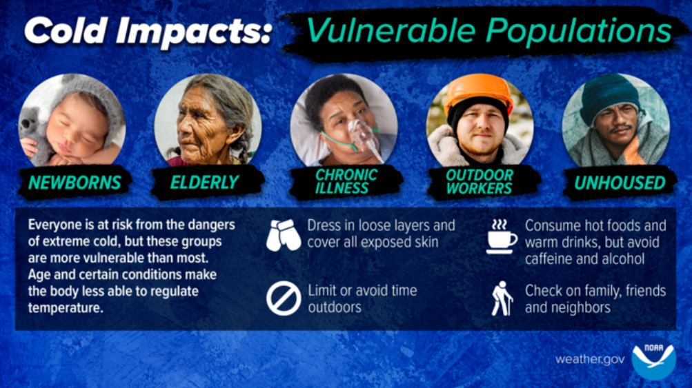
We get a break from the freezing temps for the foreseeable future – but we certainly aren’t done with the freezing temps. Our average last freeze isn’t until March 8.


You must be logged in to post a comment.