
Temperatures are hotter than yesterday reaching the upper 80’s. Dew points are up to the low 70’s. Temps and dew points will stay this way for the weekend. Looks like we will need some gills for the upcoming days 😬.

Temperatures are hotter than yesterday reaching the upper 80’s. Dew points are up to the low 70’s. Temps and dew points will stay this way for the weekend. Looks like we will need some gills for the upcoming days 😬.
Today will be warm, but not as hot as yesterday. Unfortunately dewpoints have climbed to the upper 60’s and low 70’s. We have now entered the uncomfortable to oppressive realm of humidity.
Summertime heat is in full effect today as you can expect a scorcher. Dewpoints range in the mid to upper 60’s today, so it’ll feel sticky to uncomfortable, just the way we all like it.
Rain probabilities today are low. Scattered showers and pop-up storms are possible, but also entirely not possible. HRRR thinks the world’s tiniest showers could develop in the evening hours. If they do form and go over our area, it will be quick and nothing to worry about.
Today, temperatures and dewpoints will rise back to what’s expected for this time of year. Expect dewpoints in the upper 60s.
Heat index will be in the mid 90s, so make sure to hydrate and use sun protection!
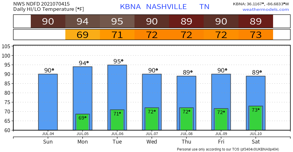
Who else can remember a rain-free Independence Day that wasn’t either blazing hot or miserably humid (or both)? I know I can’t. But that’s exactly what we’re going to see today. Don’t get me wrong, it’s still going to be pretty warm, but much more comfortable than we’ve been used to lately. Dewpoints are forecasted to rise to the mid 60s tonight, around the time that a lot of you will be watching fireworks. So a little sweaty, but temps will cool off enough to keep you comfortable.
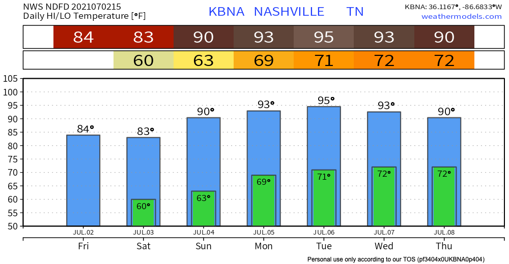
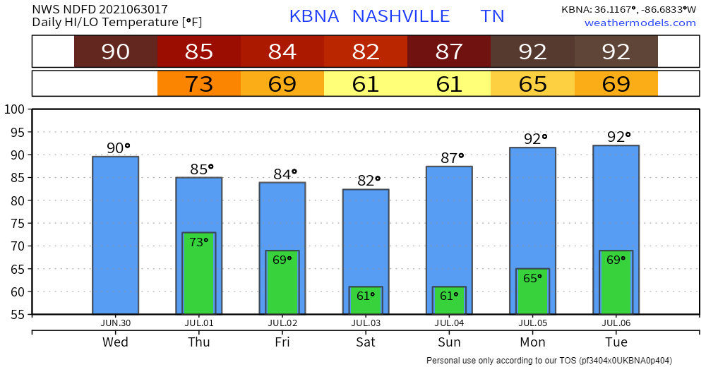
We got down to 61° at 4:53 AM, which was 4° warmer than the July 3 record low. Perfect temp/humidity combo today. Temps and dew points will rise a bit Sunday, but still way below average. Heat cranks again Monday, heat index upper 90°s. No rain possible until at least Tuesday or Wednesday, but more likely Thursday and Friday.
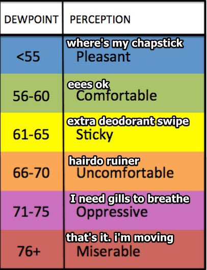
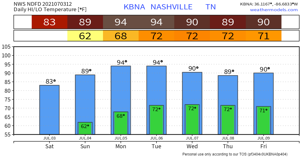
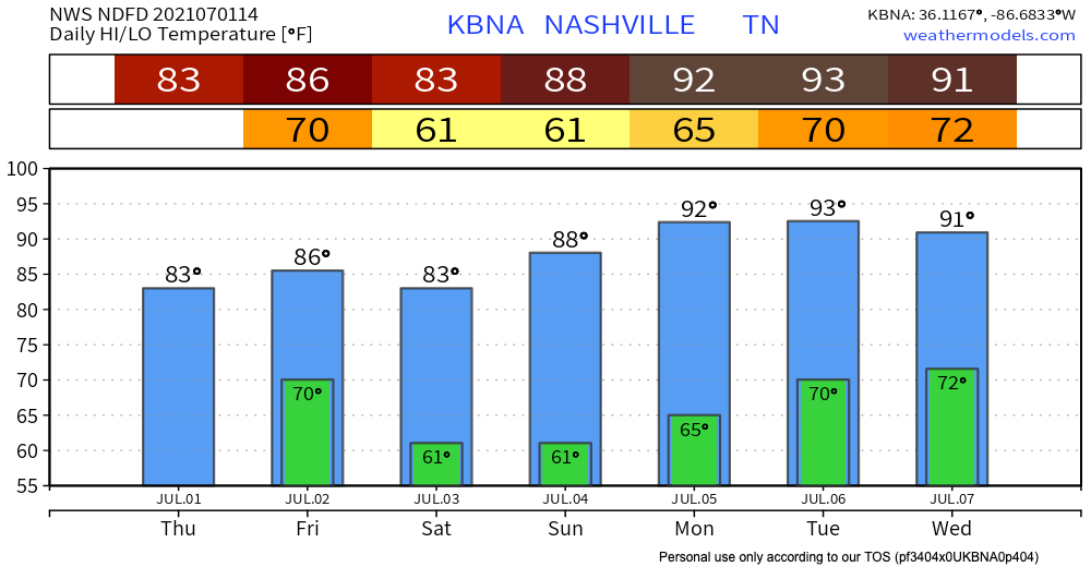
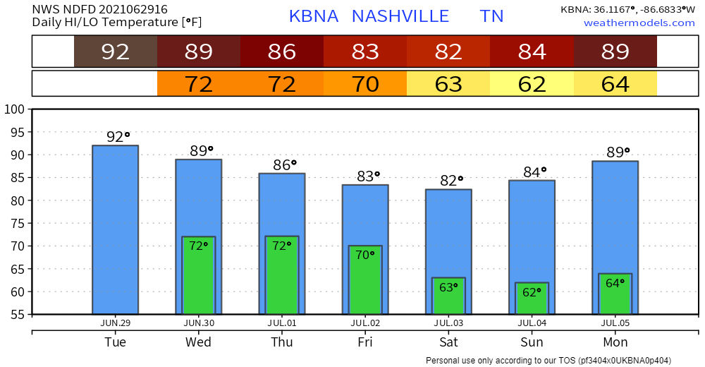
The cold front that brought all of that rain passed through TN this morning. This leaves us dry with temperatures reaching highs in the mid 80’s for the start of your weekend. Dew points are down to the low 60’s and even hit the mid 50’s for Saturday. For the 4th, highs reach back up to the low 90’s but dew points still hover around 60 degrees! Check out this handy dandy chart to reference the dew points.
We have good news and bad news. The good news is, a cold front is coming through, so there will be lower temps and sunny skies. The bad news is we have to get through some rain before those cooler temps and sunshine arrive.
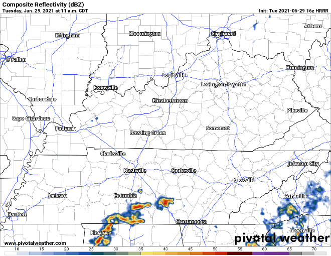
Scattered thunderstorms are in the works this afternoon… it’s become almost routine at this point. Credit goes to the daily 90+ degree temps that have been firing up showers/thunderstorms. They’re not going away just yet and neither is the humidity… for now.
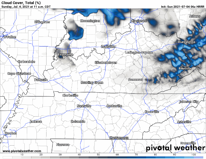
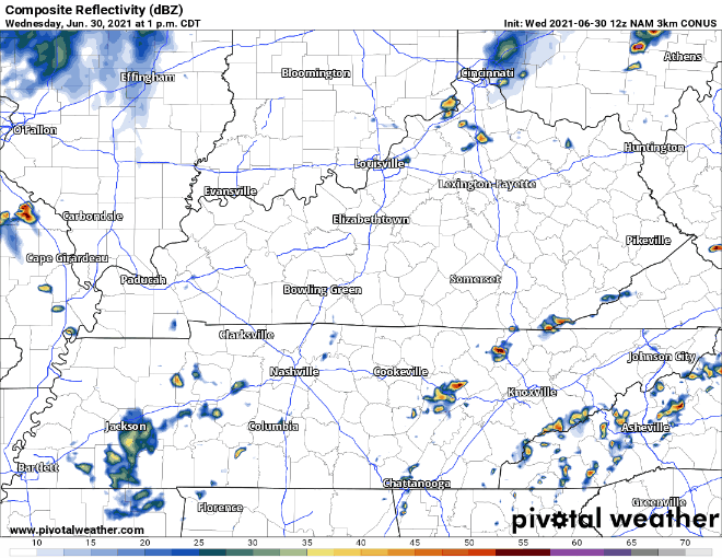
I don’t know if you’ve heard already, but a tropical storm made landfall in South Carolina last night. What does this mean for us? Not much in the grand scheme of things. No tropical storm force winds or anything of that nature. It already fell apart over Georgia earlier this morning, but remnants headed toward us could very well be packing some “lift” that we lacked yesterday. Satellite imagery shows this convection building up to the south tracking northwest.
You must be logged in to post a comment.