Category: Forecast Blogs (Legacy)

Severe Threat Has Ended; Lots of Sun for the Weekend

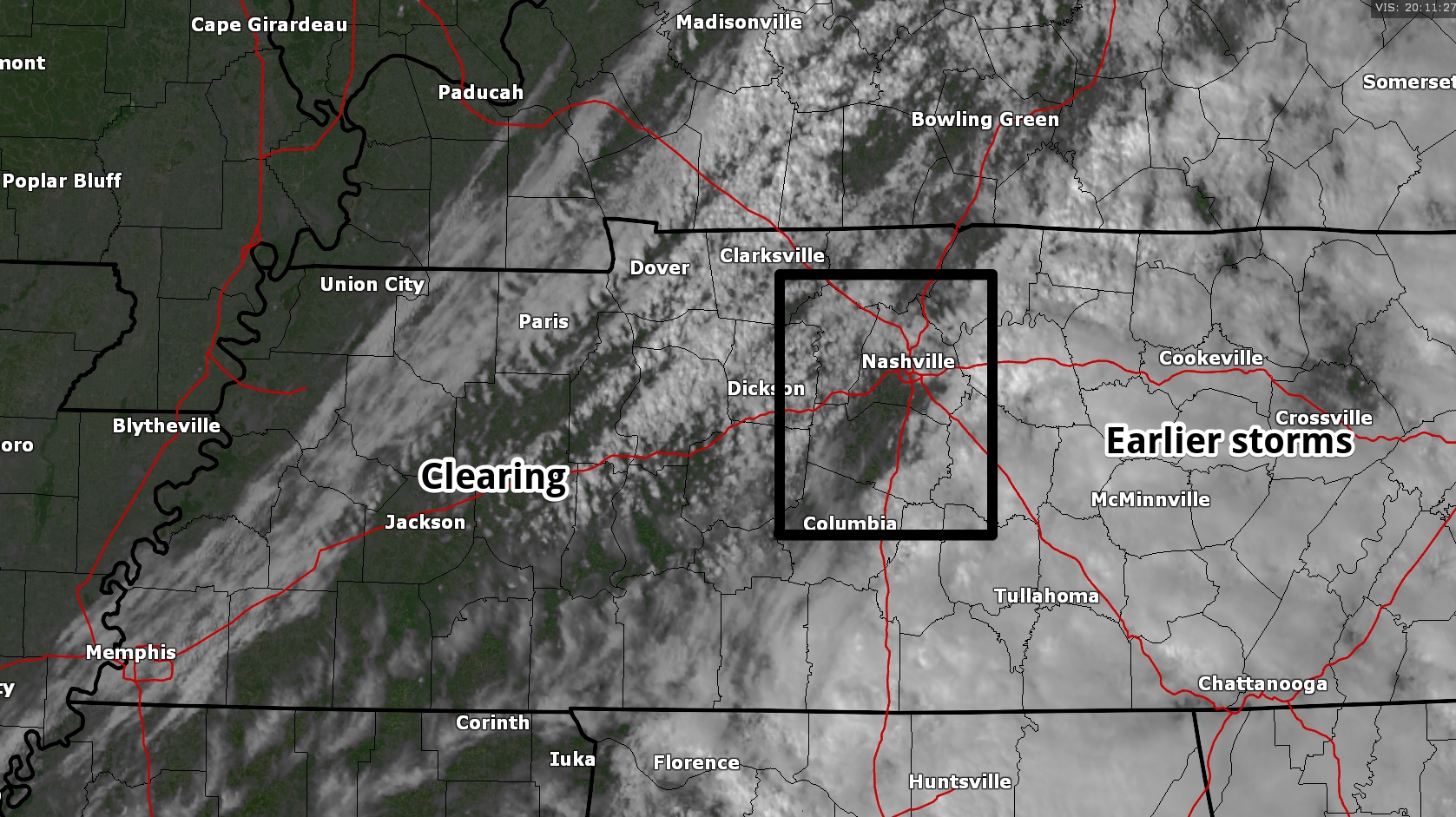
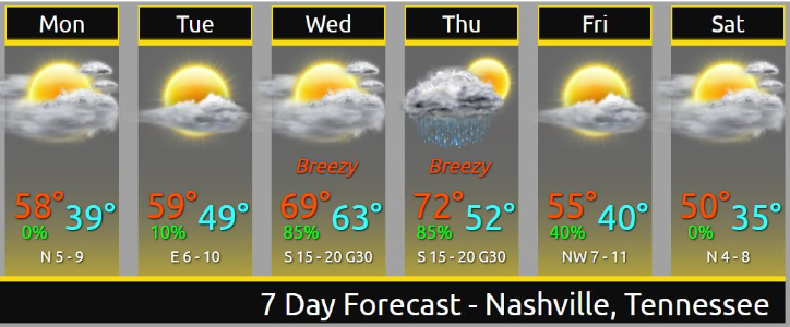
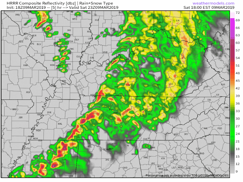
Today’s Severe Threat Is Over

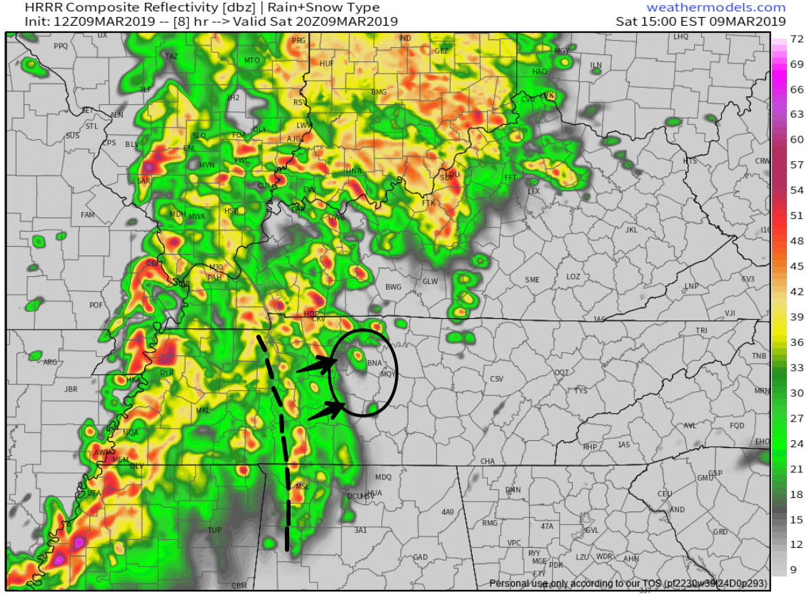
As we’ve been saying for several days, severe storms require certain ingredients. Most of them were in place, but we were lacking enough cold air aloft to get good updrafts going.

Weather balloon data is back! Shows lapse rates too low for severe weather here. Temps aren’t cold enough aloft to cause clouds to rise/lift fast enough to get robust vertical motion needed to create a storm capable of producing a rapidly rotating updraft (aka tornado). read more

This Morning’s Forecast Fail; Windy Wednesday; Rainy (Stormy?) Thursday; Cooler/Drier Weekend

Last night’s forecast was “no rain until Thursday!”

Uhhhh. Then this morning happened.

Light rain this morning surprised me. Rain was supposed to pass completely south of us. Most of it did. But we still got some this morning. At 5:56 AM NWS-Nashville noted approaching rain in West Tennessee was not reaching the ground thanks to a low level Dry Air Monster. read more

Nice Week Ahead, Except Thursday

Dry days ahead!

Pretty warm, too.

Rain, Storms Thursday

Rain and storms may start late Wednesday night/wee hours Thursday morning.

South winds will be strong. The Euro model thinks winds will gust over 40 MPH. Storm strength will depend on instability and dewpoint levels. No two storm events are the same, but this looks pretty similar to what we saw yesterday/Saturday — plenty of wind energy, questionable instability. As usual, considerable uncertainty, especially this far away. read more