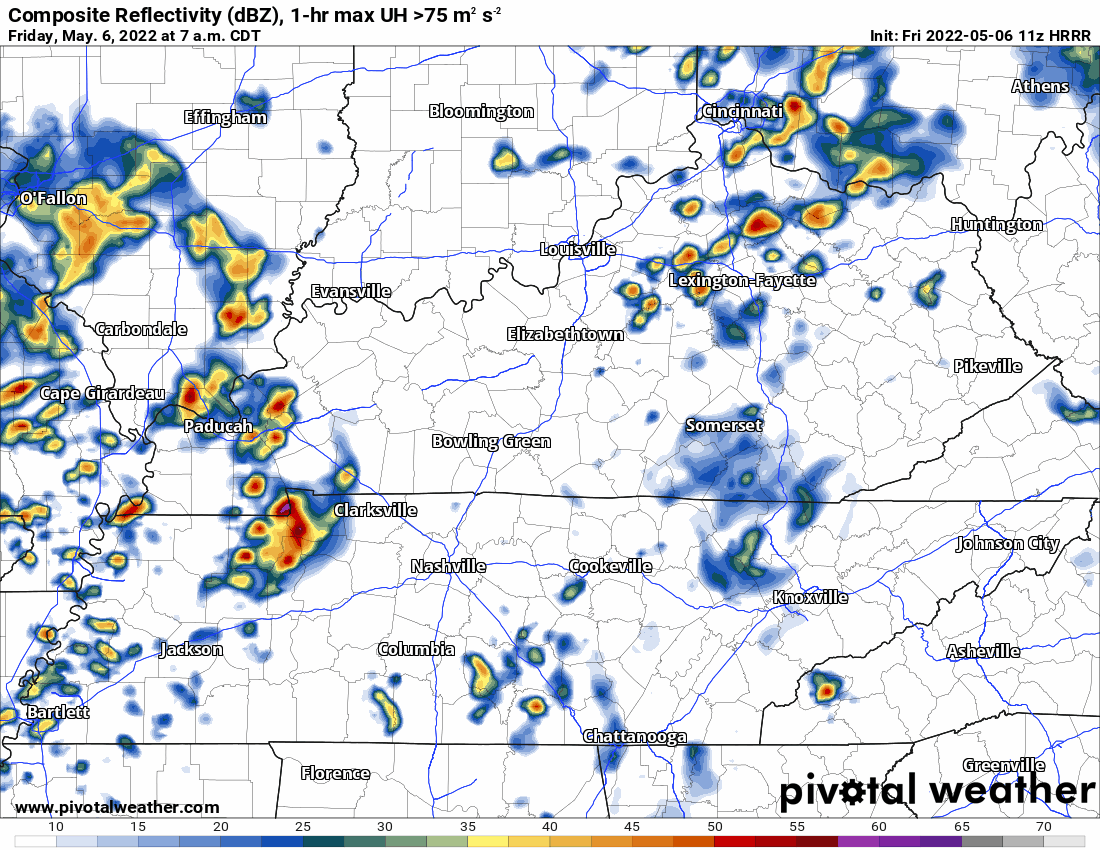
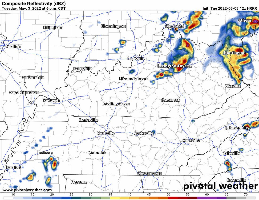
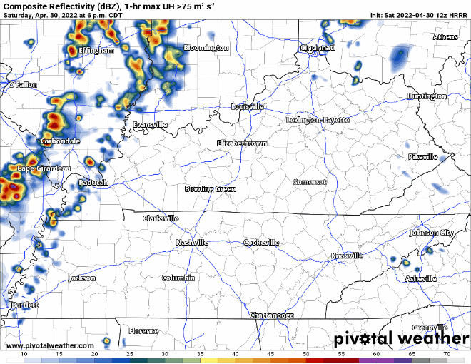
Last night almost all of us saw gusty winds and heavy rain. We were fortunate severe weather mostly avoided our two counties. However, those winds were legit.
Today, we’ll see more rain but not the severe chances we had yesterday.

Last night almost all of us saw gusty winds and heavy rain. We were fortunate severe weather mostly avoided our two counties. However, those winds were legit.
Today, we’ll see more rain but not the severe chances we had yesterday.
Moist, unstable, storm powering air will lift north into Middle Tennessee this afternoon:
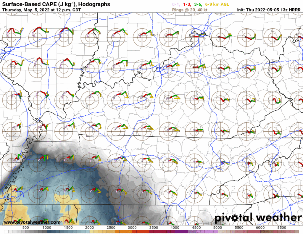
Storms approaching from the west will tap this power source. Heavy rain, lightning, and severe weather are all possible later this afternoon into the early evening.
New data arrived over the past few hours. Below see forecast changes.
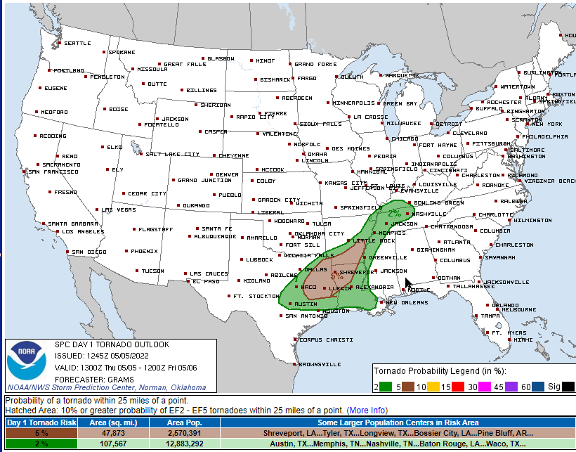
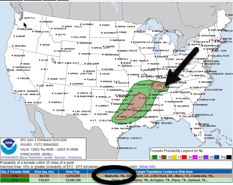
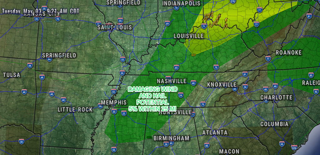
During lunch SPC introduced tornado, hail, and damaging straight line wind risks for Thursday afternoon/early evening.
The probability of a tornado within 25 miles of you is 5%.
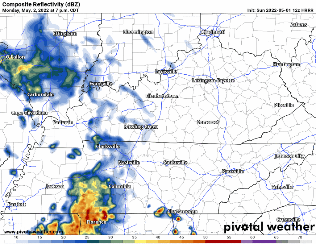
NAM3 and HRRR models think storms will fire up mid afternoon Thursday in Middle Tennessee. Both models include storms in Davidson and Williamson Counties. One model thinks another line of storms will arrive Friday morning after AM rush hour. I am not sold on the timing of any of this. Never tell me the odds!
Humidity is way up today compared to yesterday. So is storm fuel/instability.
Storms may develop in Middle Tennessee later this afternoon into the early evening hours.
Exactly when varies by model and model run.
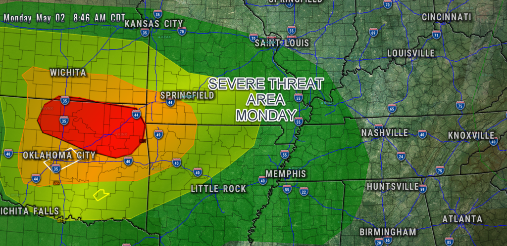
Severe weather is west of us today:
We’ll still get storms tonight. HRRR model (below) ETA 10-11 PM, event lasting a few hours. CAPE and shear both low so no severe. Lightning, maybe, but not a lot.
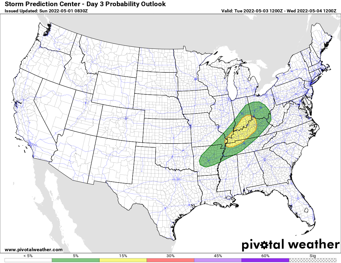
Rain possible every day this week beginning Monday.
HRRR has rain Monday night.
It may miss us to the south.
More rain may sneak in Tuesday morning, here’s the HRRR before it hits the end of its range at 7 AM. Looks like a mid/ late morning ETA.
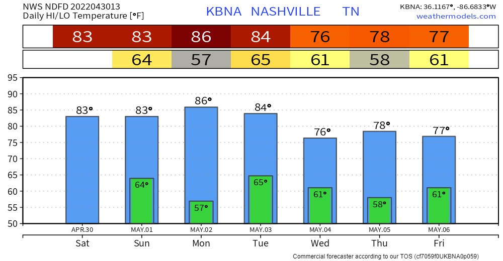

Last day of April brings us a bit above average temperatures. Nothin’ crazy. Noticeable breeze from the south and clouds will aid in keeping you a lil cooler.
Tonight
The HRRR model (above) shows some storms popping off and moving into our area around 7-9p. These storms should move out fairly quick. However, they may carry some lightning, so if you have outdoor plans, have a way to seek shelter inside. If thunder roars, go indoors. No severe weather is expected at this time, but stay connected.
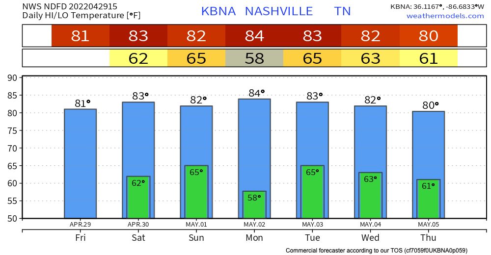
Friday and Saturday – enjoy these warm temps and rain-free skies. Highs are in the 80’s and lows in the 60’s AKA capital S Spring weather.
The next weather event we’re watching is Saturday overnight into Sunday. HRRR shows some spotty storms arriving around midnight and clearing out by 7am. This means your Saturday evening plans should be good to go, as well as your Sunday plans!
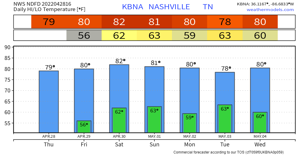
High pressure has set in… last day of zero rain chances. Relatively comfortable highs around 80 thanks to low dewps. Great day for your outdoor plans.
Rain chances start to go up tomorrow through the weekend. They’re low until Sunday. This is the time frame we’re watching for showers.
You must be logged in to post a comment.