More Heat and Humidity; Late Afternoon Rain Chances

Hot and Humid Today

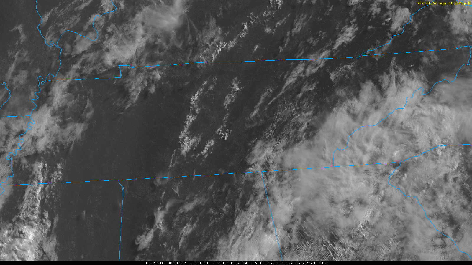
GOES-16 satellite imagery allows us a bird’s-eye view of Middle Tennessee. As of this morning, skies are relatively clear, with a few cumulus clouds. Lack of clouds will allow plenty of sunshine to come through, and temps will begin to climb. read more

Heat & Humidity Continues, Rain/Storm Chances, NW Flow Next Weekend?

It’s simple, really.

Low 90°s Heat and Oppressive Humidity all week.

The heat index will be near 100° every day in the shade, higher for those working in direct sunlight.

Rain and storm chances remain the same each day this week. There is no reliable way to ascertain whether it’ll be raining during any of your specifically-timed outdoor activities this week, generally, however, we think the following is true: read more

Triple Digit Heat Index Possible Today; Talking About Rain Chances thru the Fourth

This morning, NWS wrote:

A slight veering of the surface winds to more southerly today may allow slightly higher dewpoints to advect into the region which could push heat index values into the 100° to 105° range particularly across the Nashville to Clarksville corridor. read more

Heat Advisory to the West, Monitoring the Upcoming Holiday Week

The National Weather Service has issued a Heat Advisory again today for areas west of Nashville. That means the heat index is supposed to be in the range of 103º to 105º. We shouldn’t get that hot here, but it’ll be close. Heat indices will be near 100º today in Nashville. read more

Hot & Humid Weekend Ahead

One week ago: “I sure wish it would rain. It never rains. We need rain really bad. My garden is dying. When is it going to rain?”
Today: “Enough rain already. Everything is flooded. Make it go away. Please stop. STAAAAAHHHHHP!” read more

Severe Thunderstorm Watch In Effect Until 7 PM (Williamson Co.)

A “watch” means conditions are favorable for severe thunderstorms.

Note the probabilities of various hazards for the entire watch area:

Nashville is not included in this watch. Williamson County is included. It appears the boundary where storms are setting up is going to cut through Williamson Co., which is why they drew the area where they did. read more

Showers/Storms Possible Today; Oppressive Humidity This Week

Showers/Storms Possible Thursday

The Storm Prediction Center has placed us within a Marginal risk for Thursday. They think there is a 5% chance of severe storms occurring within 25 miles of you.

Threats are strong winds and heavy rainfall if a storm pops up over you. read more

Severe Storms Possible Today; Hot & Oppressive Through End of the Week

Severe Threat Today

*Outdoor plans at First Tennessee Park, Ascend or somewhere else? Keep your radar handy and check in frequently. Could have some storms around. See below.

It’s going to be hot and steamy today. The high will reach into the low 90s with the dewpoints staying in the low 70s.  read more

Difficult Forecast: Showers and Storms Not Expected But Possible Today & Tomorrow, Brief Relief by Mid-Week

Today

We dodged storms last night. They stayed mostly in Kentucky, although there were severe thunderstorm warnings in the counties to our north and northeast. One of them had supercell structure, like a spaceship: read more

Very Humid; Storm Chances Off & On Today - This Week

Oppressive Humidity This Week

Dewpoints will be in the low 70s all week.

On cloudy days, expect highs in the low 90s. Sunnier days, expect mid 90s. read more