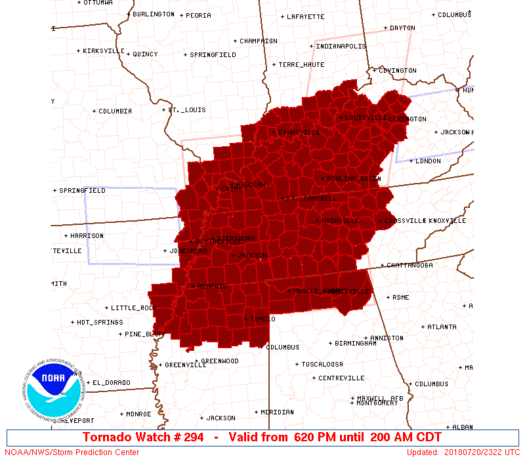
6:30 PM UPDATE
As expected, the Storm Prediction Center has issued a Tornado Watch that includes all of Middle Tennessee, in effect until 2:00am. The watch itself is HUGE, encompassing parts of eight states, and well over 100 counties:

6:30 PM UPDATE
As expected, the Storm Prediction Center has issued a Tornado Watch that includes all of Middle Tennessee, in effect until 2:00am. The watch itself is HUGE, encompassing parts of eight states, and well over 100 counties:
Sticky — but not oppressive — humidity and very low afternoon rain chances; keep all your rain-afraid afternoon plans.
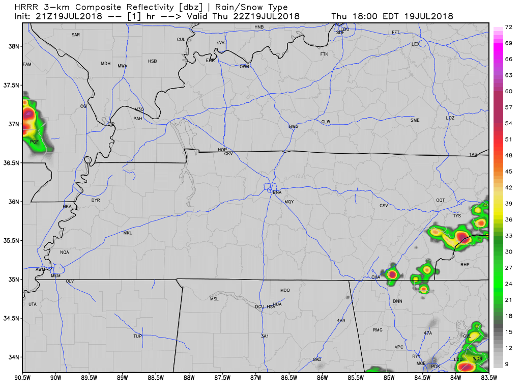
That said, a few storms could go up this afternoon, but as the HRRR model below illustrates, most of that threat will be to the south and east of Williamson and Davidson counties.

Humidity has dropped! We’ve endured Oppressive humidity for the past several weeks, but today, we are moving two places down the meter to the Sticky range. Even though still Sticky, it is all relative, the change is going to feel amazing.
Our winds have shifted and are now coming from the north, bringing us dry air overnight tonight.
The HRRR shows us what the radar could look like for the remainder of the day. Rain/storms forming mostly along and south of I-40 in the afternoon, then slowly pushing south.
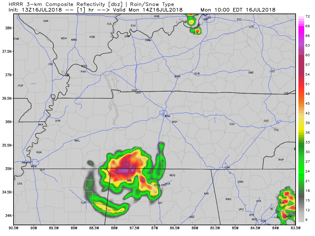
A thunderstorm complex passed mostly south of us this morning. We have slight chance of showers and storms in the Nashville area this afternoon; however, the HRRR model shows a majority of the shower/storm activity will be south and east of the city. Said threat will taper off by the afternoon, so most (hopefully all) activities are looking good.
Light rain is moving closer and should arrive tonight, but do not expect a repeat of what we saw this morning.
All quotes (but one) from NWS-Nashville:
Many of the storms should dissipate this evening but the threat for additional storm development will continue overnight and Monday as the upper level trough approaches VERY SLOWLY before finally moving east of Middle TN. The threat of heavy rain will continue due to the rich moisture but threat for severe storms is muted due to marginal CAPE values.
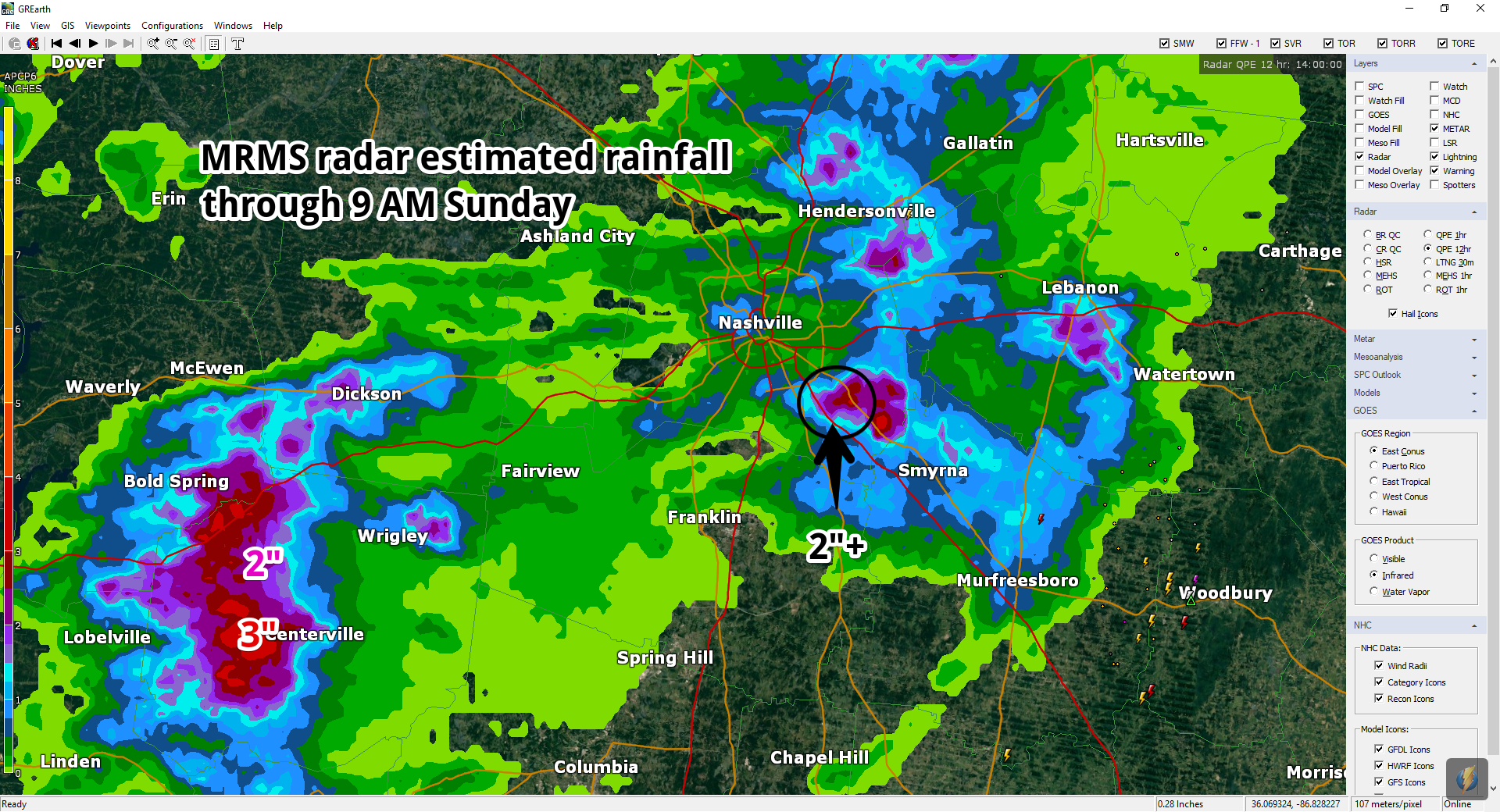
Flash Flood Warnings are ongoing this morning in the counties immediately west of us.
Radar estimates through 9 AM show where the heaviest rain has fallen:
There was also 2″ of rain down I-24 in SE Davidson County, near/around Cane Ridge.
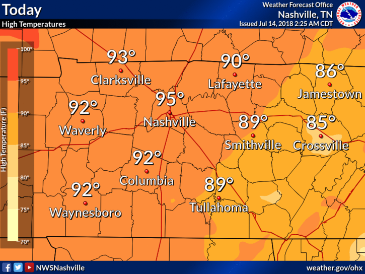
Rain-suppressing high pressure will be here today, gone tomorrow.
High temps will hit the mid 90s for Nashville, with oppressive dewpoints in the low 70s. Another hot and humid day in July.
The HRRR model (shown below) predicts afternoon downpours, but it has Williamson and Davidson Counties looking dry.

It’s Friday the 13th and an Intern broke bad by missing the “write the blog” assignment this morning which is what happens Friday, the Thirteenth and why you’re getting this at 6 PM.
A dome of high pressure has settled itself right on top of us. This will suppress rain formation and increase our high temps.
This afternoon we will hit the mid 90’s for most places around Nashville. Dewpoints will again be borderline oppressive (around the 70° mark). Heat Index values could easily reach 100°.
You must be logged in to post a comment.