
One More Wet Afternoon – Then Dry Air Arrives
Our winds have shifted and are now coming from the north, bringing us dry air overnight tonight.
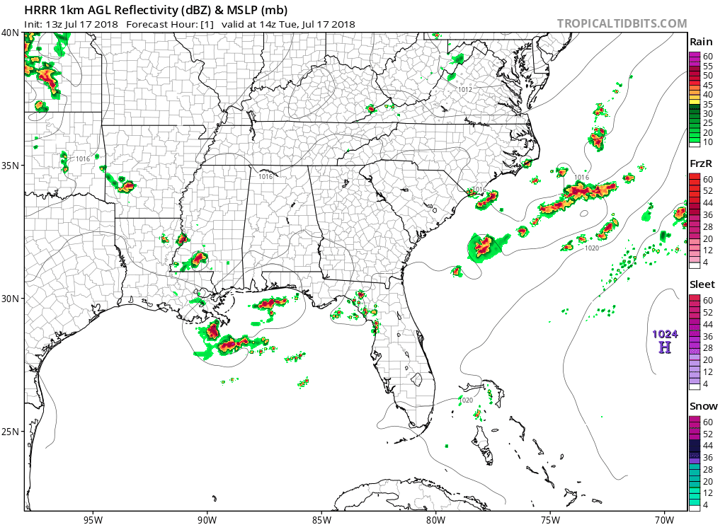
The HRRR shows us what the radar could look like for the remainder of the day. Rain/storms forming mostly along and south of I-40 in the afternoon, then slowly pushing south.
Threat with these storms will be gusty winds, lightning, and a quick downpour. Easy to dodge if you’ve got outdoor plans.
Dry air will push in tonight, scouring out moisture and dropping the humidity. The break we’ve all been waiting for! Dewpoints will drop into the low/mid 60s.

Dry, Sunny Wednesday
No rain! Dry and stable air will keep storms from forming.
A great day for outdoor plans!
Rain Chances Increase By the End of the Week
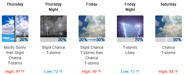
Rain chances begin to increase on Thursday. Our winds will shift back to the south bringing humidity back to Nashville.
We could see a frontal passage on Friday and possibly another sweep of dry air. Storms will be possible, but we won’t get a good feel for the timing or severity until we are closer to the end of the week.
However, the Storm Prediction Center is already talking about Saturday:
For Saturday, the models move the upper-level trough slowly eastward and again show the moist sector in the base of the system. The models would suggest an isolated severe threat will be possible across parts of the Ohio and Tennessee Valleys Saturday afternoon. Any severe threat would be probably remain marginal due to the relatively weak deep-layer shear forecast.
Our anxiety level is low, but interested.

Stay clicked to NashSevereWx on Twitter or check back here for updates!

Categories: Forecast Blogs (Legacy)
You must be logged in to post a comment.