Rain Ending, Getting Cooler. Cold Mornings Ahead. Early Weekend Rain.

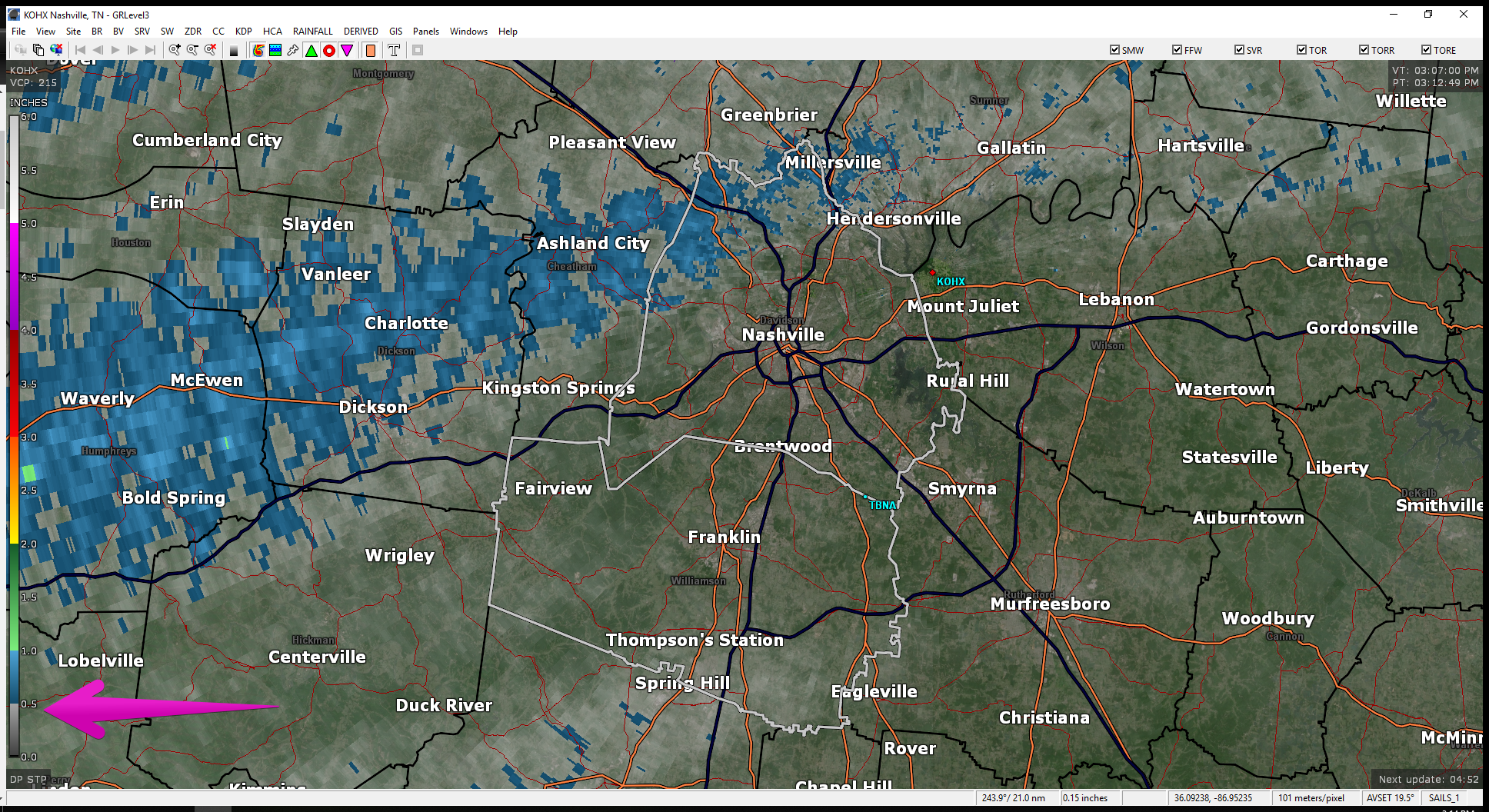
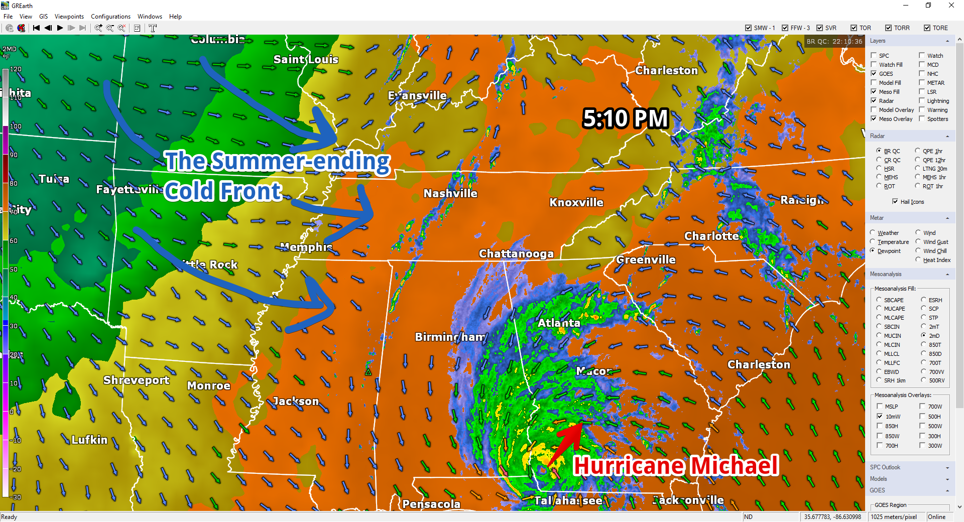
Heavy rain is ending, but it’s not over. Most areas along and north of I-40 got 2″ to 3″.

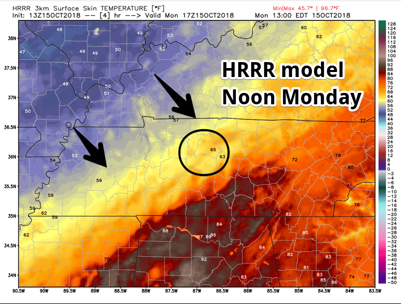
2" to 3" of rain estimated by radar last 12 hours along and north of I-40. Rain slacking off now. Blue arrows depict approach of a cold front. It's 67° now at BNA, expecting upper 50°s before/around dark with arrival of Jerk North Wind. pic.twitter.com/jgz9kJ14So read more

Off & On Rain This Evening Through Tuesday; Jerk Winds Monday

Rain hasn’t been terribly heavy today. As of 3:12 pm, radar estimates most of us have received under a 1/2 inch . Blue indicates 1/2 to 1 inch. That doesn’t include many of us…just Joeltinians/Joeltonites. Someone fill us in on what you’re called if you’re from Joelton. We shouldn’t have started guessing, but since we’re here, help. read more

Rain Begins Tonight, Continues Through Tuesday; Warming for the End of the Week

Overnight lows in the mid 50s.

Latest HRRR shows rain starting about 9 PM. Rain showers on and off all night with warm front lifting through the Midstate.

Sunday Afternoon Football – Update

Rain off and on all afternoon/early evening. Winds coming from the south sustained at 10 MPH, gusting stronger than that at times (near 20 MPH). Winning the toss key. Temps mid/upper 60s. Birds hate this weather. read more

Light Rain Showers Today; Rain Chances Increasing Saturday Night, Continuing Through Monday

Today

Mostly clear skies can be found statewide. We should remain mostly cloudless throughout the day before an upper level pulse scatters showers our way this evening.

Some scattered showers will quickly push through late tonight. Greater chances can be found to the north, decreasing as you go south. read more

Introducing Slight Chance of Light Rain Friday Night; Rain Likely Beginning Sunday

It’s going to get cold overnight into the morning.

Friday Morning Low: 45°

Ditch the t-shirt. Gonna be cold tomorrow morning!

We’ll only warm to 64° Friday afternoon.

Light Rain Possible Friday Night

Extended HRRR model run (18z) shows it:

read more

Autumn is Here! Not Cool Mornings, Cold Mornings. Rain Sunday (Titans) & Monday.

Temps dropped overnight with cold front passage. The front also scoured out summertime humidity.

BNA recorded the drop:

In 12 hours the temp dropped 15° (74° to 59°) and the dewpoint dropped 19° (71° to 52°). #ColdFront #GoodbyeSummer pic.twitter.com/9ESIhcN9Tg read more

Summer-Ending Cold Front Arrives Tonight!

Tonight’s rush hour is greeted by a broken line of inconveniently timed downpours. A summer-ending cold front is the cause. Cooler and much drier air spills in here around and after midnight.

read more

One More Summery/Humid Day; Rain Possible Later Today as Michael’s Northern Edge Goes East; Fall Begins Tomorrow

This is the last day of our summer airmass. Goodbye muggy dewpoints (near 70°)! With clouds, our high temp will only hit 84°.

Here’s the map at 6 AM. Notice all the warm air. But look to the left (west). That’s a cold front and it’s moving east. read more

Last Day of the Heat; Cold Front Arrives Late Tomorrow; Fall Arrives Thursday!

Hurricane Michael Update

Hurricane Michael strengthened to a category 2 hurricane overnight. It’s still expected to reach Category 3 (major hurricane) status before pushing inland tomorrow.

A cold front from the west will act to guide this storm up and out of the gulf, turning it to the northeast. As seen here on the NHC’s updated track, Michael should miss us all together. read more

Summer-like Pattern Coming to an End, Cold Front Incoming!

Goodbye Summer!

FINALLY! Relief is in sight. But first, we need to get through the early part of this work week.

Temperatures today will again reach the upper 80º range. Looking at a high temperature of 88º in Nashville, with dewpoints in the upper 60ºs through much of the day. Isolated showers and storms will remain possible. However, not everyone will see them. read more