From NWS-Nashville:
forecast soundings would suggest we should see plenty of wind gusts of 30-35 mph. This is just below wind advisory criteria (gusts of 40-57 mph).
Sustained winds will be strongest this afternoon.

From NWS-Nashville:
forecast soundings would suggest we should see plenty of wind gusts of 30-35 mph. This is just below wind advisory criteria (gusts of 40-57 mph).
Sustained winds will be strongest this afternoon.
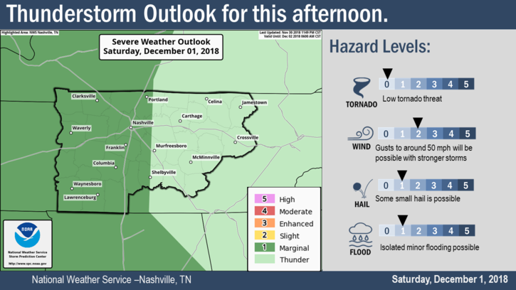
The Storm Prediction Center has us placed within a Marginal Zone (1 out of 5) of severe storm activity for this afternoon.
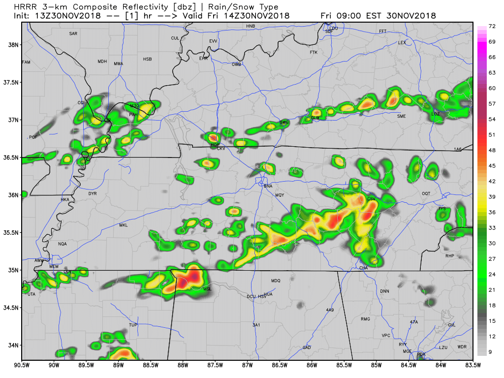
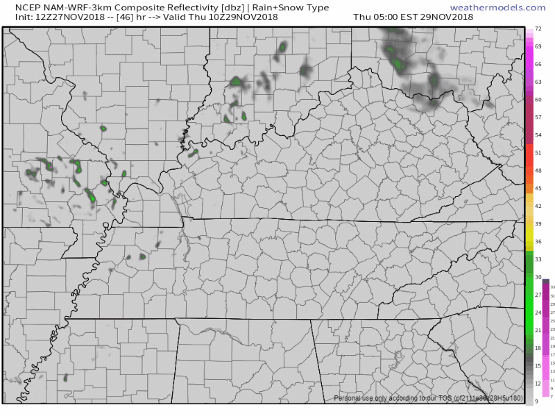
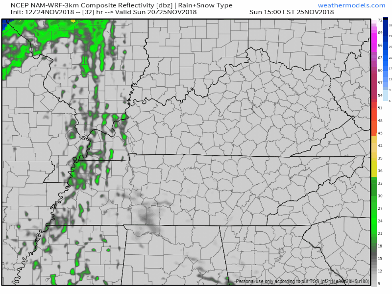
6:39 PM update: there’s another line of storms to our west.
The latest Mesoscale Discussion mentions these storms:
Scattered showers this morning will give way to heavier rain this afternoon, perhaps with a bit more coverage area. We are not expecting any severe weather, however, a few rumbles of thunder can’t be ruled out.
A shortwave trough over the Great Plains has shifted our winds to the south, bringing gross, moist air to the Midstate. For today, periods of on and off rain. Not expecting anything severe with these.

We are looking at a very chilly day ahead. Only expecting a high of 41º to occur in Nashville; some spots may not even make it out of the 30s. We will see some high clouds, however, nothing in the way of precipitation.

Cold air is pouring in from the north, making for a breezy day. Wind chills will go no higher than the upper 20s this afternoon, with breezy winds driving the wind chill into the upper teens after sundown.
Normal high temps for the end of November are usually in the mid-50s!. High could crawl close to 35° even though we’ll see more sun through the day.
Some flurries are possible but no impacts are expected. Just be careful if you see a wet road, there may be a thin layer of ice.
Overnight temps will fall even further into the low 20s. This is due in part to clouds breaking up, cold air and calm winds. Here’s what NWS Nashville has to say:
"CAA [cold air advection; fancy term for cold air moving from one place to another] today will also bring drier air with dewpoints in the teens, and with winds calming down a bit tonight, there won't be anything to keep temps up."
Wind chills will remain below or near freezing today despite our high of 41°. Winds will gradually relax through the day.
Below are forecast wind chills every three hours beginning at 9 AM today continuing through noon Wednesday:
17-20 MPH sustained this afternoon. From 9 PM to midnight, winds will gust up to 32 MPH. You may hear things creak.
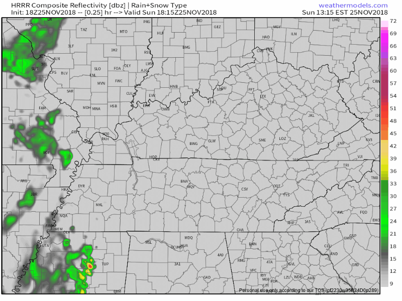
Very light, scattered showers possible beginning at 4 PM. Off and on, meh. Should end around 11 PM. HRRR model future radar:
The kids say “rn,” efficiently meaning “right now.” Hey, it’s your tomorrow. It means everything.
48° and foggy rn. pic.twitter.com/nswJ3CPraI
— NashSevereWx (@NashSevereWx) November 25, 2018
The last band of rain has moved to our east, bringing today’s rain chances to a close. Sun is returning as we go into the afternoon.
Winds will calm down this afternoon/evening as dry air is ushered into Nashville. High temps should reach the low/mid 60s, slowly cooling into the mid 50s by bedtime.
You must be logged in to post a comment.