BNA got all the way up to 47° today, which feels like quite the accomplishment.
Snow melts at different rates at different places, most of it probably melted today, but some stubborn snow/ice could hold on until tomorrow.

BNA got all the way up to 47° today, which feels like quite the accomplishment.
Snow melts at different rates at different places, most of it probably melted today, but some stubborn snow/ice could hold on until tomorrow.

Ice remains. It was 5° at BNA overnight. Many local areas colder than that.
Temps above freezing – barely, briefly – this afternoon. Sunlight and light winds will erode but not eliminate ice sheets. Back down to 20° overnight and Monday morning.
Most main and secondary roads are OK, but could contain “invisible” black ice in “hard freeze” (T<26°) temps today and Sunday morning. Neighborhood roads, sidewalks and decks remain icy, esp on hills and in shady areas.
The brutal cold is the big story. More on that in just a bit. First, quick note about the snow.
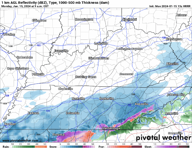
Light snow showers across the area have been stubborn to dissipate today with some sites still reporting light snow or flurries ongoing this afternoon. So a dusting or a quick half inch of snow isn`t out of the question still through this afternoon, but all of this should wind down within the next few hours. NWS NashvilleIf you get a quick burst of snow, roads can deteriorate quickly on a local level, even if just for a few minutes. Take it easy out there.
Freezing rain/drizzle is moving in our area and already causing travel issues.
Temperatures currently range from 30 – 33°, throughout our counties, impacts will differ from place to place.
Snow already on the ground will help ice accumulate either, freezing on top of the snow.
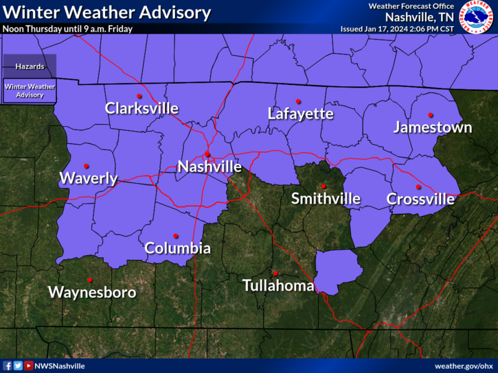
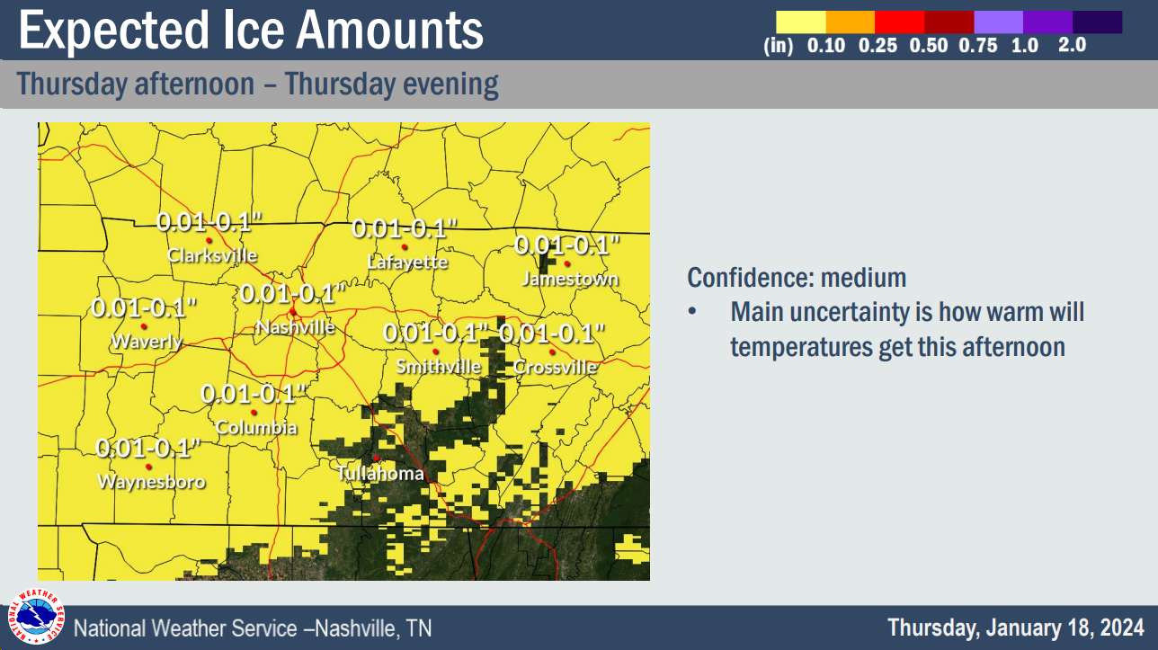
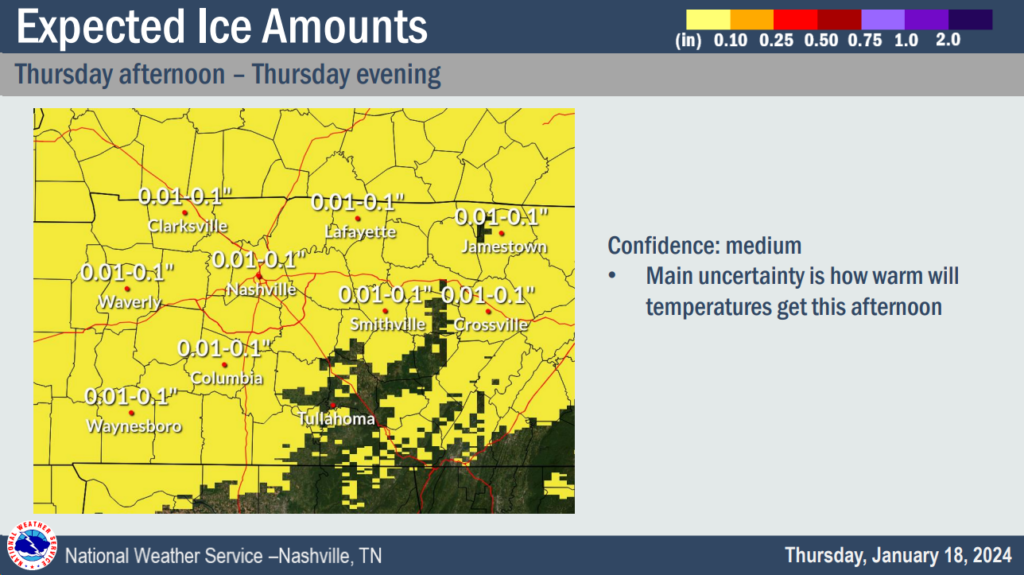
We have a Winter Weather Advisory for both of our counties from noon Thursday – 9am Friday.
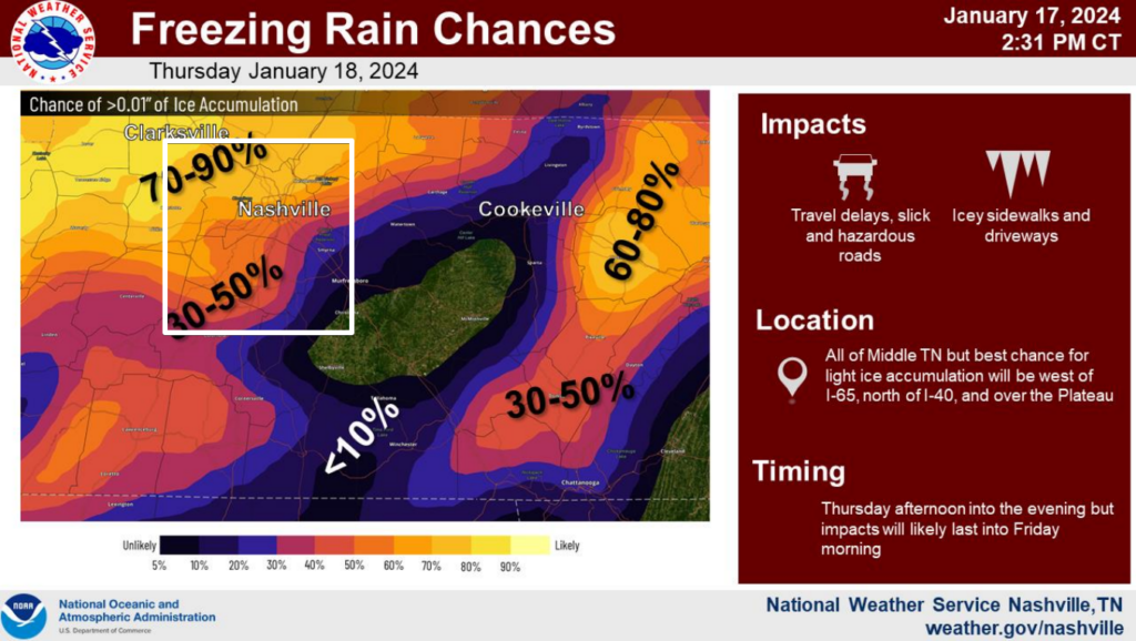
Across our counties, probabilities for >0.01″ of ice accumulation range from 30 – 70%.
Ice is a lot different from snow. All it takes is a glazing of ice to cause issues on the roads.

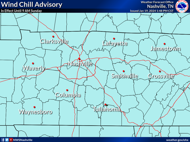
Wind Chill Advisory continues thru 10 AM Wednesday.
High temps only expected to make it to 18° today. Wind chills will be stuck in the single digits during the day.
Air temps tonight will be very close to 0°, your backyard may make it below zero.
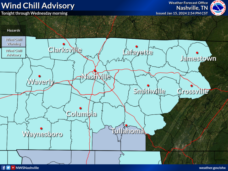
Wind Chill Advisory. Tonight 10 PM thru Weds 11 AM.
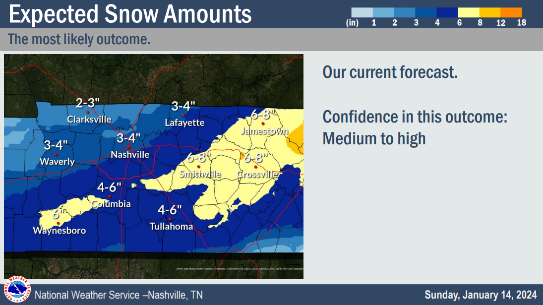
Snow Totals Vary 5.5″ to 9.5″. Snow fell unevenly. Elevation and location skew results. I’ve seen 5.5″ to 9.5″ in our replies. An average winter in the last 30 years delivered 4.7″. Snowfall is ending now and should be gone after dark. Send measured snow taken from hard surface (not grass) by tagging it with #tSpotter on Twitter.
We woke up this morning to several inches of snow on the ground and air temperatures around 10°, with wind chill values around 0°. That doesn’t sound much like Middle TN. Quite the snow event we have here.
Well…it’s snowing.
As expected, snow has quickly accumulated across the area and road conditions are quickly deteriorating. If you don’t have to get out, please don’t. If you must get out, please, take it slow, leave plenty of room, and *clean the snow off the top of your car*. Snow on top of vehicles can become aerodynamic ice missiles, and you do not want that flying thru a windshield.
You must be logged in to post a comment.