Rain, Cold Mornings, Weekend Rain Event (storm/snow comments)

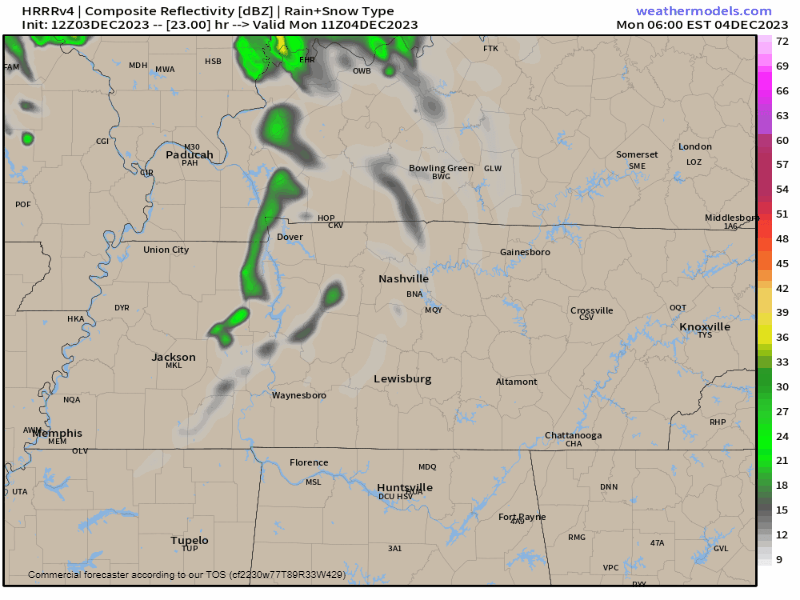
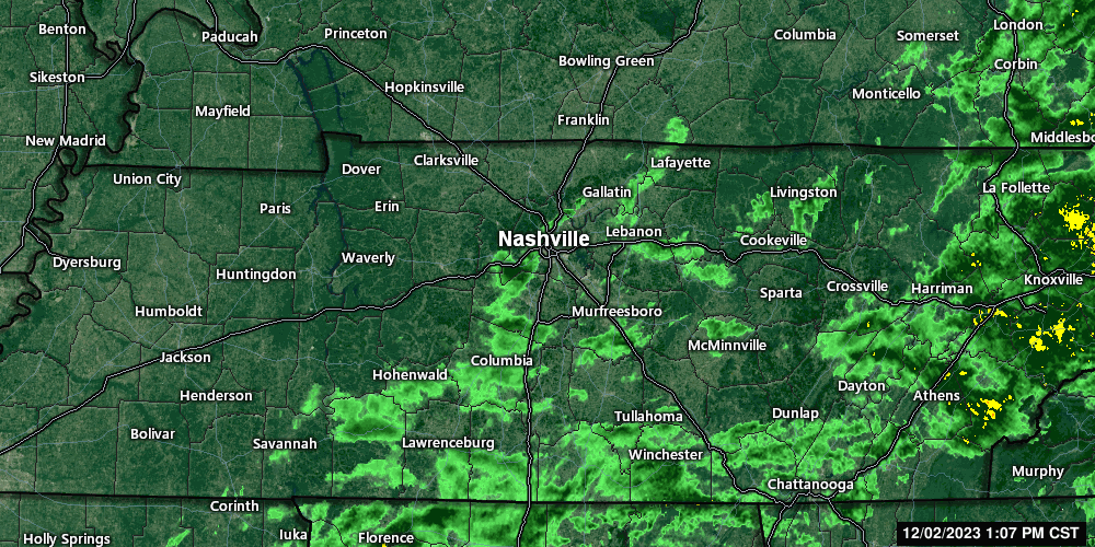
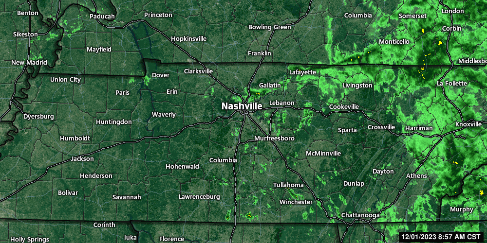
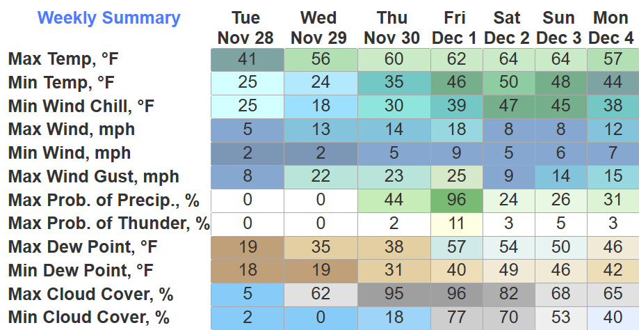
Rain showers later today/tonight.

  • 1. Brief, chilly, and unevenly rainfall caused by – impress coworkers at holiday parties with a well timed – this “is common for these clipper systems.”
  • 2. Rainout/Washout unlikely.
  • 3. You may hear talk of “snow” — that’s for non-accumulating snow potential on the plateau.
  • 4. GEO ICYMI: The plateau is east of us – think between Cookeville and Crossville – they’re at higher elevation – easier for them to snow than us.

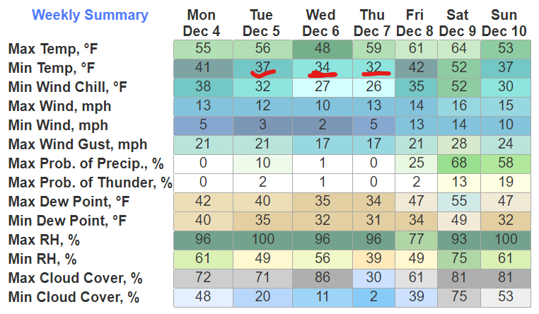
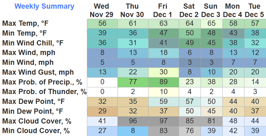
Near/Freezing Morning Temps & Thursday’s Marginal Fire Danger

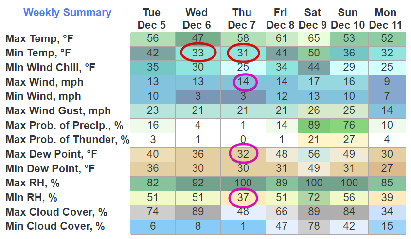
  • 1. Ice may form where fog develops on bridges and overpasses Weds & Thurs mornings.
  • 2. A marginal fire danger Thursday afternoon will discourage outdoor burning – dry airmass with low relative humidity + winds in the low teens = may cause fire containment problems.

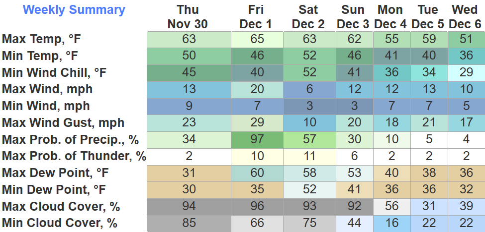
Big Rainmaker Coming This Weekend

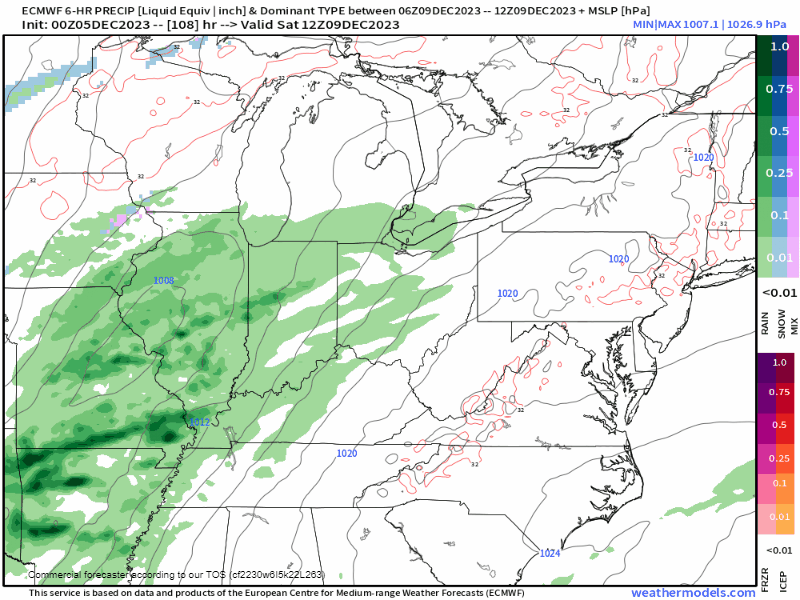
  • 1. TIMING: best guess right now arriving Saturday night and departing around lunch Sunday – timing will probably change.
  • 2. RAIN: on average 1″ to 1.5″ – this too may change either way – models diverge in key areas – this reduces forecast confidence.
  • 3. STORMS: again our confidence is shaky here due to model disagreement – the path of the storm favors thunderstorms – but other essential ingredients (instability, lapse rates) are very weak in the models – SPC excluded us from severe weather risk – no risk will be introduced unless and until models develop agreement – more to follow later with new data.
  • 4. SNOW: not for us – our ground will be way too warm – unreceptive to ice – models at this range routinely advertise snow that never happens – even the Euro (above) pulls the colder air columns way too far north of us.

Quick References:

Weather changes constantly.
Follow @NashSevereWx on Twitter for any changes to this forecast. read more

Weekend Rain, Storms (?), and Just in Case Someone Says Sn*w This Weekend…

A Great Lakes snowstorm may spin a little rain into Middle Tennessee Tuesday – no biggie here – HRRR model below:

Mild days, cold mid week mornings – near freezing – ahead:

A big system will plow through this weekend. Here it is: read more

3 Things: Monday, Tuesday, & Ladies and Gentlemen The Weekend

Skies clearing today. Looks pretty good.

  1. Monday morning. HRRR has a weak rain band tomorrow (Monday) morning. Inconsequential.

2. Tuesday morning. Cold brief rain if the HRRR is right (model cuts off before arrival):

3. Weekend rain. Timing and “accuracy” iffy at this range. A soaker is best bet. Not sure if Saturday or Sunday or both. May involve thunderstorms but no current severe concerns. Notice those pinks and blues as the system moves away – common false flag for wintry precip. More about this system tomorrow. read more

Rain, Light, Off & On - This Afternoon Into Tonight.

Plan for off and on light showers this afternoon into tonight.

Reasoning. This was the radar as of 2:02 PM:

Rain between Savannah – Hohenwald – Lawrenceburg will get to us later today and tonight according to the HRRR model: read more

Intern Taking Finals, So You Get The OG

The Intern is on Finals Haitus until 12/8 – so like Fortnite, you get the OG for a while –

Most of the morning rain is gone — below is the radar before 10 AM this morning – we may squeeze out a few more showers this afternoon which would be NBD: read more

Drought Improvement, Light Rain Tonight Into Friday AM, Weekend Uncertainty

I’ll start off with good news, and that is that our drought situation has improved. It is not gone, but it has improved.

Davidson has been left with a Moderate Drought, while WillCo. is under a Severe Drought. Better than the Extreme Drought we were dealing with. read more

Light Rain Overnight Thursday, Low Rain Chances Stick Around For The Weekend

A few locations might reach 32° tonight, but other than that, we’ll take a pause on sub-freezing temps for a little while. Strong southerly flow will help our high temps reach the 60’s Thursday – Sunday. read more

Cold + Dryyy, Rain OTW Thursday PM

BNA only got to a high of 43° today, which is the coolest high since March 19th earlier this year. We’ll dip down into the low 20’s again tonight, I bet a few backyards could reach the upper teens. read more

Subfreezing Mornings - Fire Danger & Drought - Rain Late Thu Into Friday - & Our Weekend EduGuess

Subfreezing mornings Tue & Weds – hard freeze both mornings – many of us will be colder than that – coldest temps around sunrise – redboxed below are the 24° and 26° lows – then a warmup rest of the week. read more

Drizzle Moving Out, Cooler + Dry End to November

Some light drizzle still moving thru the area, just enough to be slightly annoying.

Drizzle will be all gone by Monday morning as we wake up to temps below freezing, with wind chills in the low 20s.

This will be a common theme Monday – Wednesday. Thursday high temps finally warm up to the 60s and they’ll stay there as we enter December. read more