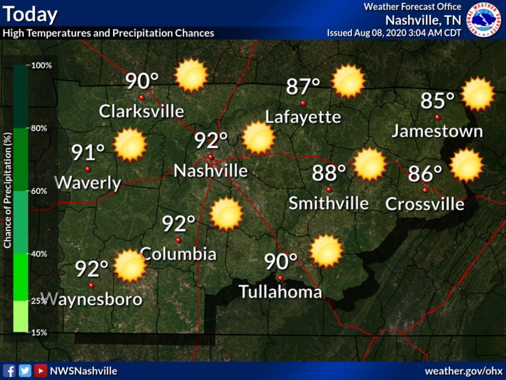
Beautiful Monday
High of 89 with dew points low-mid 60s. We will definitely take that for mid-August. No rain today with mostly sunny skies. Go outside and enjoy it.
Tonight will feature clear skies with temps hovering around 70

High of 89 with dew points low-mid 60s. We will definitely take that for mid-August. No rain today with mostly sunny skies. Go outside and enjoy it.
Tonight will feature clear skies with temps hovering around 70
A Fairview thunderstorm is heading for Spring Hill as I write this. It’s being covered on Twitter @NashSevereWx.
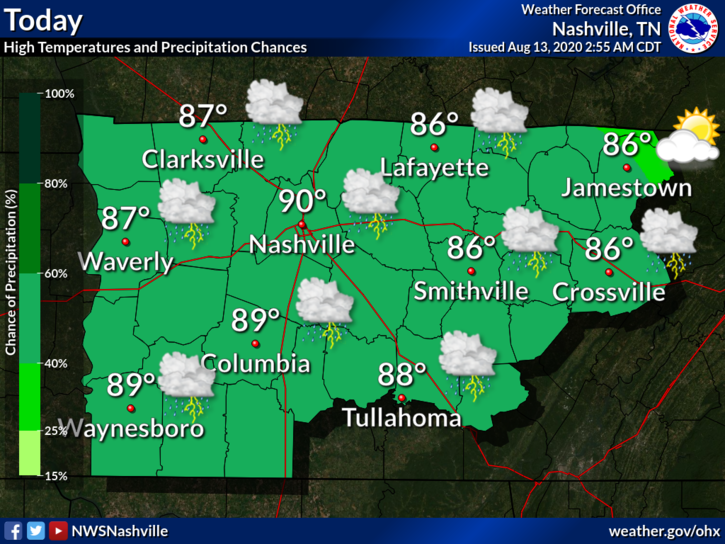
Rain and a few more thunderstorms are possible today. It’s very humid, there’s plenty of instability, and a cold front is approaching to provide lift, kicking off your chances for a few storms this afternoon.
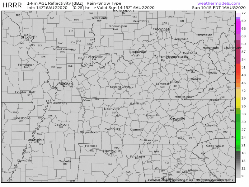
The HRRR is showing much of the rain staying in the far east portion of the state today.
We can’t rule out a stray shower or storm rolling into your backyard late this afternoon, but we should be looking at some drier conditions.
Scattered showers and thunderstorms will arrive by about 1 PM. We’ll see these on and off throughout the afternoon until it finally picks up and moves to the east before midnight.
Notice the motion of the atmosphere? How it’s moving in a counterclockwise fashion?
Scattered Afternoon Rain, and OMG It’s Humid Today
An enjoyable morning will set the stage for thunderstorm activity to pick up throughout the day.

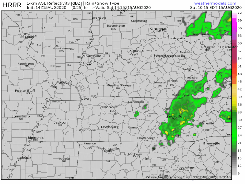
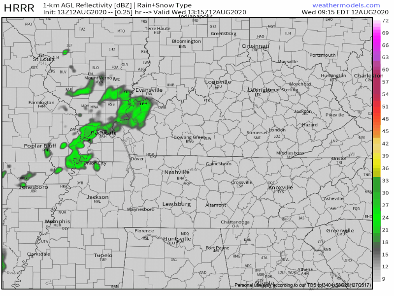
The HRRR shows scattered showers mostly missing Williamson/Davidson this afternoon, but I’m not taking the model’s word for it. With the moisture in the air + afternoon heating, I expect more showers to pop up. Some may be in your backyard, some may not.
Storms will use very humid air to make rain and storms today through the weekend. Humidity relief arrives Tuesday of next week.
The HRRR model’s ETA for today’s thunderstorms begins after 2 o’clock, but storms are most likely between 4-6 PM. Storms should die out an hour or so after sunset.

It’s going to be hot.
High temps will be around 94°, but the dew point will reach as high as 73°. This will push heat index values into the upper 90s and even low 100s.
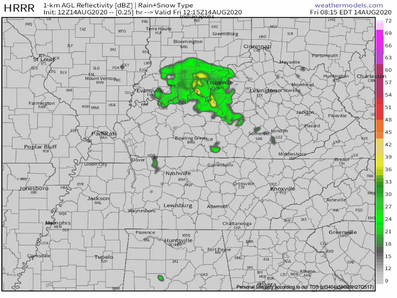
We should be relatively dry throughout the day. The HRRR has most of the storms staying west and south of us.
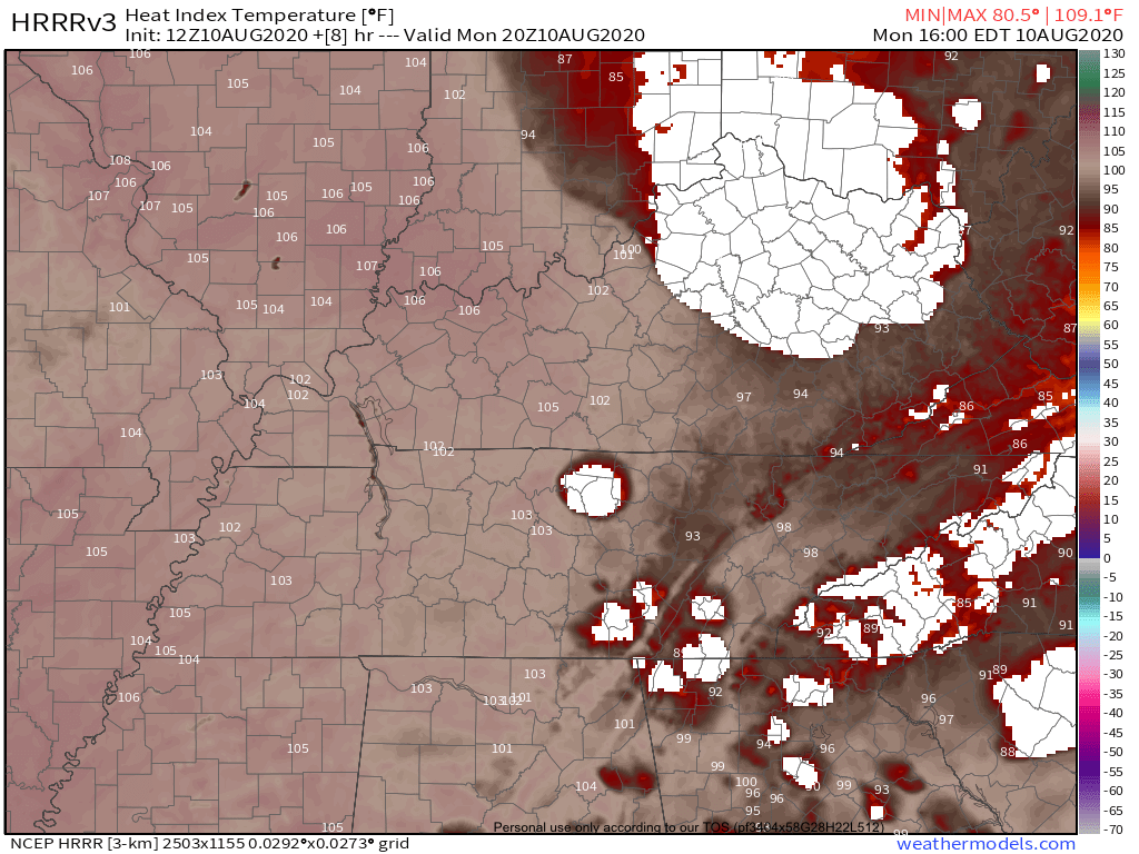
August heat and humidity…
Low 90s for temps and low 70s for dew points means dangerous heat indices. HRRR Model is very bullish with a max heat index of 103.
Upper 90s to around 100 appear very likely. Limit time outside during the peak heating hours and check the backseat!!

A thunderstorm cluster is in Western Kentucky moving southeast toward us, but the models think it’ll fizzle out before it gets here.
More storms may redevelop for a few of us this afternoon. Severe weather is not expected. There might be lightning or even a few pretty big downpours, but not for everyone.

A Tolerable Form of “Hot” on Saturday
Hear me out. It *sounds* hot outside today! It’s 10 am and the cicadas are already out chirping in full force.
Few clouds out this morning to provide relief from the sun. Today will be the first August day of this year to surpass 90º. That’s not very “on brand” for 2020, but I’m not complaining! Lucky for us, our dew points are still hanging out right around 65º. Hence, the “pleasant” heat.
You must be logged in to post a comment.