Storms will use very humid air to make rain and storms today through the weekend. Humidity relief arrives Tuesday of next week.
The HRRR model’s ETA for today’s thunderstorms begins after 2 o’clock, but storms are most likely between 4-6 PM. Storms should die out an hour or so after sunset.
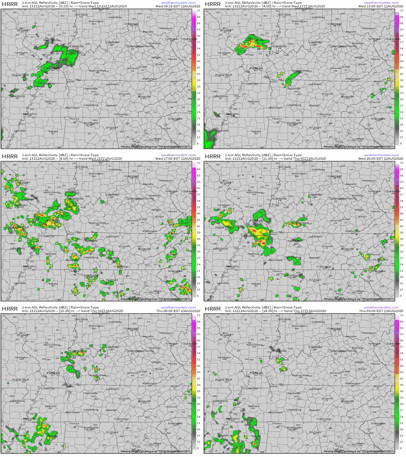
Those who get hit by a thunderstorm should expect about a half inch of rain. Others will get nothing. Storms will feature torrential rainfall and frequent lightning. Gusty winds may occur as storms collapse. Shear is lacking, so no hail or tornado worries today.
Same Story, Different Day.
Thursday, the HRRR model expects a north-moving cluster of showers and storms around 5-7 PM:
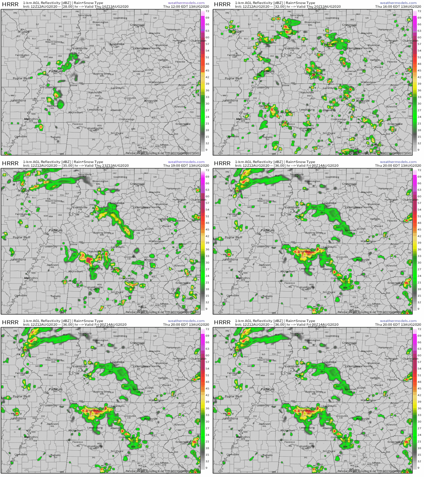
These storms are created by an upper level shortwave. A shortwave is a mid-level or upper-level atmospheric disturbance which forces upward motion ahead of it. That creates and lifts clouds, clouds get heavy with rain, temps aloft are cold and as clouds race up, lightning is made, hence all the stormy weather.
Typical August Weekend
Friday – Best chance for showers and thunderstorms for the weekend, mainly occurring after 9 AM. That’s earlier than normal. We’ll see more rain on Friday than thunderstorms, but a pop of lightning and a clap of thunder could be in the mix.
High temp on Friday (graphic below) says about 80, but that’s the Euro model assuming it’ll rain all day. The National Weather Service expects mid-to-upper 80s.
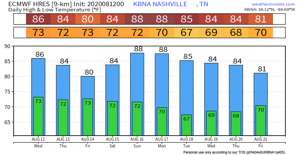
Saturday – Scattered showers and thunderstorms possible during the day but by evening, storms will move off, leaving us with partly cloudy skies and a low in the lower 70s. Storms may not scatter over us.
Sunday – About the same as Saturday.
Total Rainfall Through Sunday
The Euro model shows a total of 1″ to 2″ between now and Sunday. Getting a little bit every day.
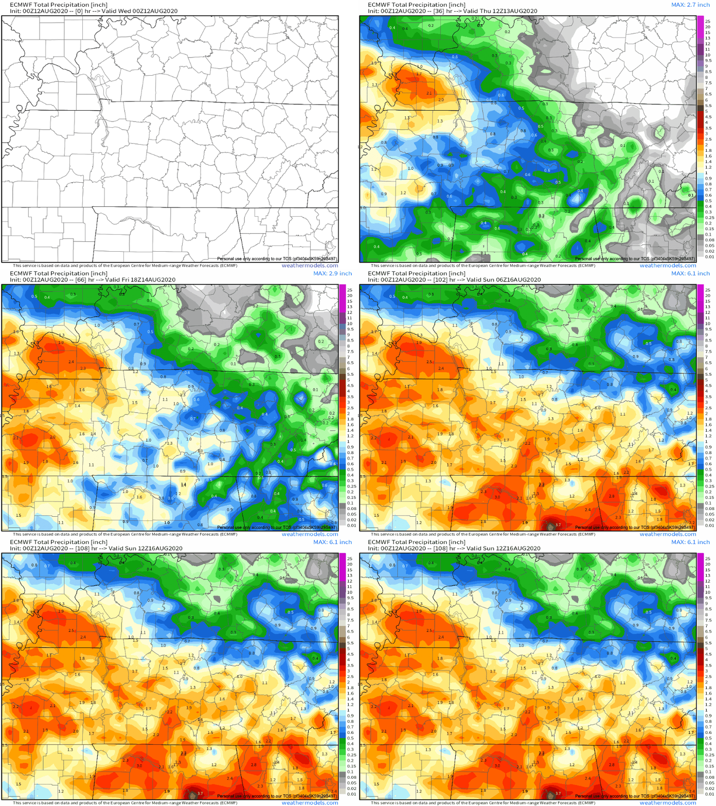
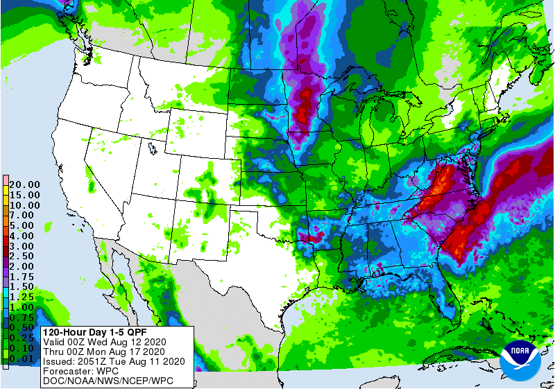
The WPC outlook, which is a blend of all model data, pops a few areas of 1.5″ to 2″, with most of us getting less than that.
As always, check back for updates to the forecast and be sure to follow @NashSevereWx on Twitter!
Categories: Forecast Blogs (Legacy)


You must be logged in to post a comment.