
Scattered Afternoon Rain, and OMG It’s Humid Today
An enjoyable morning will set the stage for thunderstorm activity to pick up throughout the day.

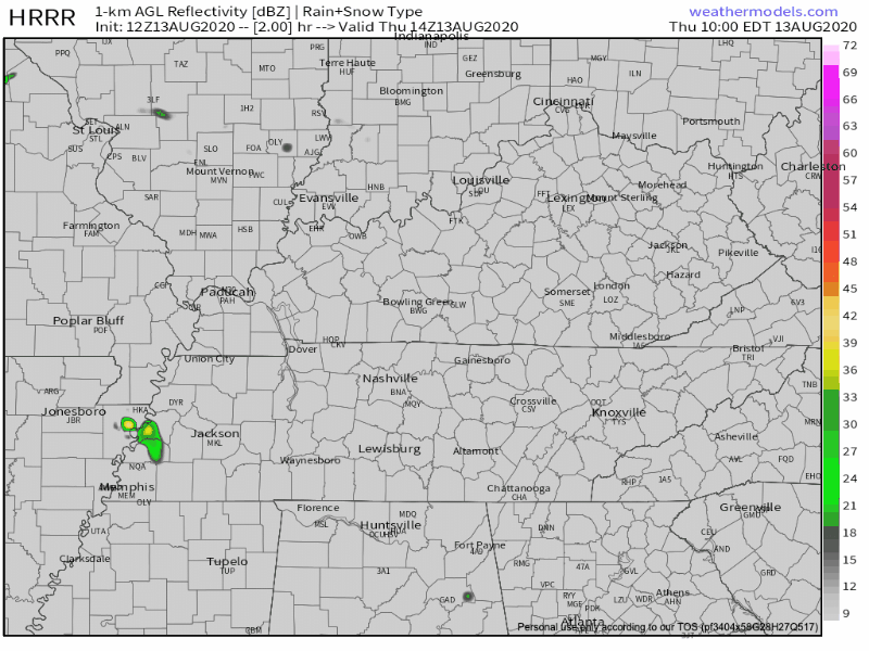
The HRRR shows scattered showers mostly missing Williamson/Davidson this afternoon, but I’m not taking the model’s word for it. With the moisture in the air + afternoon heating, I expect more showers to pop up. Some may be in your backyard, some may not.
Scattered storms become a little bit more organized after sunset. A greater chance for rain arrives tonight around 11 pm. This timing may change later, and will be updated on Twitter.
Shear today and tonight is weak, so nothing severe should form this afternoon or tonight. But we cannot rule out one of those superstrong downpours that creates a brief microburst and destroys your tomato plants or tips weak trees. Sometimes NWS-Nashville issues severe thunderstorm warnings for those.
Frequent cloud-to-ground lightning, heavy rain, and strong wind are the biggest threats, as is the case with most summer pop ups.
The lightning is no joke. Thunder is nature warning you to go inside ASAP.
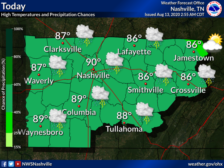
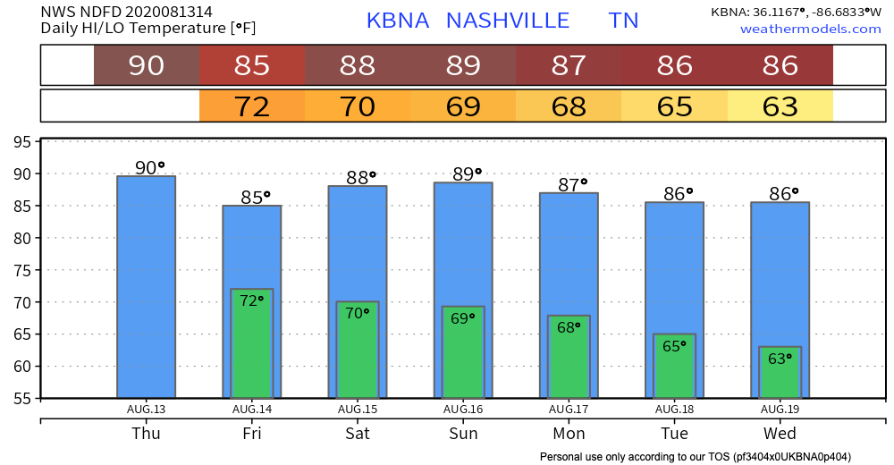
Dew points today are also no joke. Even though today’s high temperature is right around 90º, the dew point will be 72º or above A L L D A Y. That’s just oppressive.

This is the kind of heat that will sneak up on you. The heat index today peaks at 96º.
More Consistent Rain Friday Will Keep Temperatures Mild
Fog may form before sunrise Friday morning. Our dew point is not going to fall tonight (as is usually the case overnight), so the cooler morning air will become saturated and create fog.

A cool meteorology phenomenon, sure, but sometimes an inconvenience on the road.
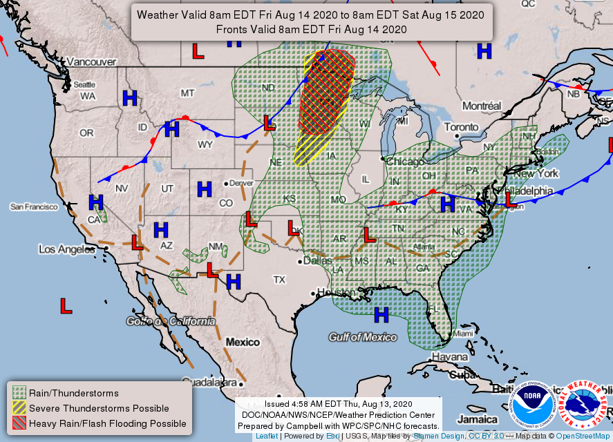
Rain chances increase Friday. Blame that surface low, the red “L” on the map below. It’ll move towards Middle Tennessee. High temperatures will stay relatively mild thanks to more cloud cover.
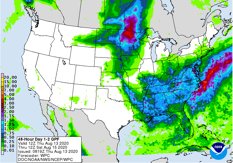
About 1–1.5 inches of rain are expected to fall over the course of Thursday and Friday once all is said and done. Locally higher/lower amounts aren’t out of the question given the unruly nature of storms in the summertime.
Sunny Saturday, then Rain Chances Reappear Sunday Evening
Rain is less likely Saturday, but don’t rule it out! The heat index will reach the mid 90’s.
A front will pass over Middle Tennessee Sunday night into Monday, bringing back higher rain chances. Humidity will decrease after the front clears. Monday, Tuesday, and Wednesday won’t feel like fall, but it’ll feel so much better. Even though there isn’t much variation in the temperature forecast for the next 7 days, the changes in humidity will make all the difference.
Categories: Forecast Blogs (Legacy)
You must be logged in to post a comment.