It’ll probably rain a little before midnight tonight, no big deal.
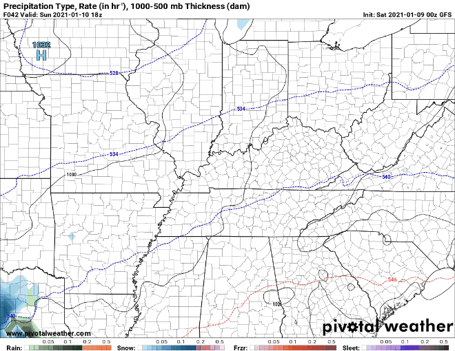
Models indicate snow Friday night lasting off and on overnight into Saturday morning.
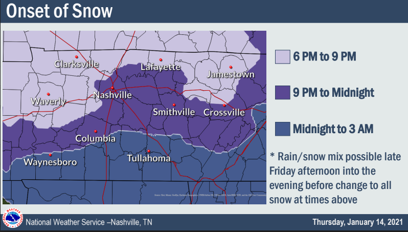
What Time?
Rain is expected to change to snow Friday night between 9 PM and midnight:

It’ll probably rain a little before midnight tonight, no big deal.
Models indicate snow Friday night lasting off and on overnight into Saturday morning.
Rain is expected to change to snow Friday night between 9 PM and midnight:
Sunny skies and pleasant during the day. Southerly winds could gust upwards of 25 mph.
That’s all ahead of an approaching front tonight.
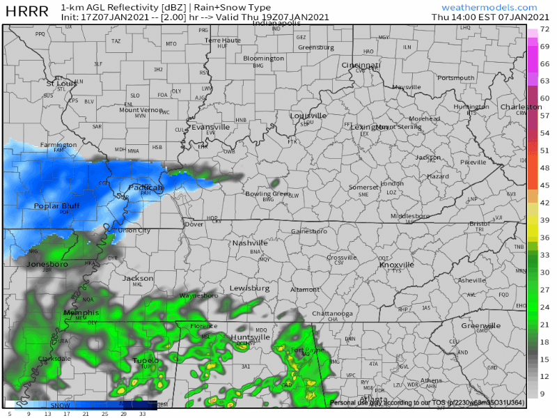
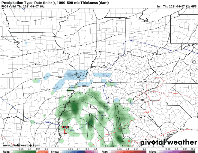
HRRR Model shows a weak band of showers moving through Thursday Evening into the overnight hours.
It’s noticeably warmer today…same for tomorrow with sunny skies sticking around. Light south winds today should become more gusty Thursday ahead of our next system.
An incoming front may bring a spotty shower late Thursday night into early Friday morning.
(Sunday’s forecast for Monday’s snow wasn’t horrible, wasn’t great. Looked like SE Will Co could get clipped and that’s what happened. The “place” forecast was good, the “amount” forecast was not. All the models “missed” this event, a reminder that weather models are not forecasts. Forecasts are not truth. Future prediction is hard. The arrogant forecast will be humbled. –David.)
It has been a tale of two counties this morning
Parts of Williamson County have picked up an inch…
Even nearing 2 inches near Thompson Station..
Those in Davidson County haven’t been as lucky
Moisture that has infiltrated Williamson has been losing the battle with the dry air north of I-40 in Davidson County.
Confidence is “low to medium” (NWS-Nashville) in forecast accuracy for snow Monday.
Variables include:
NWS-Nashville make no changes to its snow total forecast. Under a half inch, which includes us getting nothing. Most of those north of I-40 get shut out:

Snow will pile up across Texas, Louisiana, and Mississippi today and tonight.
Monday this system will turn into Tennessee and weaken.
We may get no local snow. The best snow chances are between us and Chattanooga.
Here’s a quick rundown of how today’s gonna go:
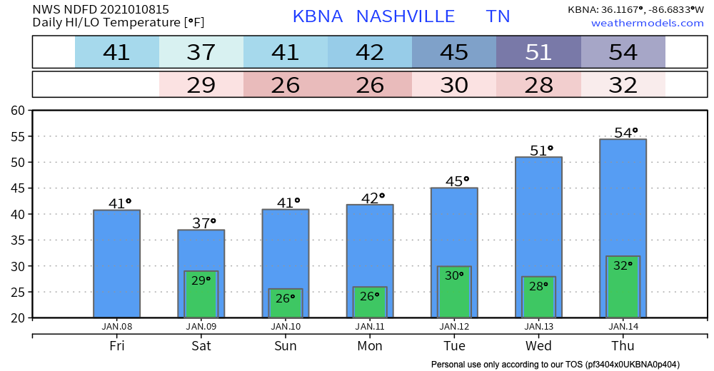
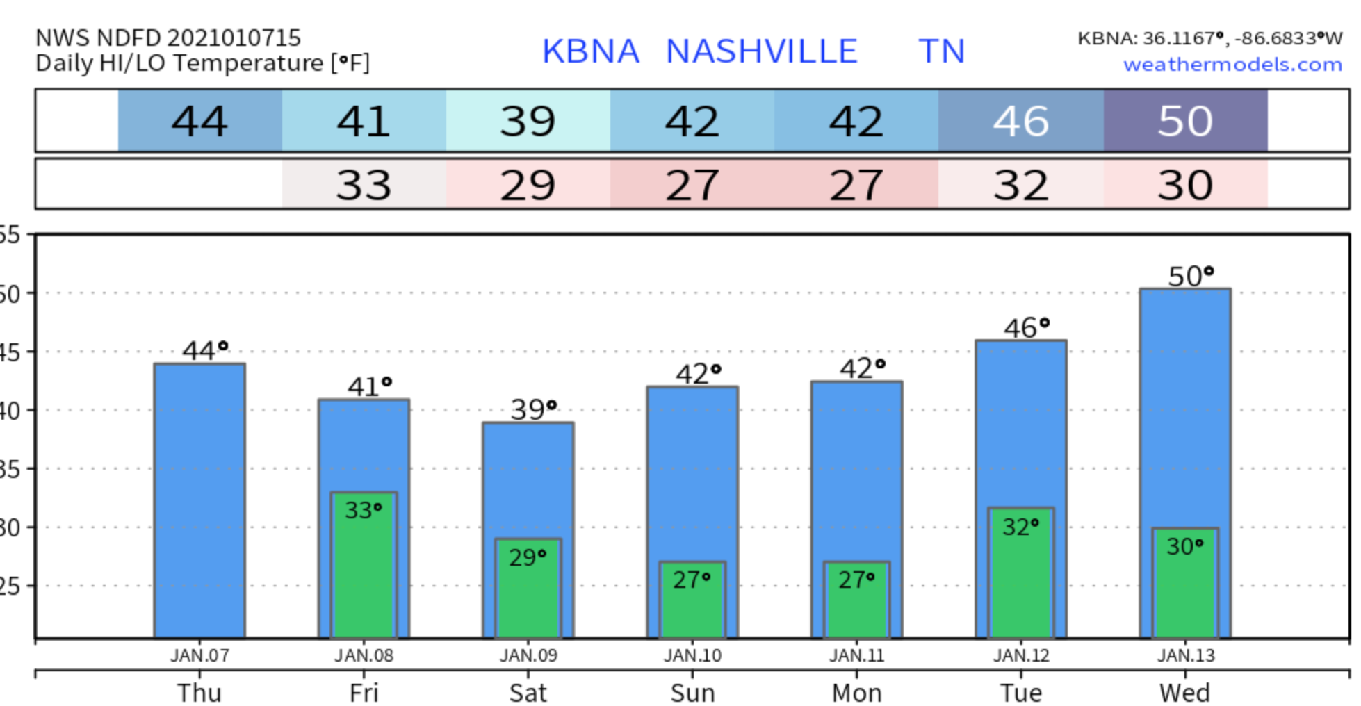
Sunday will be a little sunnier, and a little warmer.
Unfortunately, they’re not looking great right now.

Here’s what the National Weather Service has to say about this system:
The line between rain and snow isn’t always east or west like it was last night.
It’s also a matter of elevation.
Snow in Boston, TN (SW Will Co) hit 3.5″ last night. Legit snowmen were rolled up in Leiper’s Fork:

The real story here is that rain will begin pretty soon. JK the real story is that there is a non-zero chance of snow tonight and tomorrow morning. Let’s dive in…
After the afternoon rain event today (mainly after 5pm), temperatures will drop below freezing and that rain will transition into a rain/snow mix.
Nashville, although, is only expected to see less than half an inch. If anything, we will just get a dusting.
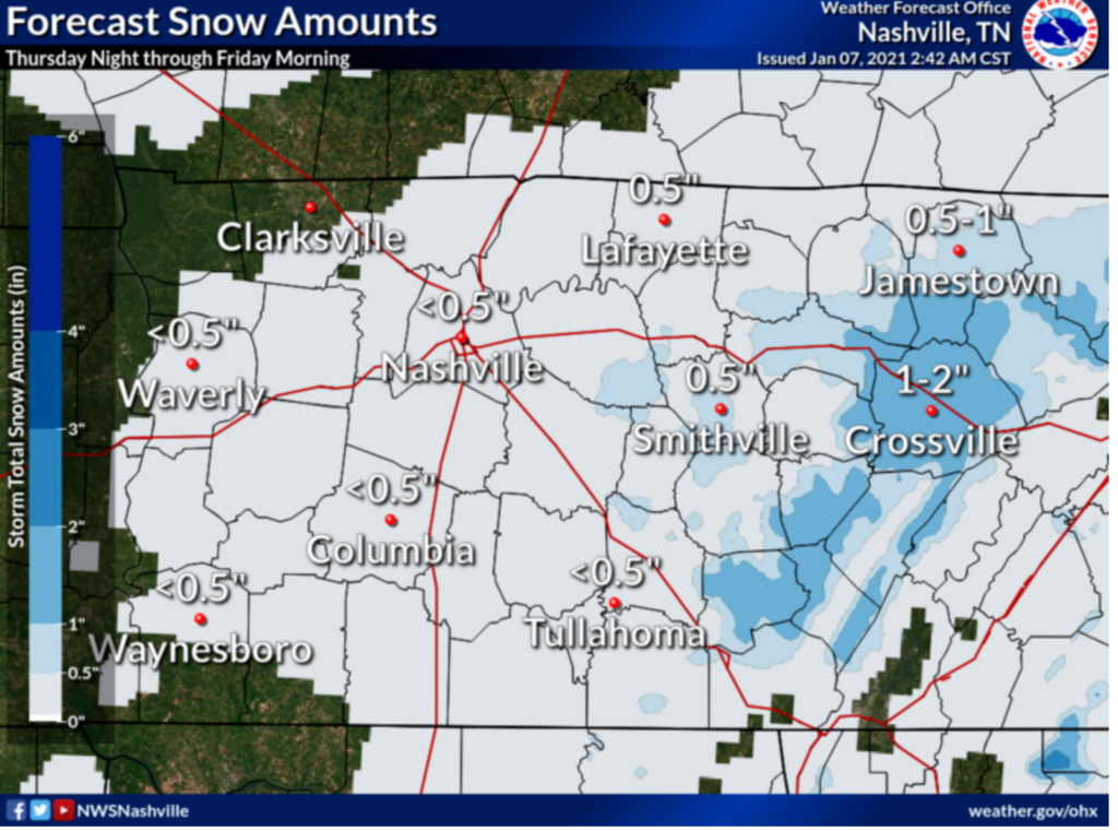
In general, impacts remain low. Temps should hover just a little bit above freezing at the surface in Nashville, but in the hollers, if it’s colder, bridges and overpasses could be impacted. Regardless, if you plan on traveling anywhere tonight or tomorrow morning, be cautious!
Let’s take a look at forecast models.
The Euro model (above) shows the snow Friday staying to the east. Other models show lingering moisture and weak lift which should be enough for some areas to see flurries.
Here’s what the NWS says…
IT STILL LOOKS LIKE THERE MAY BE A BRIEF PERIOD OF MIXED PRECIP THIS MORNING ON THE LEADING EDGE OF THE PRECIP WEST OF I-65 AND LOOKS TO BE ALL RAIN THROUGH THE DAY THEREAFTER. AFTER SUNSET, TEMPS WILL DROP TO THE MID 30S BEFORE 9 PM, AND PRECIP WILL CHANGE FROM RAIN TO A RAIN/SNOW MIX, FOLLOWED BY ALL SNOW JUST AFTER MIDNIGHT. HIGHER ELEVATIONS INCLUDING THE PLATEAU MAY COOL OFF A FEW DEGREES SOONER, AND SEE ALL SNOW BEFORE MIDNIGHT. SHOULD TEMPS COOL OFF A BIT SOONER AREA WIDE, WE MAY SEE MORE SNOW, AND IN THE OTHER DIRECTION, SHOULD TEMPS STAY WARMER, SNOW WILL BE DELAYED AND AMOUNTS WOULD DECREASE.
You must be logged in to post a comment.