
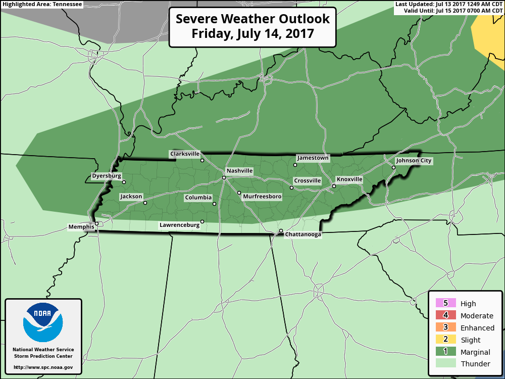
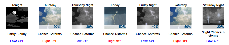
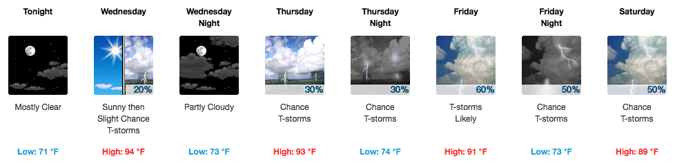
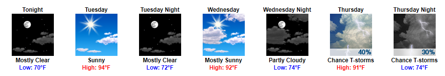
A Relatively Boring and Way Too Hot Forecast Ahead
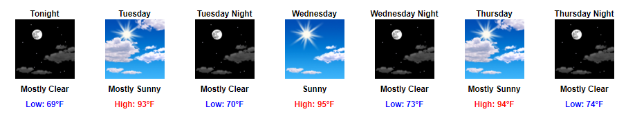
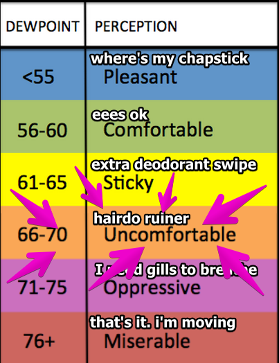
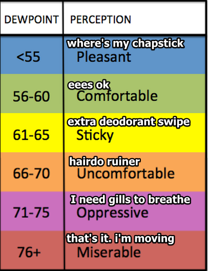
We’ve officially reached the not-so fun part of summer this week. Highs will stay in the 90s with our dew point temps in the mid-60s to start the week and low-70s to end the week.
https://giphy.com/gifs/reaction-imgfave-RddAJiGxTPQFa


You must be logged in to post a comment.