
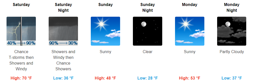
A Fantastic Friday
A little above normal today with highs in the mid-60s. Sunny skies will prevail through a good bit of the day, only a few passing clouds expected.
https://giphy.com/gifs/redbull-3oEduSYl39Ng5kpNbW
Tonight into the overnight hours, expect more clouds to begin to funnel into our area. Additionally, winds will begin to ramp up, reaching the 15-20 mph range overnight. There could be gusts as high as 30 mph, so you may want to secure lose items before heading to bed.
https://giphy.com/gifs/hulu-snl-saturday-night-live-nbc-l0MYspMIcd100vmN2
Showers Tomorrow + Chance of Strong/Severe Storms
First of all, it is going to be windy all day tomorrow and last into the evening hours. Winds are expected to be in the 20-25 mph range throughout the day with gusts into the 35 mph range possible. By the late evening, these winds will begin to die down, but still be in the 10-15 mph range.
What are driving these winds? A cold front that will march through Middle Tennessee tomorrow afternoon. We may see a few scattered showers earlier in the day before the main line of showers passes through. The main line of showers is expected to pass through sometime during the afternoon hours.
NAM3 Loop Saturday 9 AM Through Saturday 9 PM
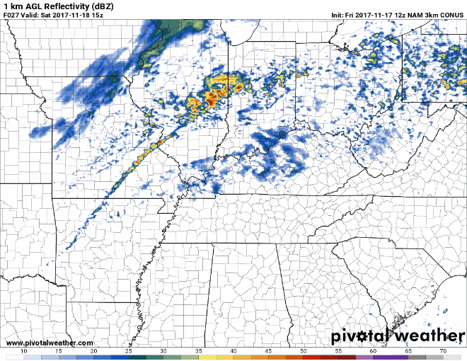
Luckily, showers should clear out into the evening hours.
With any fall cold front, we have to keep an eye on severe weather. The SPC currently has us in their Marginal Risk with damaging winds being the main concern.
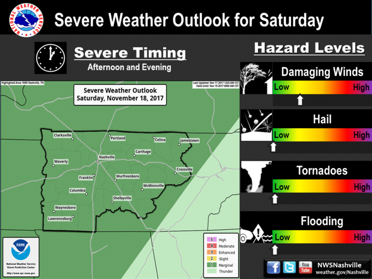
Takeaways:
- Gusty winds last through the day tomorrow.
- A few scattered showers are possible earlier in the day.
- Main line of showers moving through during the afternoon.
- Main severe weather concern is damaging wind gusts.
We will continue to monitor this system through the day today and tomorrow. Stick with us on Twitter @NashSevereWx for the latest information.
Cooler Temps and Sunny Skies
With Saturday’s cold front, much cooler temps will be following behind.
NAM3 Temperature Map Saturday Afternoon Through Early Monday Morning
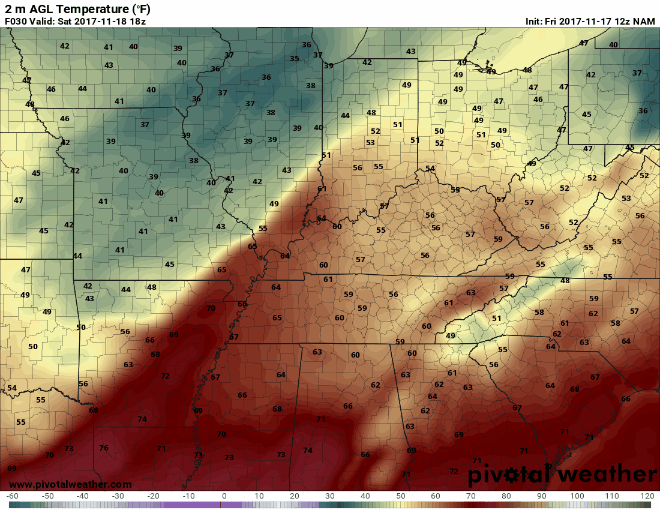
Saturday our high will reach 70°. On Sunday, our high is expected to only reach the upper-40s. The overnight low on Sunday will be in the upper-20s. Get ready for a big cool down from the 60s we’ve been experiencing lately.
https://giphy.com/gifs/hero0fwar-television-new-girl-winter-is-coming-5xtDarvGTVmZCbDoDJK
Besides the massive cool down, there aren’t many rain chances in the near future. Most models continue to keep us dry through the majority of next week, with only sunny skies in the forecast.

Categories: Forecast Blogs (Legacy)
You must be logged in to post a comment.