
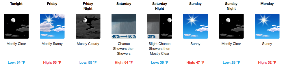
A Few Clouds Through the Day Today, Still A Bit Chilly
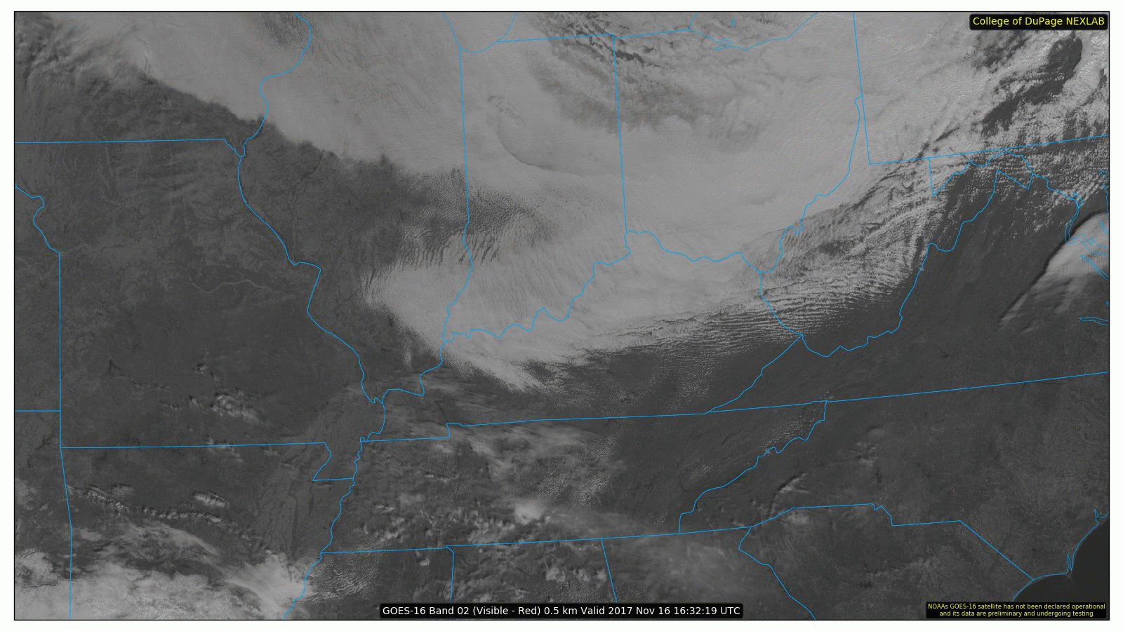
GOES 16 Satellite Loop
Sunshine, isn’t it wonderful!? We will have it on our side through Saturday, which, along with returning southerly winds on Friday, will warm us into the 60s on Friday and Saturday.
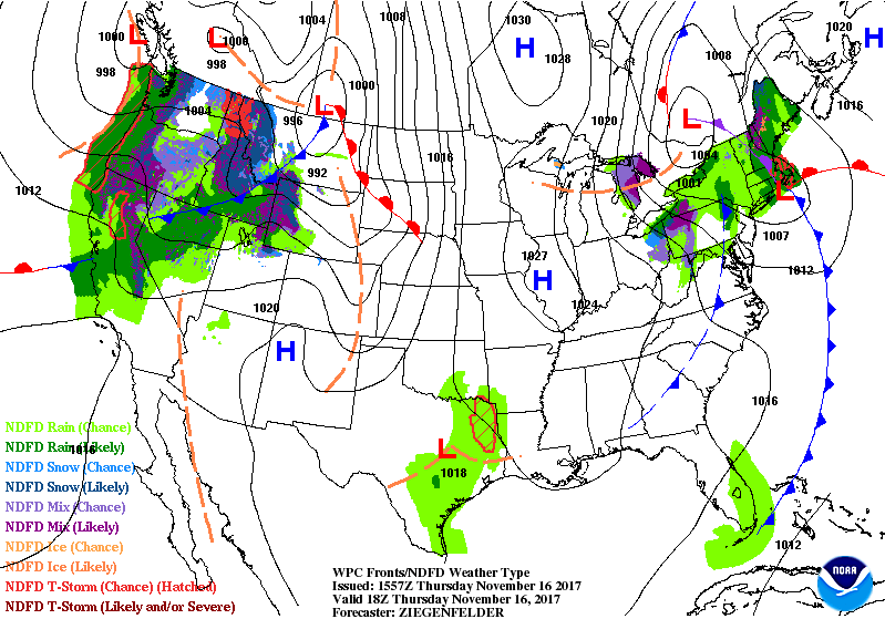
Weekend Rain Chances and A Stronger Cold Front
WPC 3 Day Surface Map Forecast
A few showers are possible Saturday morning, but will be very light and sporadic. The main activity waits until the afternoon when the cold front approaches Middle Tennessee. The main time frame looks to be anywhere between 2-6pm, with any rain moving east of I-65 by 6-7pm.
SPC Day 3 Severe Weather Outlook
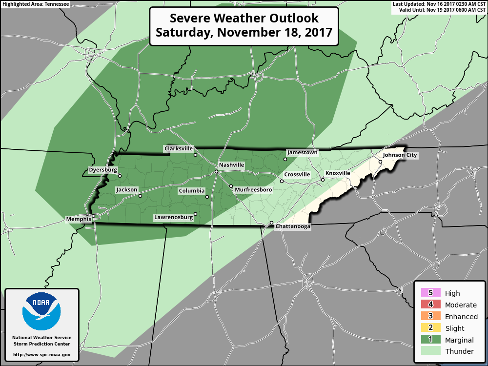
The Storm Prediction Center and NWS Nashville think that a couple of storms could go strong/severe on Saturday afternoon, with more models bumping up their “storm food forecasts”. Shear, or winds turning with height, will be in great abundance, but “storm food” will be relatively low. That’s why we have been placed under a “Marginal Risk” (1 out of 5) only, for Saturday during the day. The main threat in terms of severe weather would be damaging winds. However, this is not expected to be a widespread issue…just something to monitor.
Saturday morning and early afternoon, expect winds to kick up the dust, gusting as high as 35 mph. A wind advisory may be needed if trends continue to increase wind potential. Behind the cold front, expect northwesterly winds to take over in the same manner…gusting to 30-35 mph.
Thanksgiving Week – Unsure About Precipitation, Cool Week Overall
GFS 2-meter Temperature Forecast
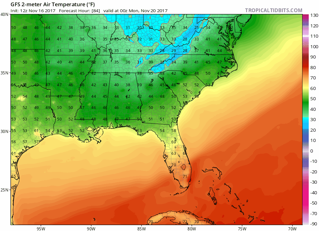
Definitely some chilly air on the way for next week! Lows Monday morning will be in the upper 20s with highs in the lower 50s, maybe even upper 40s by Wednesday and Thanksgiving Day! For right now, the forecast remains dry through the holiday, so travel problems (in terms of weather) across the Mid-State should be minimal.

Categories: Forecast Blogs (Legacy)
You must be logged in to post a comment.