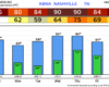
Today and Wednesday will be the days to mow the yard and get outside. Highs in the low to mid 80s, tolerable humidity and dry.
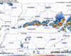
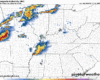
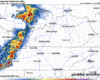
Thursday a more summer-like pattern returns. High temps near 90° with popup showers/storms (the ole’ Wattery) possible in the afternoon and evening.