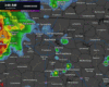
Another nice day in store. By last day of July standards, dewpoints will be comfortable in the low 60s, with highs temps “only” near 90°. No rain chances.
Saturday, not so much of a nice day as we kick off August.

Another nice day in store. By last day of July standards, dewpoints will be comfortable in the low 60s, with highs temps “only” near 90°. No rain chances.
Saturday, not so much of a nice day as we kick off August.
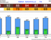
Certainly more comfortable outside this morning compared to yesterday, with dewpoints about 10° lower, now in the lower 60s. Not too bad for late July.
Similar weather today and Friday. Those nicer dewpoints stick around with highs near 90°. No rain. About as good as it gets by summer standards as we close out July – which I have no clue how we are about to enter the eighth month of the year.
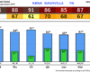
Although it’s still hot today – it won’t be as hot as the past couple of days. Highs in the low 90s, dewpoints are still up in the low 70s, so it’s still pretty muggy. Dry.
Thursday and Friday will be slightly nicer as dewpoints drop back into the 60s, with highs near 90°. No rain chances, so both will be great days to get outside.
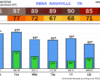
Our Heat Advisory is now in effect until Tuesday evening.
Afternoon highs in the mid 90s with dewpoints in the mid to upper 70s will send heat index values near 105°. Please take precautions against this heat, such as staying hydrated and taking frequent breaks. Know the signs of heat illness and what to do if you are someone else is experiencing any symptoms.
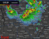
While we will be dry (and hot) during the day today, we are looking at the possibility of a wind bag later tonight.
The Storm Prediction Center has introduced a 15% chance of damaging straight-line winds and a 2% chance of a tornado within 25 miles for us. We are not included in any hail probabilities.
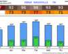
A couple more hours of on/off showers this morning. Nothing too crazy, but you’ll need rain gear for any plans.
You can check the radar anytime on our website here: Radar – Nashville Severe Weather
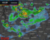
Another fairly nice day of weather in store today. Highs still getting into the upper 80s, but dewpoints will remain tame in the low 60s – making it feel tolerable. Can’t totally rule out some showers, especially as we get closer to sunset, but majority of the day will be dry.
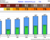
Our cooler and drier air has arrived. At 9a, BNA reported a temperature of 72° with a dewpoint of 59°.

This won’t last forever, so get out and enjoy it. Today and Friday will be good days to catch up on yardwork.
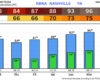
A few quick showers will be possible today, especially around WillCo., but these won’t amount to anything.
We finally get a few dry days strung together. Dry Thursday and Friday before rain chances return on Saturday, where some scattered showers/storms look possible. No severe weather expected but can’t rule out a strong storm or two. We’ll keep an eye on things as always. Timing looks iffy, with chances hanging around most of the day. Heads up for those with outdoor plans.
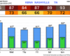
We certainly have plenty of headlines to talk about.
Before the storms, it’ll be a hot one. Our Heat Advisory continues thru 8p. High temperatures will soar into the mid 90s, paired with dewpoints in the mid 70s = heat index values in the 105 – 110° range. Please take precautions against the heat if you have to be outside for long periods of time, including staying hydrated and taking frequent breaks. Heat illness can happen to anyone.