
As of 12:15p, showers are just about out of here. Models are pretty set on keeping us mostly dry for the remainder of the day after that, with the possible exception of a few quick showers. As of right now, I see no reason to alter any dinner/evening plans.
For the past several days, models have insisted that Saturday would have the lowest rain chances out of the 3 weekend days.
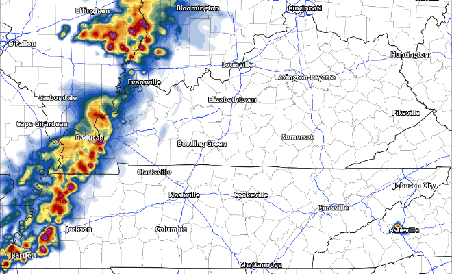
However, the 12z HRRR model throws a Greg Maddux curveball.
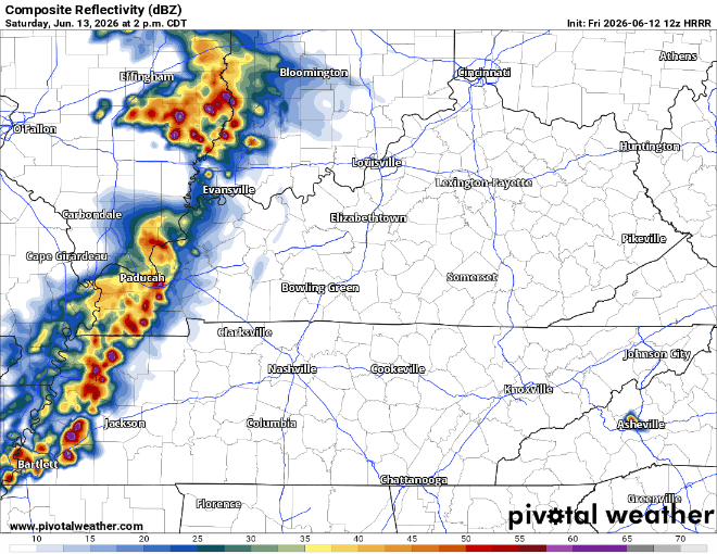
This particular run shows a line of storms moving thru the area around dinnertime. Other models totally disagree, keeping us dry. Which is right? IDK. Maybe neither. The grids only have ~30% PoP during the afternoon/evening.
For now, I wouldn’t change any outdoor plans you may have. However, I would keep an eye on the forecast and be ready to be flexible. We’ll get some more model runs in later today and hopefully there is some more clarity.
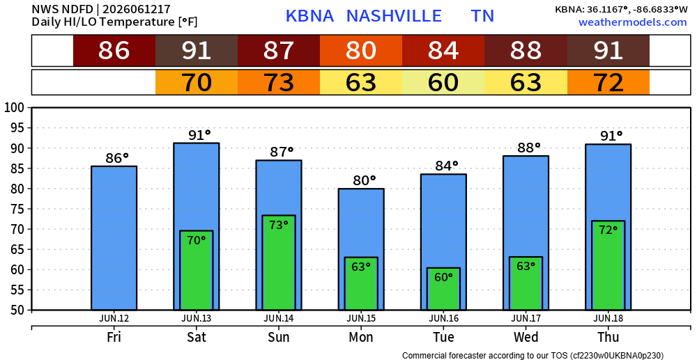
Sunday continues to have the highest rain chances, with medium to high chances lasting essentially all day. Scattered showers/storms are expecting to linger around most of the day. Although no severe weather is expected, any storm could have heavy rain, lightning and gusty winds. Although it won’t rain the entire day, any outdoor plans on Sunday should have an indoor backup plan ready to go.
Monday thru Wednesday will feel at least somewhat refreshing, with both lower temperatures and dewpoints. Very low to no rain chances during this stretch.
Warmer temperatures and rain chances return by Thursday.
Categories: Featured Blog