
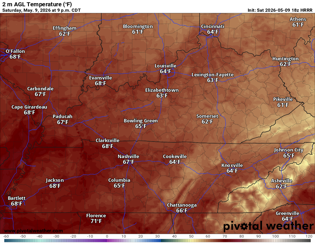
TLDR: Two more summer-like days before a wetter pattern moves in late Tuesday into Wednesday.
Today and Tonight
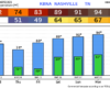
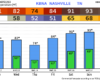
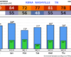
Sunny and warm. High near 91 with a south wind 10 to 15 mph and gusts to 25. NWS-Nashville notes this is the first time many spots west of the Plateau hit the low-90s this year. Tonight stays mostly clear and mild, low around 68.
You must be logged in to post a comment.