
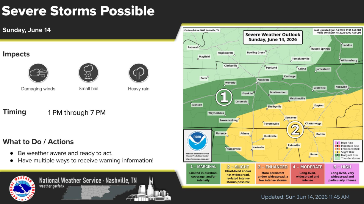
As of 1:15p, there’s a line of showers/storms just off to our west. We’ll be watching how that behaves, and any potential development behind it.
The Storm Prediction Center has our counties outlooked with a 5% chance of damaging straight-line winds within 25 miles. We are not included in any probabilities for hail or tornadoes. Although I reckon it’s feasible a strong storm could produce some sub-severe sized hail.
Although it’s not our normal radar (it’s currently down), we do have an alternative radar you can view on our website: Radar – Nashville Severe Weather
Scattered showers/storms will be possible thru this evening. Those with any outdoor plans (including those at Roo) should remain weather aware. Roo partakers should secure their tents/campsites before heading out and doing yo thing.
We’ll be posting updates as needed on all of our socials all day.
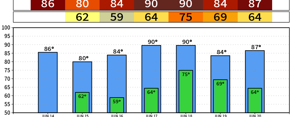
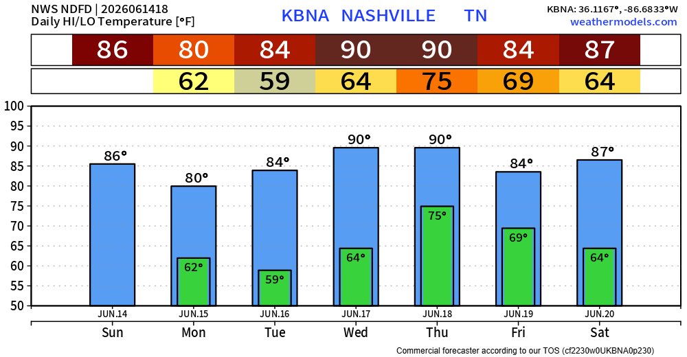
Monday and Tuesday things turn cooler and drier. Both great days to get outside, highs in the low 80s and dewpoints in the comfortable range in the mid 50s.
Temperature and moisture both turn up by Wednesday, with isolated pop-up showers/storms possible in the afternoon – although coverage looks very isolated and I think most of us will stay dry.
Our next system to watch will be Thursday, as we are likely to see some widespread showers/storms at some point Thursday PM into Friday AM. Specifics are still unclear, but we’ll have to keep an eye on the potential for some strong storms.
Categories: Featured Blog