
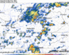
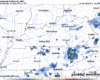
Scattered showers/storms have already begun to pop-up over Middle TN and will continue to randomly do so throughout the day. You can always use your favorite radar app, or we have one (for free) on our website: Radar – Nashville Severe Weather

Scattered showers/storms have already begun to pop-up over Middle TN and will continue to randomly do so throughout the day. You can always use your favorite radar app, or we have one (for free) on our website: Radar – Nashville Severe Weather
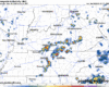
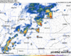
Our band of heavier showers has moved on out, leaving us with only isolated showers for the rest of the day. These will be few and far between, with some of us staying dry for the remainder of the day.
Jason was born in Nashville. He graduated from Franklin High School. He met Ashley at ETSU. Then he joined the Army.
Jason and Ashley married and moved to Ft. Bliss. Jason had a boxer, Charlie. He rode motorcycles, played tennis. Jason and Ashley planned a formal wedding after he returned from Afghanistan.
Not to sound like a broken record, but I will.
Rain/storm chances continue to be in the forecast every day for the entire week.
Scattered showers/storms will be possible this afternoon, Wattery style – popping up at random. Unlikely that everyone sees rain, but you’ll want an indoor backup plan for any outdoor activities.
There’s uncertainty to some degree in every forecast, but there’s a little extra in tonight’s.
Models have not handled the showers/storms that are ongoing today, so it’s likely that they might not have a good grip on things later today.
There will be a brief window for severe weather potential this afternoon.
Specifically, there is a 5% chance of damaging straight-line winds and a 2% chance of a tornado, both within 25 miles.
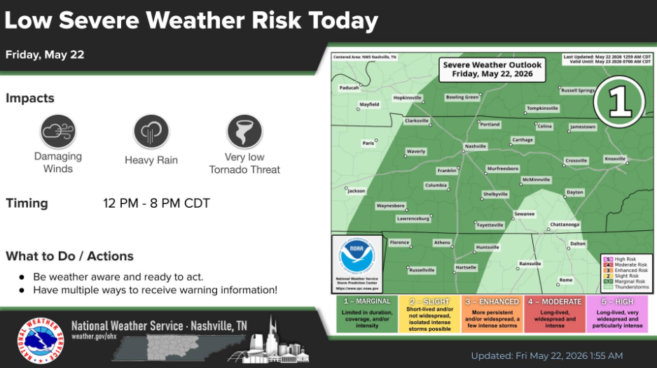
Scattered showers and storms will move in from the S/SW (a little different than usual), providing an opportunity for not only the needed rain but a very low-end severe weather threat.
Summary:
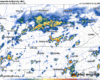
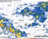
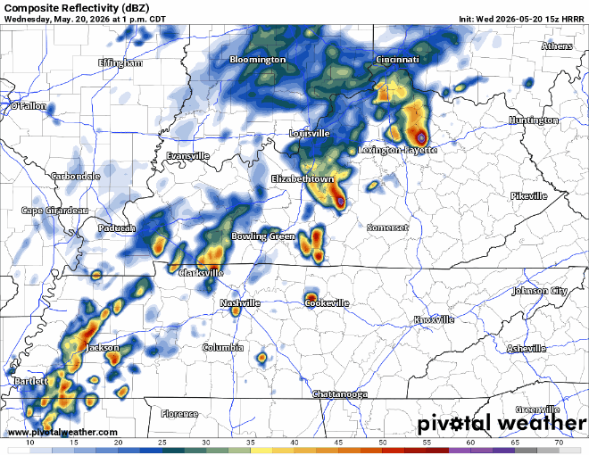
Scattered showers are already ongoing (as of 11a) and will continue to do so thru this evening. The coverage of these showers/storms looks to be less than yesterday, so there is certainly hope for any outdoor events this PM, including any graduations. It’ll be close though.
Some scattered showers have already started to move through the area and will continue to do so thru this evening.
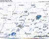
The HRRR model paints a picture, although it might not be the picture:
Lightning will certainly be possible with any of these storms, along with some strong winds in one or two storms. When thunder roars, go indoors.
After our recent very quiet and dry spell, we are now playing catch up, with rain chances every single day over the next week.
Today [Tuesday] has the lowest odds of us seeing rain out of the next seven.
We certainly have no lack of rain/storm chances this week.
However, today [Monday] will be the lone exception to that. It’ll be hot, with highs in the low 90s – so if you need to do any yard work, right now or closer to dinner will be your best bet.
You must be logged in to post a comment.