
Forecast remains on track.
Scattered storms this afternoon will carry the threat of heavy rain, lightning, along with some strong winds.
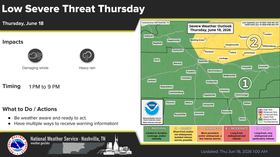
The Storm Prediction Center still has us outlooked with a 5% chance of damaging straight-line winds within 25 miles. We are not included in any probabilities for hail or tornadoes.
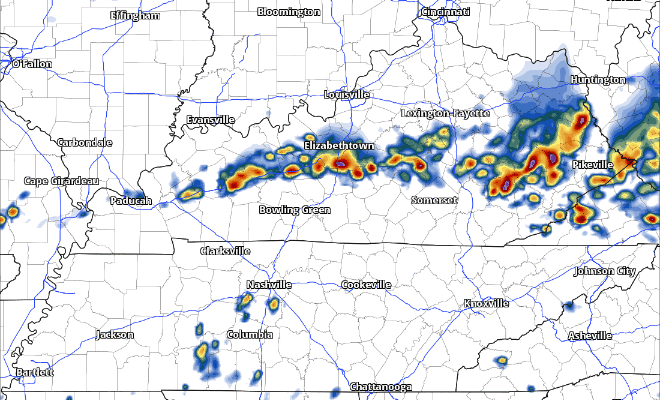
The latest HRRR model shows the scattered storms being possible from around lunch thru late this evening. It’s possible you see multiple storms today, and there’s also the chance you see none. That’s just how the cookie crumbles.
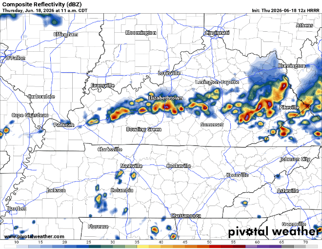
With moisture levels being quite high today, any storms that go over the same areas/move super slow will carry the risk of producing some localized flash flooding. Widespread issues are not expected, but it’ll be something to keep an eye out for – especially if you live near a low-lying/flood prone area.
We’ll be watching all day and will post updates on all of our socials. If we do see a Severe Thunderstorm Warning, we’ll go live on our YouTube channel, which you can find here: Nashville Severe Weather @NashSevereWx – YouTube
Good news is that Friday and Saturday both look fairly nice. A shower or two may be lingering around Friday AM, but should be dry otherwise. Similar on Saturday, maybe a stray shower or two during the day, but really think most, if not all of us will stay dry. It’ll still feel warm and muggy, but better than a washout I suppose.
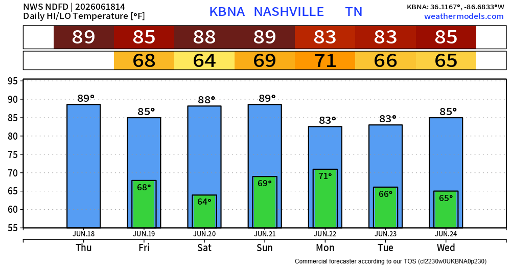
Sunday and Monday will both carry medium to high chances of rain/storms.
“There are a lot of model differences in timing at this point, but it would not be surprising to see at least a low-end severe threat Sunday and/or Monday with this system.” says NWS Nashville
After we get through today, we’ll be able to take a look at more of the specifics on this next system. For now, we’ll keep an eye on things – stay connected!
Categories: Featured Blog