
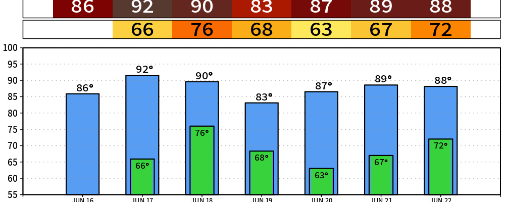
Before we get into Thursday’s business, we do have another beautiful day in store.
A tad warmer than yesterday, with highs in the mid 80s, but dewpoints remain comfortable in the mid 50s. Another day to get outside or catch up on any yard work that needs to be done.
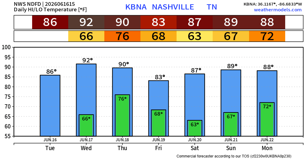
Although Wednesday will also be dry, we start to get back into the “it’s uncomfortable to be outside” territory. Highs in the low 90s with dewpoints in the mid 60s, not the best. Gusts up to 25mph will be possible during the afternoon/evening, which could help a bit.
Now onto Thursday.
The Storm Prediction Center has outlooked our area with severe probabilities, with I-40 essentially being the dividing line between 15/5% severe odds – although try not to pay too much attention to where the lines are drawn, as they’ll likely change between now and Thursday.
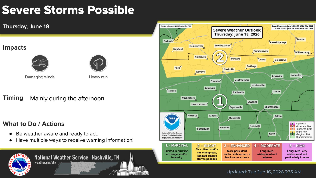
The main threats will be damaging straight-line winds, along with some heavy rain that could induce some isolated flooding issues. Not really seeing a hail/tornado threat, although things could always change.
As of right now, timing looks to be between Thursday afternoon thru Friday morning. Yes, that’s a wide timeframe, but it appears there could be multiple waves of storms that move in during this time.
Expected rainfall totals have come down just a tad since yesterday, with about 1-2″ being possible. Flash flooding threat is much higher to our south in LA/MS/AL due to PTC1 – which will not affect us besides aiding in additional moisture.
As always, we’ll keep an eye on how things progress. High-res models will come into range over the next day, which will help add confidence. Updates from us will continue to stream in between now and Thursday. Those with outdoor plans Thursday PM should certainly have a backup indoor plan ready to go.
The good news is that we should begin to dry out by midday Friday and stay dry through Saturday. Rain/storm chances return Sunday PM.
Categories: Featured Blog