
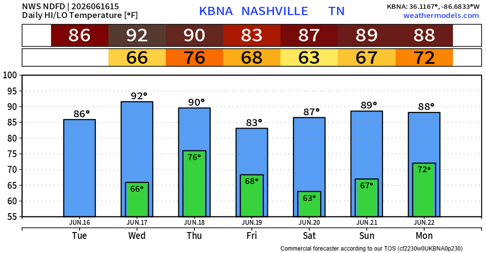
Today will be dry, but it certainly won’t feel as good as the past two days. Highs will get up into the low 90s, along with dewpoints in the mid 60s. The only factor that will be helping us will be gusts up to 25mph this afternoon and evening, which may help it feel a tad better.
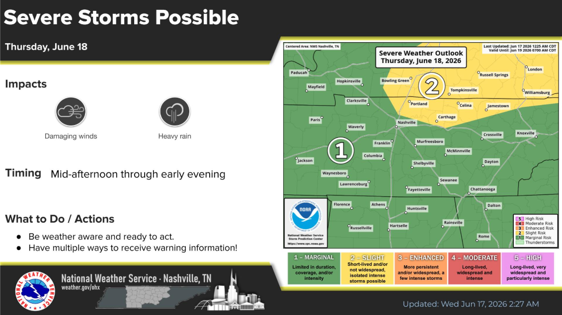
We still are watching our very low-end threat for some damaging straight-line winds Thursday afternoon/evening.
The Storm Prediction Center has trimmed back the 15% probs just a tad, leaving both of our counties with a 5% chance of damaging straight-line winds within 25 miles. We are not concerned about the threat for tornadoes or hail.
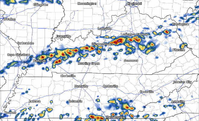
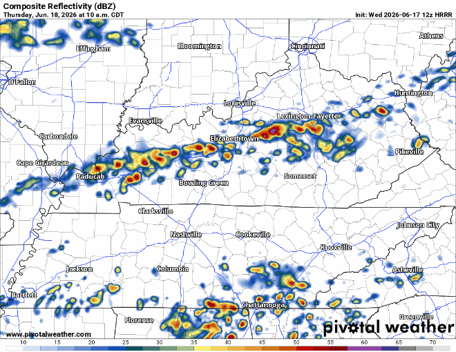
The latest HRRR model suggests the possibility of multiple waves of storms, beginning around midday. Although this is just an educated guess – models are guidance, not gospel.
Another thing that will need to be watched will be the potential for isolated flash flooding. Although widespread issues are not expected, the combination of gross dewpoints (low to mid 70s), high precipitable water values, and the potential for training storms could lead to a few instances of flash flooding.
As always, we’ll keep y’all updated with the latest information. Those with outdoor plans Thursday PM should almost certainly have an indoor plan ready to go.
Besides for a few lingering showers, Friday appears to be dry. It’ll still be warm and muggy, but at least dry.
Dry weather will continue into Saturday, although you’ll have to deal with highs near 90°. Could be worse, could be better.
Medium to high rain/storm chances return Sunday and linger into Monday. We are currently not included in any severe probabilities, but models suggest we could be looking at some healthy rainfall totals from this system as well. We’ll get more into this after we get through Thursday.
Categories: Featured Blog