Even Better Weather Next Weekend? Are We Slowly Easing Away From Summer? (Kinda, #yeahweare).

Editor’s Note: Check out Denver.

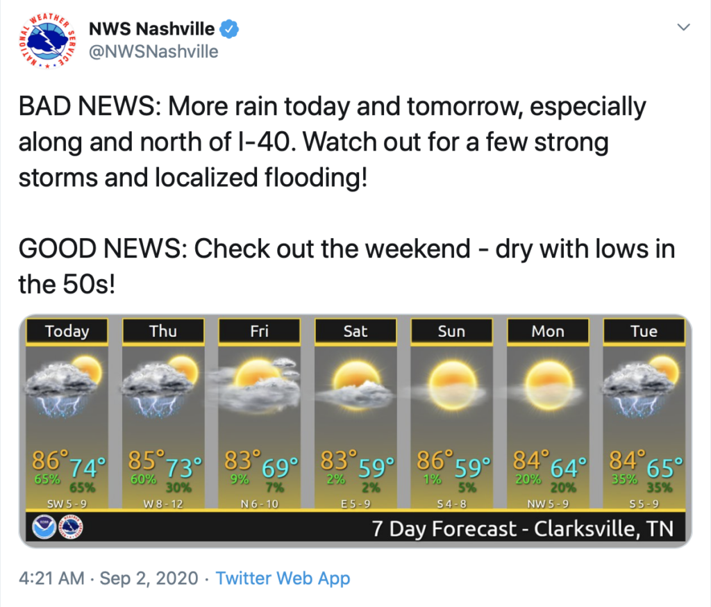
Last week we suffered through 70° dewpoints. It’ll get more humid this week, but not expecting 70° dewpoints.

We’ll max out in the upper 80s this afternoon. Little humidity so not running high 90s heat index values!! Our dewpoints this morning hung out in the 60s and will make their way down to the 50 degree mark by the afternoon. read more

Potential Strong Thunderstorms This Afternoon. Still Looking Forward To Cooler Weather This Weekend!

Low clouds building into the area this afternoon as our risk for strong thunderstorms increases.

Low threats associated with these developing storms, mainly gusty winds and localized flooding. The chance of an isolated tornado to develop out of one of these storms is possible, but the threat is low, mostly N of I-40. read more

Storms Could Be Strong Today, Temperature Relief Is Coming…

First and foremost, Happy September 1st! Today marks the start of meteorological autumn, but unfortunately it won’t “feel” like fall until next week.

[Editor’s Note: Actual Autumn starts September 22. We won’t be budged. However, we won’t judge your happiness if fake fall makes you happy.] read more

T.D. Laura ETA Here Friday Night or Saturday Morning: Rain, Wind, Low Probability of a Tornado

This satellite image runs through 11:51 AM. Notice Laura in the Gulf (now a Cat 3 hurricane). Also notice cold cloud tops over Middle Tennessee indicating light rain.

A hefty downpour to our south this morning should weaken and scatter this afternoon as the energy works north. So says the HRRR model: read more

Humidity Relief is Coming! But first we must dodge some storms.

A Fairview thunderstorm is heading for Spring Hill as I write this. It’s being covered on Twitter @NashSevereWx.

Rain and a few more thunderstorms are possible today. It’s very humid, there’s plenty of instability, and a cold front is approaching to provide lift, kicking off your chances for a few storms this afternoon. read more

Humidity and Stormy Weather Until Sunday. Less Humidity and More Sun by Monday!

Scattered showers and thunderstorms will arrive by about 1 PM. We’ll see these on and off throughout the afternoon until it finally picks up and moves to the east before midnight.

Look Closely at this HRRR model

Notice the motion of the atmosphere? How it’s moving in a counterclockwise fashion? read more

Same Horrible Humidity. And Now: More Storms.

Storms will use very humid air to make rain and storms today through the weekend. Humidity relief arrives Tuesday of next week.

The HRRR model’s ETA for today’s thunderstorms begins after 2 o’clock, but storms are most likely between 4-6 PM. Storms should die out an hour or so after sunset. read more

Much Better, Y’all.

Is it really the 2nd day of August? With this weather?

A surface cold front swept through the area yesterday and completely wiped out that hot and superhumid airmass.

Dewpoint temperatures have backed off significantly, and will remain manageable for the rest of the week. read more

Chance of Storms this Afternoon, Stormy Week Ahead

Scattered showers and thunderstorms expected to make an appearance this afternoon.

HRRR model below is not showing great chances for Nashville this afternoon, but make no mistake. We’re all fair game for typical pop-up storms today. Storm organization will increase later in the week. read more

Morning Rain/Clouds Messing with Today’s Forecast, Looking Thru the Weekend, and Three Systems in the Tropics … Oh My!

Rain streaked by this morning north of I-40, with a few downpours south of I-40. Clouds were dragged along with it. This may wreck our rain/storm chances this afternoon.

Maybe.

Why?

Most summertime afternoon storms occur because of the heat-of-the-day. Cloud cover has kept the highs down, interrupting/delaying this storm-making process. read more