
Scattered showers and thunderstorms expected to make an appearance this afternoon.
HRRR model below is not showing great chances for Nashville this afternoon, but make no mistake. We’re all fair game for typical pop-up storms today. Storm organization will increase later in the week.
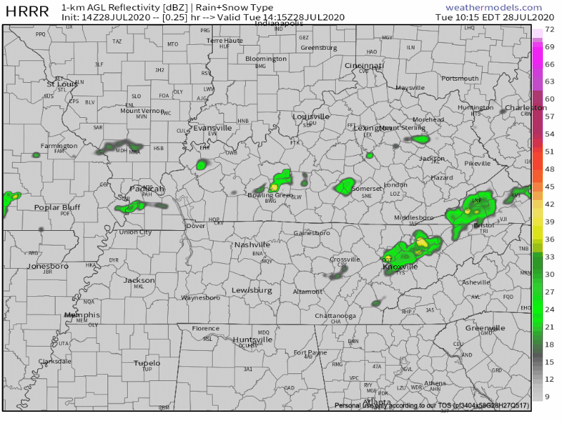
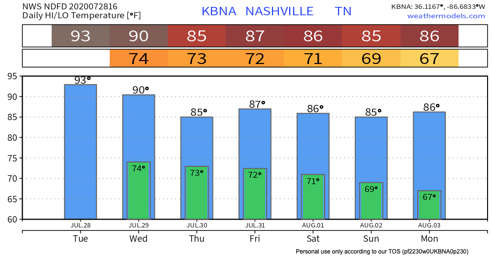
Another hot and humid day with high temperatures in the mid 90s, and will feel more like 100 when you factor in the high humidity.
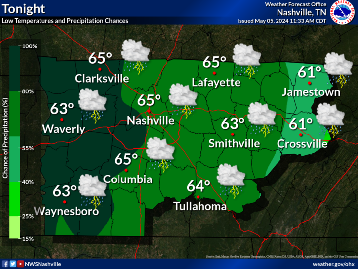
Storms will taper off around 9 PM, leaving us with mostly cloudy skies and a low in the mid 70s.
Tomorrow
Shower and storm chances increase after noon as a weak cold front settles southward.
Thursday and Friday
Cooler and even wetter conditions expected for Thursday and Friday. Widespread showers and thunderstorms forecasted for most of the day and continued pattern for Friday.
Luckily, we’ll get a break from the exhausting 90 degree heat as this upcoming precipitation will knock our high temperatures back into the 80s for the end of the week.
August Already??
Saturday is August 1st, and as we welcome a new month, we’ll also welcome the continual rain pattern. Saturday’s chance of rain is likely, as an upper level trough will sit over the Ohio Valley.
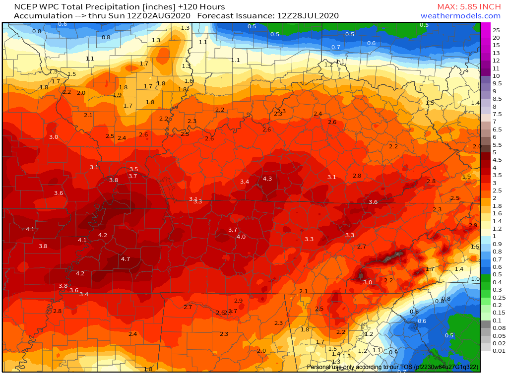
Rainfall looks to add up this week with WPC forecasting 3 to 4 inches of rainfall by 7:00 am Sunday morning.
As always, check back for updates to the forecast and be sure to follow @NashSevereWx on Twitter!
Categories: Forecast Blogs (Legacy)
You must be logged in to post a comment.