Nashville totaled 3.51 inches of rain in the month of October, almost 0.5 inches above normal.
A lot of tropical activity this past month which made for a wet October… October 10th being our wettest day at 1.15 inches.

Nashville totaled 3.51 inches of rain in the month of October, almost 0.5 inches above normal.
A lot of tropical activity this past month which made for a wet October… October 10th being our wettest day at 1.15 inches.
A Flash Flood Watch is in effect for Davidson and Williamson County starting at 1 PM this afternoon until 7 AM tomorrow morning.
Heavy rain will be possible today into Thursday, with amounts of around 2 to 3 inches expected across the area. Some isolated areas may see amounts exceed 3 inches, especially in the northwest and southern Plateau. Heavy rain may result in minor flooding this afternoon into the early morning Thursday.
If you stepped outside, you can definitely feel the cooler air in place after a cold front moved over most of the state, leaving us with fall temperatures and some overcast skies.
The cold front is still pushing itself towards the eastern coast, so places like Alabama and Georgia, even eastern Tennessee has not felt this surge of cooler air.
Wait for it. The sun rises on a cold front to our northwest:

Cooler temps are behind the front, rain is along the front. Looks like it’s coming this way. But . . . Doesn’t look like the front get to us. It’ll stall, then fizzle out tonight.
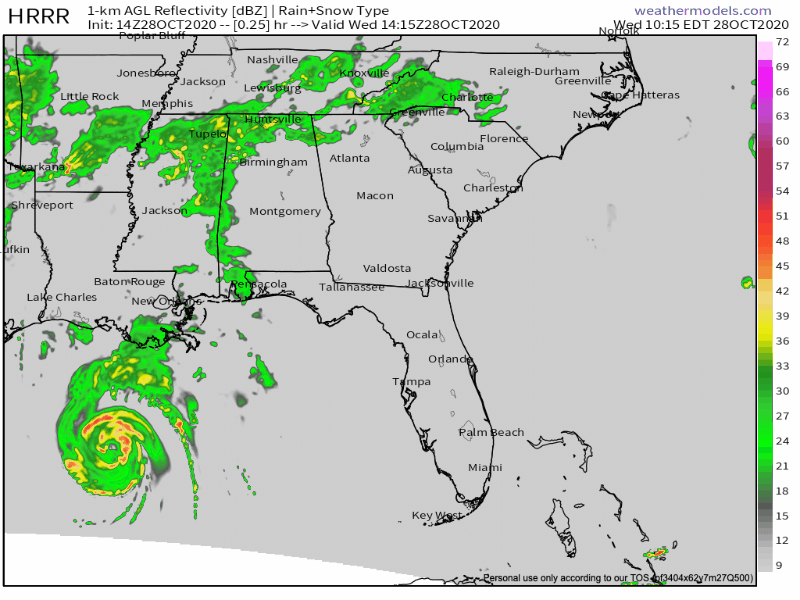
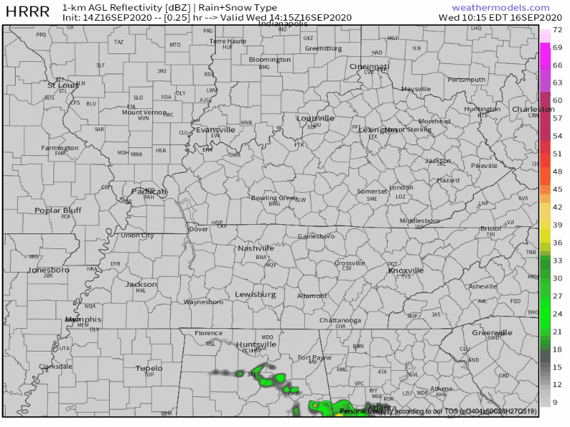
Category 3 Hurricane Delta still churning in the Gulf of Mexico this morning as its arrival time to make landfall awaits tonight.
A build-up of cloud cover over the Middle Tennessee area into the afternoon is due to the very outer bands of Delta as it approaches the Louisiana coastline.
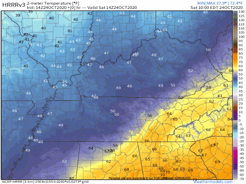
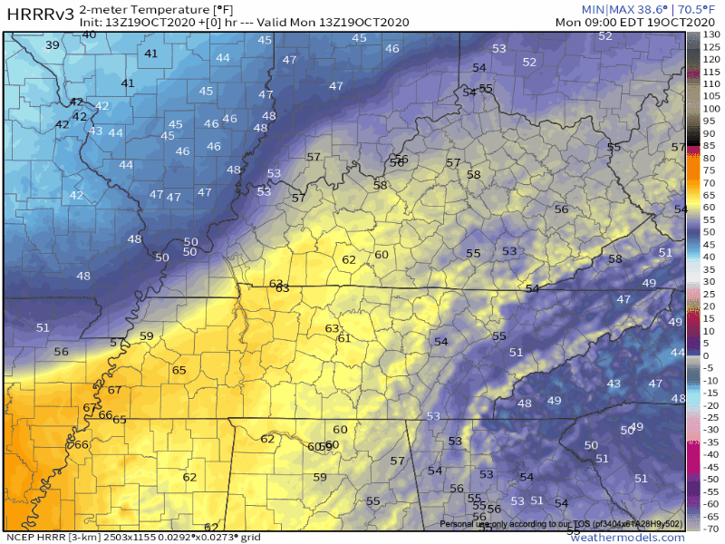
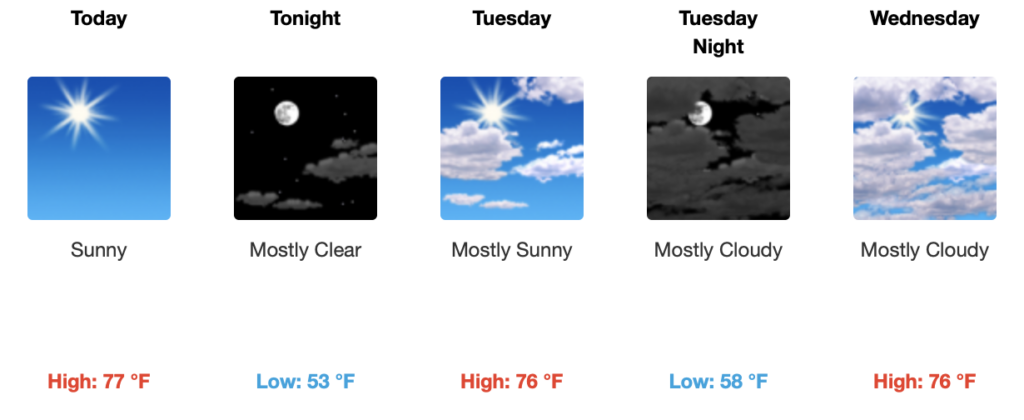
Cold front passage yesterday afternoon allowed our temperatures to cool, leaving us with a pretty chilly morning in the 40s.
We’ll warm into the upper 60s by this afternoon with a lot of sunshine and some pretty dry air.
David says Fall doesn’t smoothly transition. Temps go up and down. Like this:
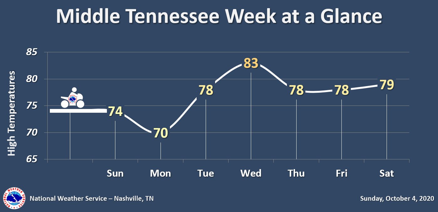
That temp dip Monday is due to an approaching cold front that gets here later tonight. Lows Monday morning into the 40s.
Kicking off our week by continuing our trend of high temperatures in the 70s and a lot of sunshine until mid-week.
We’re slightly below average in terms of high temperatures, but not by a lot. Normal highs for this time of year usually range in the low to mid 80s and for the past few days, our highs have been in the mid-upper 70s.
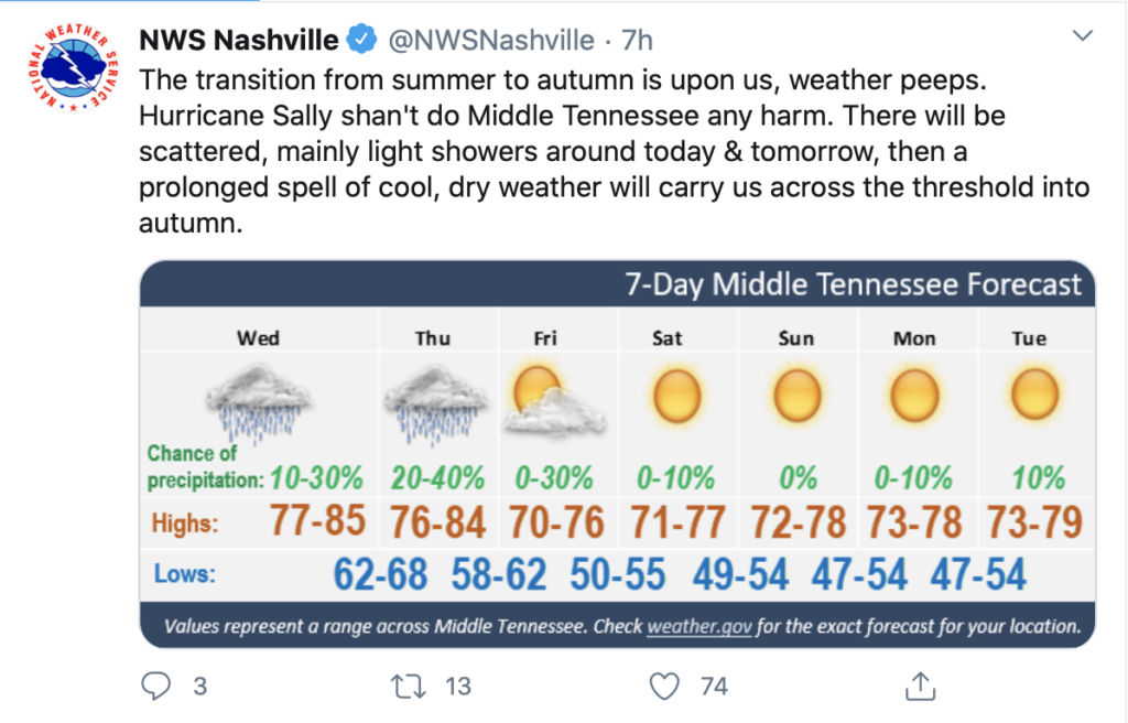
Hurricane Sally made landfall as a Category 2 hurricane after churning the Gulf Coast this past week. Maximum sustained winds of 100 MPH brought heavy winds and catastrophic flooding to the coast area like Gulf Shores, AL, and Pensacola, FL
A pretty mild and dry afternoon approaching with our high temperature in the mid-80s.
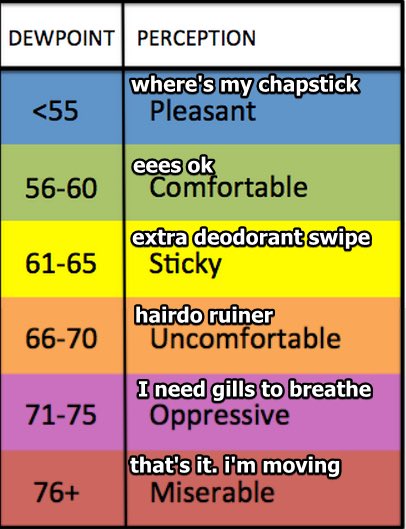
It’ll feel warmer, though, with those dewpoint temperatures projected to hang out in the upper 60s today.
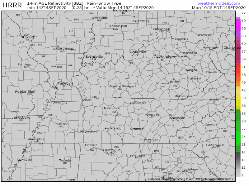
A chance for isolated showers is forecast for the southern region of the state. Most of the activity will stay mainly south of us, along the Tennessee and Alabama border this afternoon.
You must be logged in to post a comment.