Clear Day Today, Warming Trend Bringing Rain Later

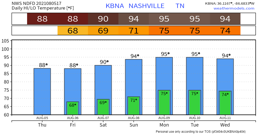
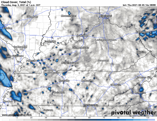
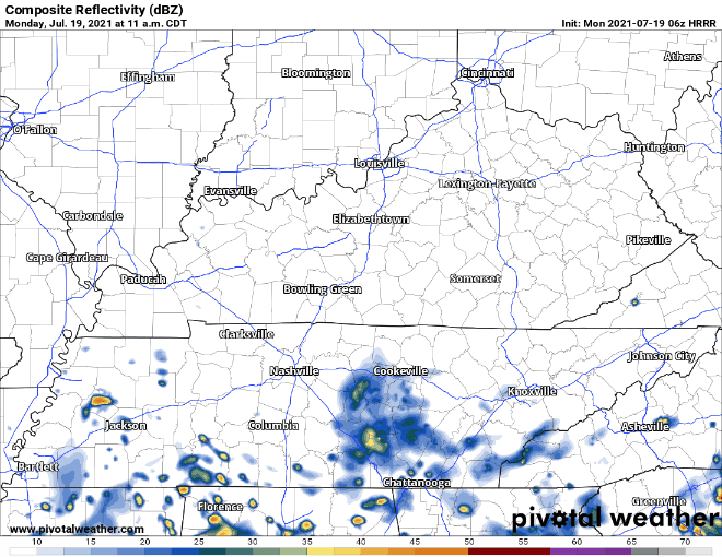
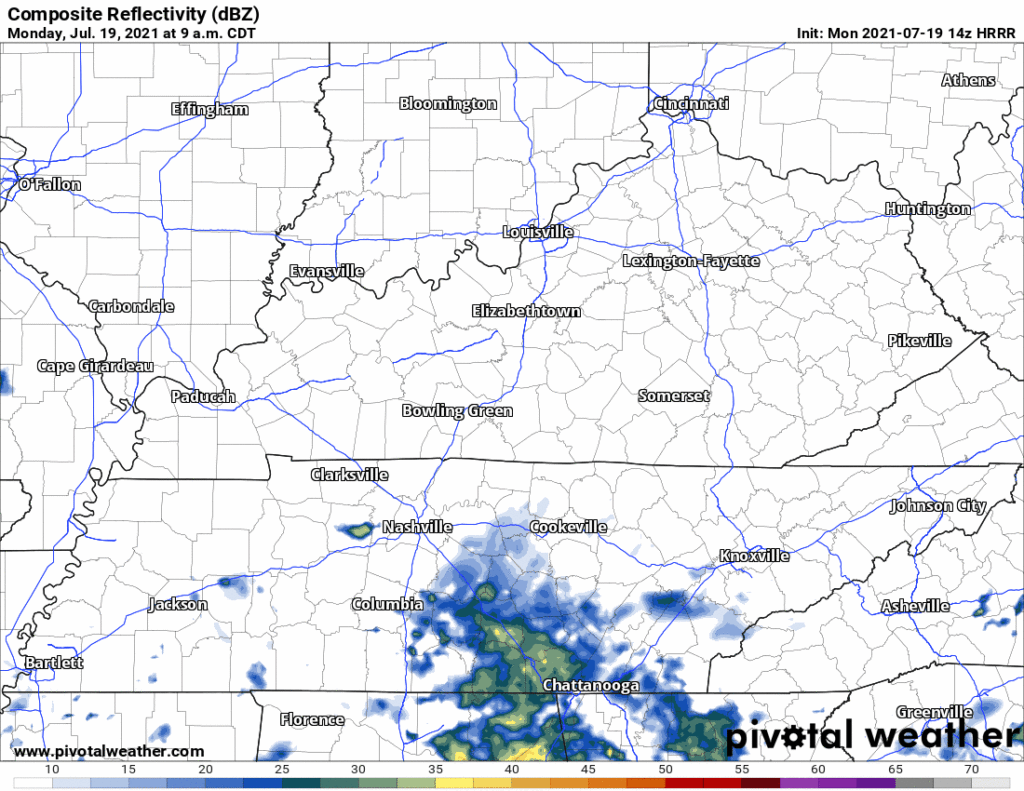
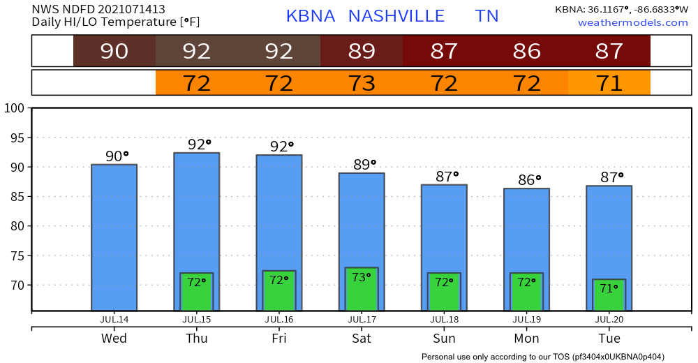
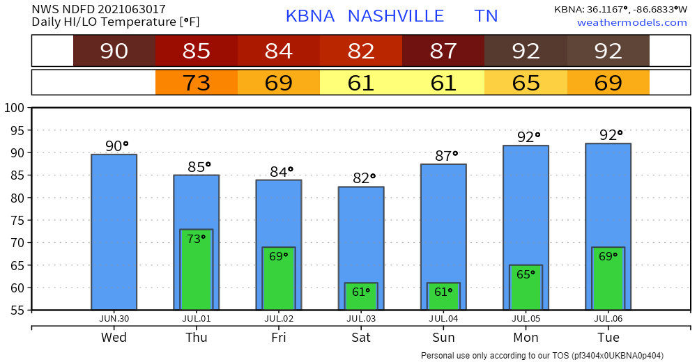
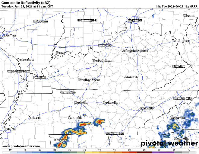
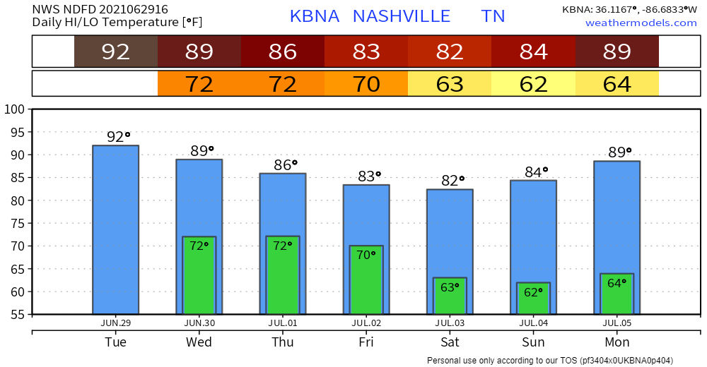
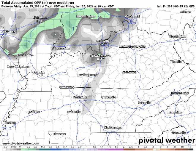
Nothing but dry and warm today. Rain is practically nonexistent in the most current model runs. Some more cloud coverage later today through tomorrow.

HRRR Cloud Coverage, valid Thurs. 1pm – Thurs. 9pm

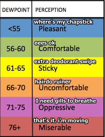
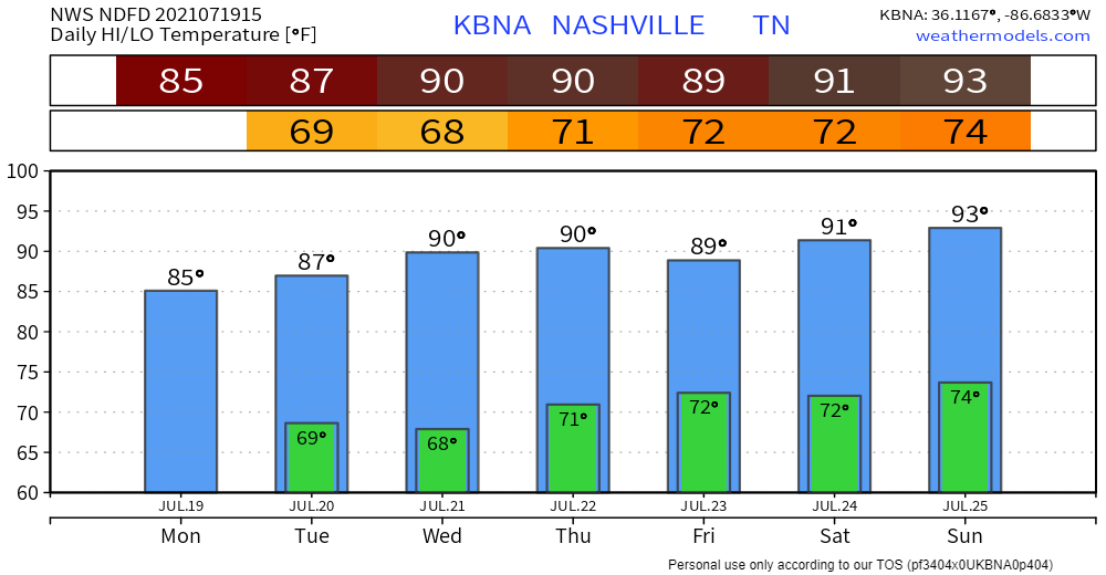
Highs today are just shy of 90 and dewps in the low to mid 60s. Sticky, but pretty low for August. Tomorrow will be similar, but dial up the humidity a bit (dewps in upper 60s). Highs sneak into the low 90s and dewps hang out in the upper 60s for the weekend. read more

Hot/Humid/It May Storm (what else is new?)

The NWS Blend of Models thinks our heat index will get to 101° this afternoon. That’s in the shade!

NWS BOM 2 m AGL Heat Index, valid Mon. 10am – Mon. 8pm

Dewpoint around 73° to 74° this afternoon.

Models thought we would see a line of storms here mid afternoon. That was yesterday’s models. Today it shows that line south of us. Some of us will probably see a few showers/storms pop off this morning (we have one already in Brentwood/Nolensville) and/or this afternoon from a weak upper level boundary, but the meat of the system should be south of us if the HRRR is right. read more

:I’m Not Feeling Great: emoji

Air quality is improving. Most of the wildfire smoke cleared. It’s heavier northwest and southeast of us.

NOAA HRRR-Smoke, Sun. 9am

Today expect a miserable combination of temps and dewps. Like walking out into a tropical rainforest. NWS-Nashville issued the below Special Weather Statement for the heat. See below. Heat exhaustion is likely for those who ignore basic hydration, rest, and shade. read more

Is The Rain Over? Maybe Not?

Heavy rain got many of us this weekend. Others, not so much. Today the rain is more likely in southern Middle Tennessee. Notice the HRRR model, below . . .

. . . it’s got a few downpours south of I-40 today. Those north: nothing. read more

Quiet Day Today, But Rain Returns For the Weekend

Copy and paste yesterday onto today, because rain chances are down and temperatures are up. It’s looking like it may even be a bit hotter than yesterday with heat index forecasted to reach the mid to upper 90s later this afternoon. Typical muggy, summer day in Tennessee. Not going to be much cloud coverage to keep the sun from beating down on you. read more

Rain Backing Off Today Into Tomorrow

Rain chances are taking a downturn the next couple days. Precipitation will be minimal. Now this doesn’t mean you won’t see any rain at all. But rain events won’t be near as widespread as we’ve been used to recently, and chances of any turning severe are slim to none. HRRR says parts of our area could see typical summer afternoon showers, but most of the action will move east over the Plateau. read more

Sunny, Dry 4th of July Ahead; Smoky/Hazy Fireworks Tonight

Who else can remember a rain-free Independence Day that wasn’t either blazing hot or miserably humid (or both)? I know I can’t. But that’s exactly what we’re going to see today. Don’t get me wrong, it’s still going to be pretty warm, but much more comfortable than we’ve been used to lately. Dewpoints are forecasted to rise to the mid 60s tonight, around the time that a lot of you will be watching fireworks. So a little sweaty, but temps will cool off enough to keep you comfortable. read more

Afternoon Heat Bringing More Showers and T-Storms

Scattered thunderstorms are in the works this afternoon… it’s become almost routine at this point. Credit goes to the daily 90+ degree temps that have been firing up showers/thunderstorms. They’re not going away just yet and neither is the humidity… for now. read more

Periodic Rain/Lightning Delays Possible With Outdoor Plans Through Friday

I don’t know if you’ve heard already, but a tropical storm made landfall in South Carolina last night. What does this mean for us? Not much in the grand scheme of things. No tropical storm force winds or anything of that nature. It already fell apart over Georgia earlier this morning, but remnants headed toward us could very well be packing some “lift” that we lacked yesterday. Satellite imagery shows this convection building up to the south tracking northwest. read more

Rain-Free Start To the Weekend

Rain chances continue to dwindle for the rest of today and tomorrow–models are tending drier with each run. All the atmospheric features that were expected to bring rain are moving farther to the north and west of us. More cloud coverage today but not much else. read more