Let’s get right into it. A Flash Flood Watch was issued earlier this morning including our counties. It’s in effect until 7pm tonight as of now. Keep a close eye on your weather alert apps in case Flash Flood Warnings are issued.

Let’s get right into it. A Flash Flood Watch was issued earlier this morning including our counties. It’s in effect until 7pm tonight as of now. Keep a close eye on your weather alert apps in case Flash Flood Warnings are issued.
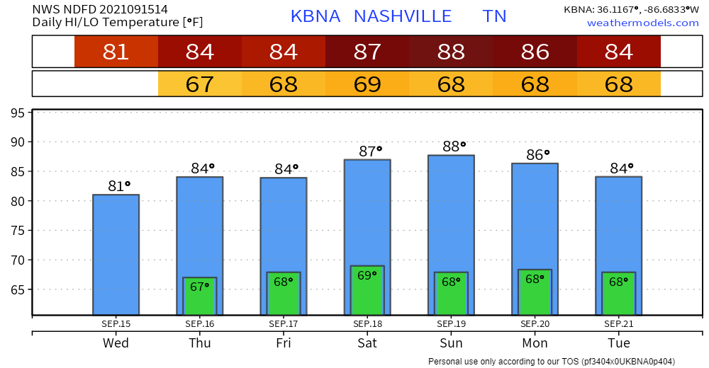
It’s been pretty dry for the last week or so. Some incoming rainmakers look to change that for us. There’s Tropical Storm Nicholas that will bring some tropical moisture to the area. Add a front moving in from our northwest and you get widespread rain chances.
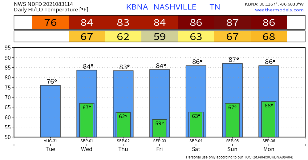
Not much to it today… expected to be warm and sunny. Any belated Labor Day plans are a full go. Slightly warmer than average highs in the upper 80s. Still enough to get us excited for fall. Dewps jump around a bit. Mostly at or below 60 degrees (comfortable) until later this afternoon. Low to mid 60s (sticky) this evening through tomorrow night.
We finished up with Ida last night. What better way to follow it up than with clear skies and comfortable temps/dewps?
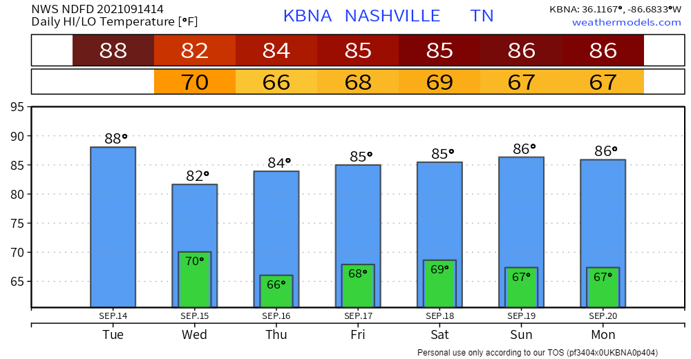
So what’s up? A little tease of fall, that’s what. Highs the next couple days hang out in the lower 80s, a couple degrees below average. What you really want to hear is that dewps are on a downward trend. Sticky today, but we might just creep into that “comfortable” range tomorrow and Friday–a far cry from the 66+ degree dewps we’ve come to know and hate.
Rain continues today, but it appears the majority of the rain for this system has already fallen. The latest HRRR run shows most of us receiving less than an inch of additional rainfall, but a few spots may pick up a quick downpour.
High pressure should keep skies clear and dry for the better part of this week. No rain in sight today.
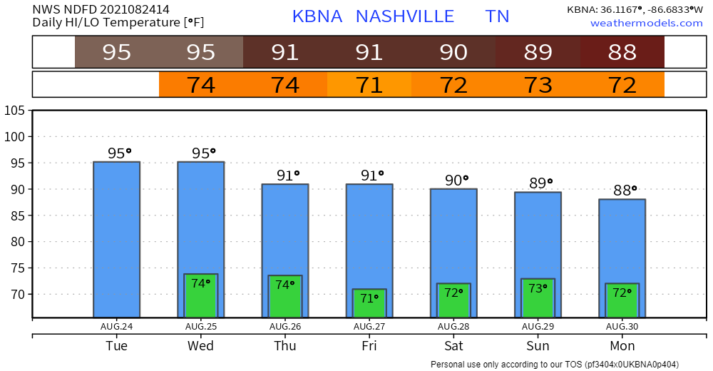
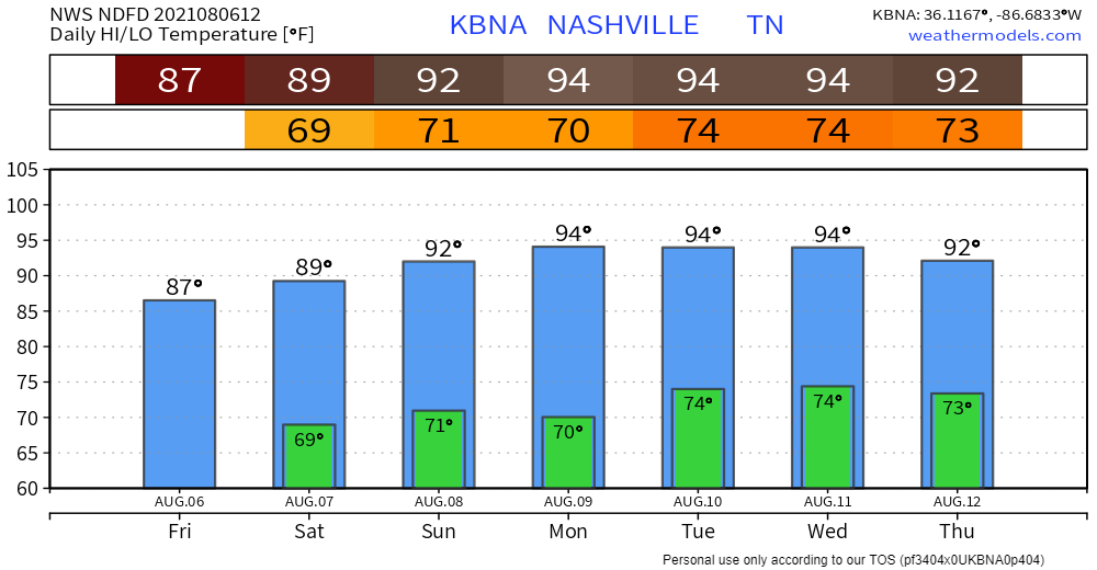
It’s hot. Highs in the mid 90s, dewps up in the low 70s. Result: triple digit heat indices again… maybe higher than yesterday. Below is the heat index outlook for the next couple days. One word: Sweaty.
Scattered rain activity and overcast skies in store for our counties. Chances are best this afternoon, but most won’t see anything. Those that do get storms likely won’t see anything severe with these, just brief downpours and the occasional rumble of thunder. See the HRRR below.

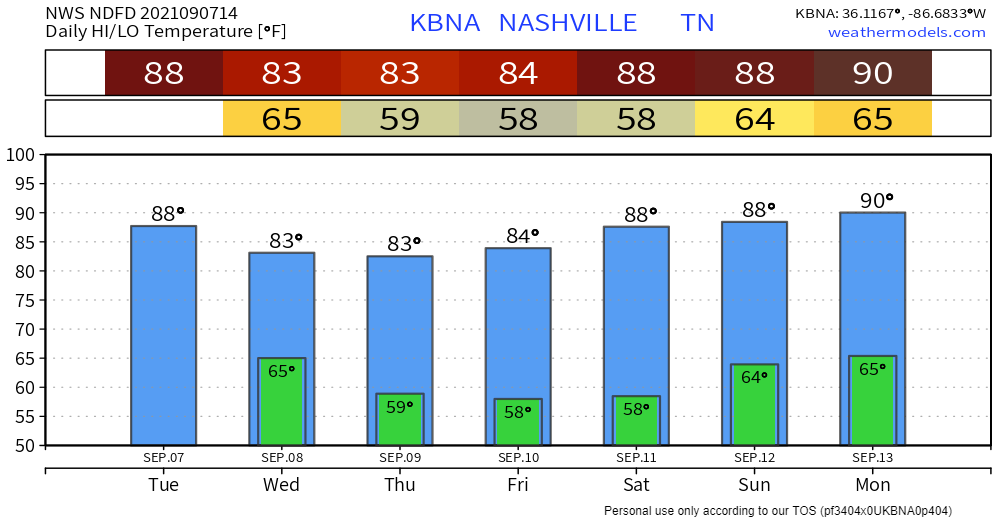
Happy Friday the 13th! Today is like the disgruntled middle child caught between yesterday and tomorrow. Highs are on a downward trend to the low 90s. Let’s not get too ahead of ourselves now… dewps in the low to mid 70s could still give us our most beloved 100+ heat index. No more heat advisory, so that’s good news. Practice heat safety anyway.
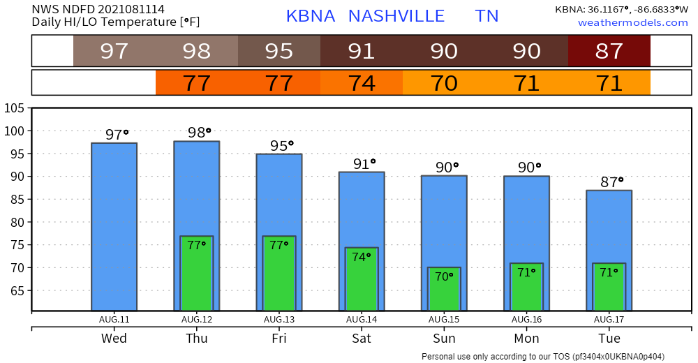
Heat advisory in effect for us today and tomorrow 11am-8pm CDT. What does this mean exactly? Heat indices ranging from 105 up to 109…. pretty miserable. Reason for caution if you’re planning to be outside. Plenty of fluids, shade, and A/C are your best friend. Important to know signs of heat exhaustion/stroke, so please give the graphic below a quick once-over.
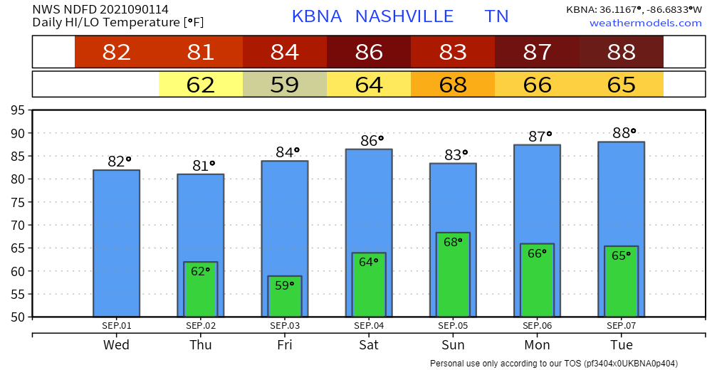
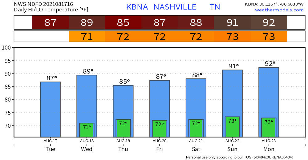
Today marks a return to normalcy for August: dewps in the upper 60s and afternoon storms/showers. Highs likely won’t break 90 just yet, but the heat is just getting started.

Rain is back in the forecast today. Model runs are showing activity in the afternoon (see HRRR run below). I say more activity, but we’re not expecting widespread coverage, severe weather, or anything of that nature. Anticipate unpredictable scattered showers/storms here and there, but any action could miss you altogether. Not washout material. Still could delay outdoor festivities.
You must be logged in to post a comment.