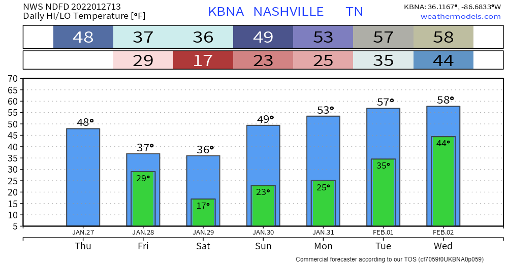
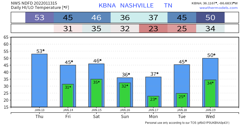
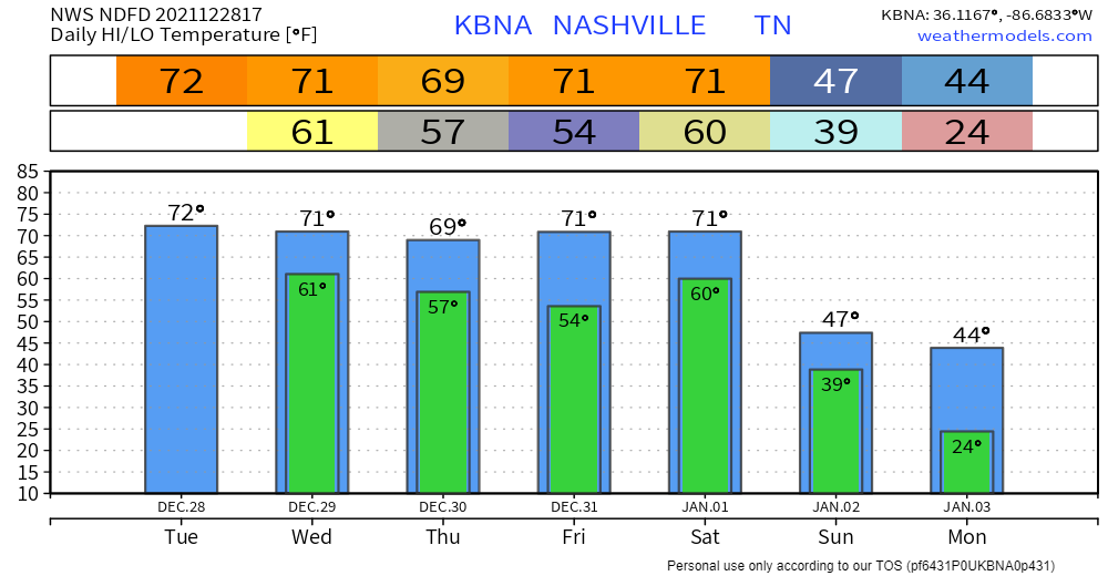
Pretty average day for January temp-wise with highs in the upper 40s. More cloudiness throughout the day ahead of tonight’s cold front. And then temps drop back down tomorrow. Wind chill looks no fun:

Pretty average day for January temp-wise with highs in the upper 40s. More cloudiness throughout the day ahead of tonight’s cold front. And then temps drop back down tomorrow. Wind chill looks no fun:
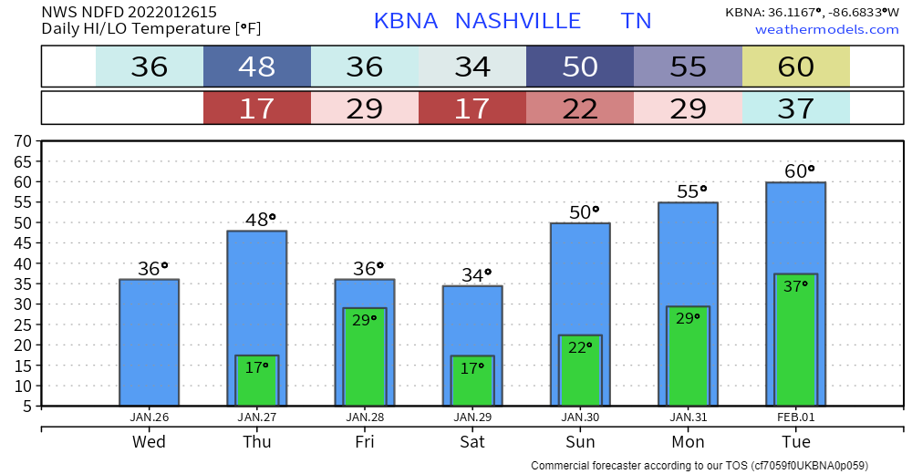
Mid 30s the high today and llllow humidity. If you’re one of those people who cringe before you touch a door knob this time of year, today’s one of those days. Expect temps in the teens again tomorrow morning. Wind chill won’t be as much of a factor thanks to lighter winds. Still cold. Even for January.
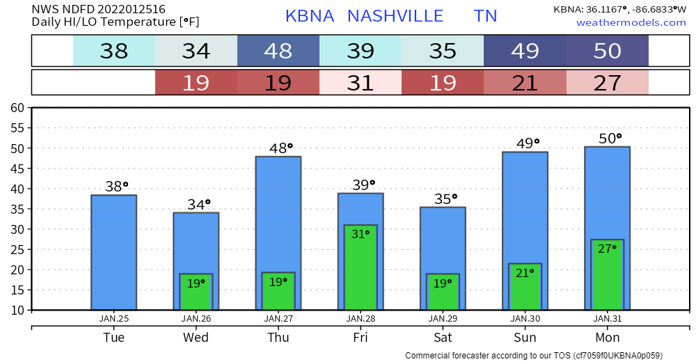
Front is in and out. Cold temps and REALLY dry air are what’s left. Highs this afternoon in the upper 30s, overnight lows in the upper teens. Won’t get too far above freezing tomorrow. Wind chills definitely won’t thanks to winds out of the north.
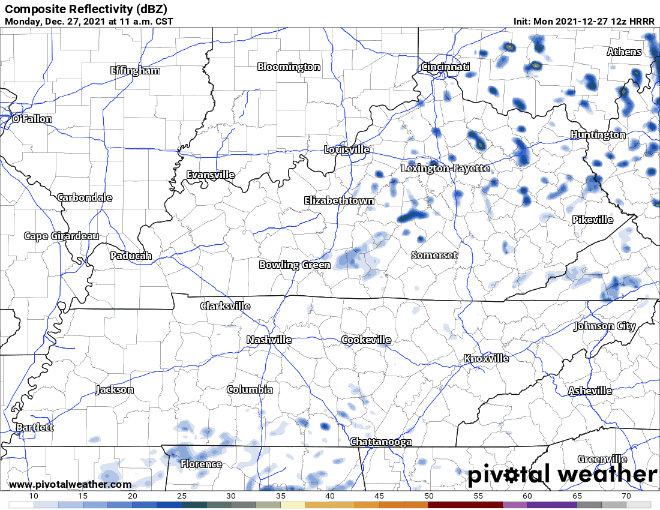
A line of rain has arrived. No severe weather/flooding concerns. Can’t rule out an isolated thunderstorm here or there, but most will see just showers.
Showers transition into a wintry mix late tonight as temps dip to at/below freezing. Models are in pretty good agreement as far as precip type/accumulation goes. Not much more than a dusting expected for our area (less than a half inch).
Not much change to the forecast for today. More cloud coverage throughout the day plus some scattered sprinklers. Timing: this afternoon. Cooler and dry tomorrow with highs in the mid 40s. Look for wind chills to hang out below 40.
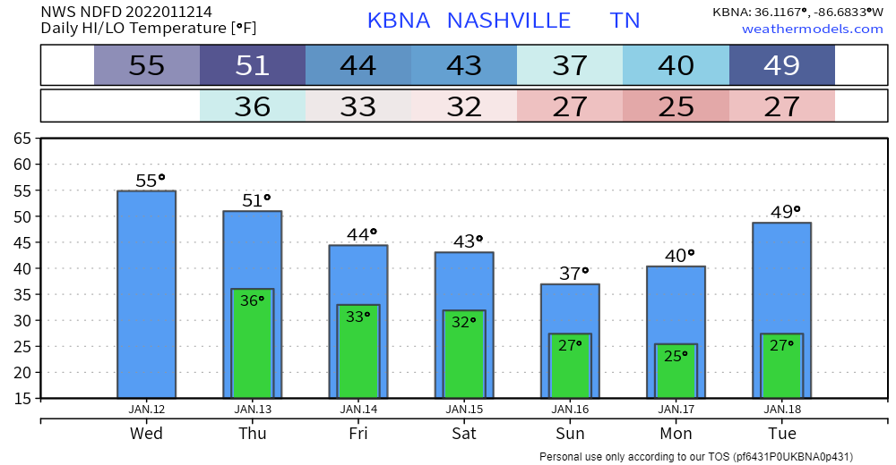
A bit warmer today than yesterday… highs generally 5-10 degrees higher. Staying dry until at least tomorrow.
Overcast skies and maybe rain for some folks tomorrow. Likely just sprinkles; nothing to write home about. A slight cool off starting tomorrow ahead of a possible winter weather event this weekend.
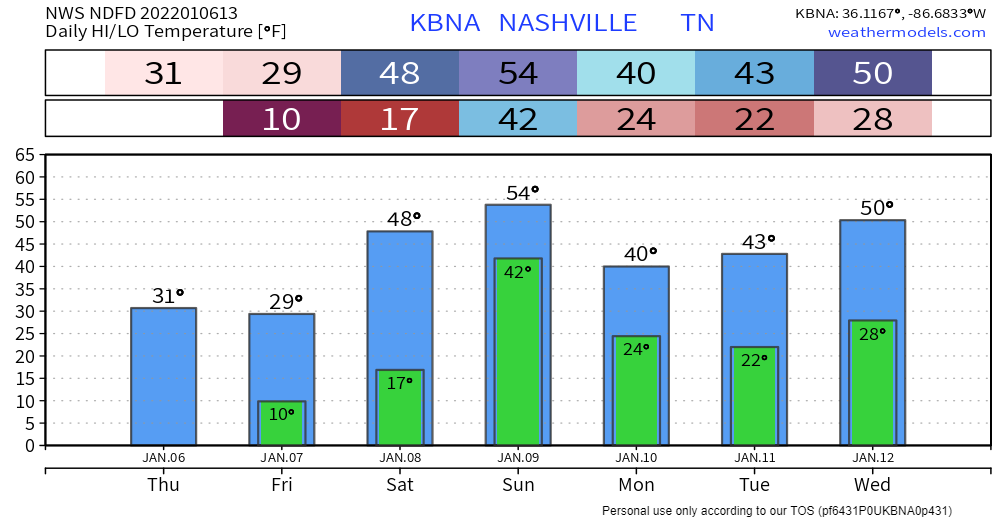
Our counties are currently under a Winter Storm Warning (in effect until 8pm tonight). According to the NWS:
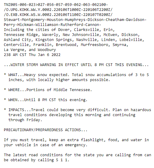
Can expect 3 to 5+ inches of accumulation… higher amounts could be seen locally. Let it be known that this is an all snow event. None of the freezing rain/sleet. Seeing pretty quick accumulation from flurries already.
It’s windy, and there may be showers around today, tonight, and in the morning:

Strong to severe storms are possible Wednesday afternoon and/or evening. Since yesterday, our area’s been upgraded to a slight risk of severe weather by the Storm Prediction Center.
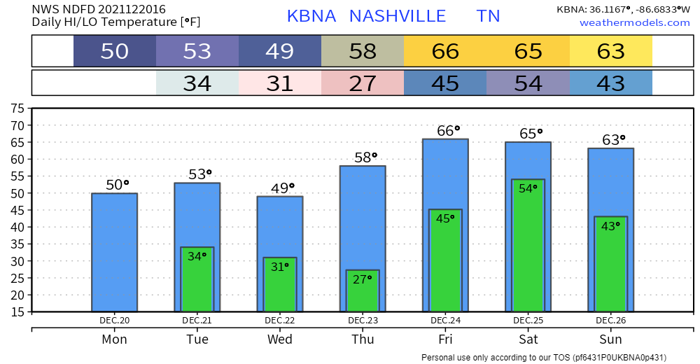
Highs are running 20-25 degrees above normal this week. Rain is possible every day, most likely Wednesday and Saturday. Those are the days we are concerned about.
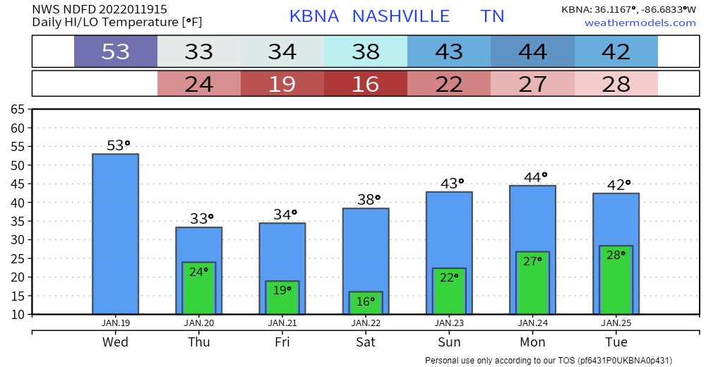
Below shows Monday and Tuesday, no worries about it.
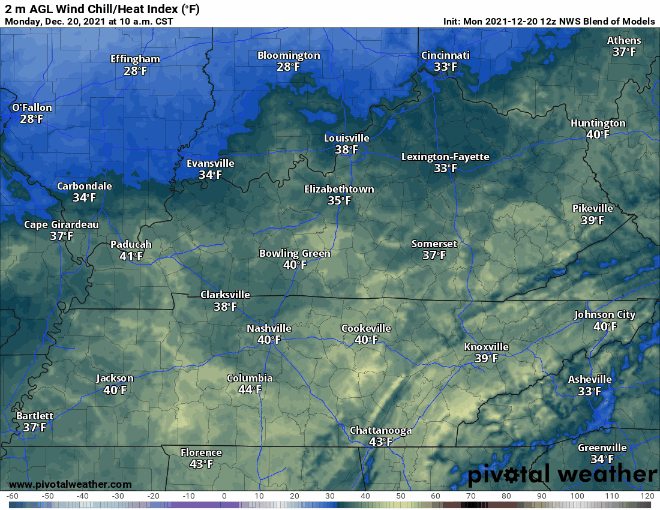
Normal temps, some sun. Wind chills drop tonight, time stamp upper left:
Additional moisture rolling in tonight plus near freezing temps equals a low probability chance of freezing fog early tomorrow morning. If you are out really early and see fog on the road ahead – especially on bridges and overpasses – a thin layer of ice may have formed on the road. The potential hazard will be brief. Just be aware. It’s freezing fog szn.
You must be logged in to post a comment.