Rain is done for most of us. Maybe light showers here and there for some. Altogether inconsequential. Just your average spring day. Mild temps and breezy (gusts up to 40 mph possible). Hang on to your hats!

Rain is done for most of us. Maybe light showers here and there for some. Altogether inconsequential. Just your average spring day. Mild temps and breezy (gusts up to 40 mph possible). Hang on to your hats!
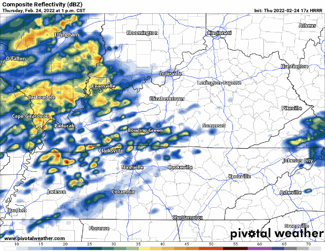
We’re on the tail end of the low pressure responsible for the latest rain. Nothing left but a few light showers (mostly south of I-40). Everything should be out by this evening:
NWS has backed off of forecasted highs for today… courtesy of cloudy skies. Will get more sun tomorrow as we dry out. Thursday will be more agreeable with your spring break plans. Warm temps and no rain.
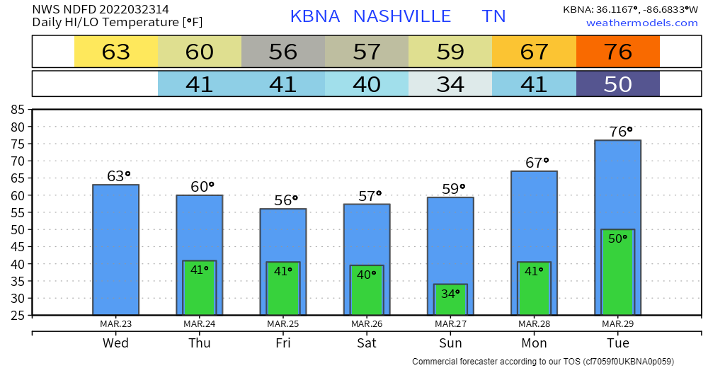
Rain has moved out… so what’s next? Highs warm up to the 60’s tomorrow and Friday. More sunshine the next couple days.
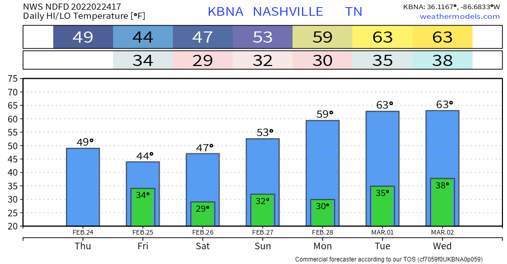
Late Friday night is when things start to get interesting. A strong cold front is expected to roll through… frigid temps along with it. Talking about a turnaround of almost 45 degrees from Friday afternoon to Saturday morning! Possible that we don’t get above freezing Saturday:
Meteorological spring has sprung and it sure feels like it. Highs near 20 degrees above average today! Expect calm, clear conditions until the weekend. (Editor’s note: We call “meteorological spring” fake spring. Gotta wait til March 20 for the real thing. But, we’ll take the warm weather).
The heaviest of the rainfall is past us. Hit or miss showers rest of today. Under a half inch of rain between now and the wee hours tomorrow morning. Everything should be mostly out by then.
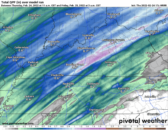
Good news is the ground has more time to accommodate this new rain. But flooding is still possible. Anything that falls is going to easily runoff to already flooded areas. Especially north of I-40 where more rain is expected. We remain under a flood watch until 6AM tomorrow morning.
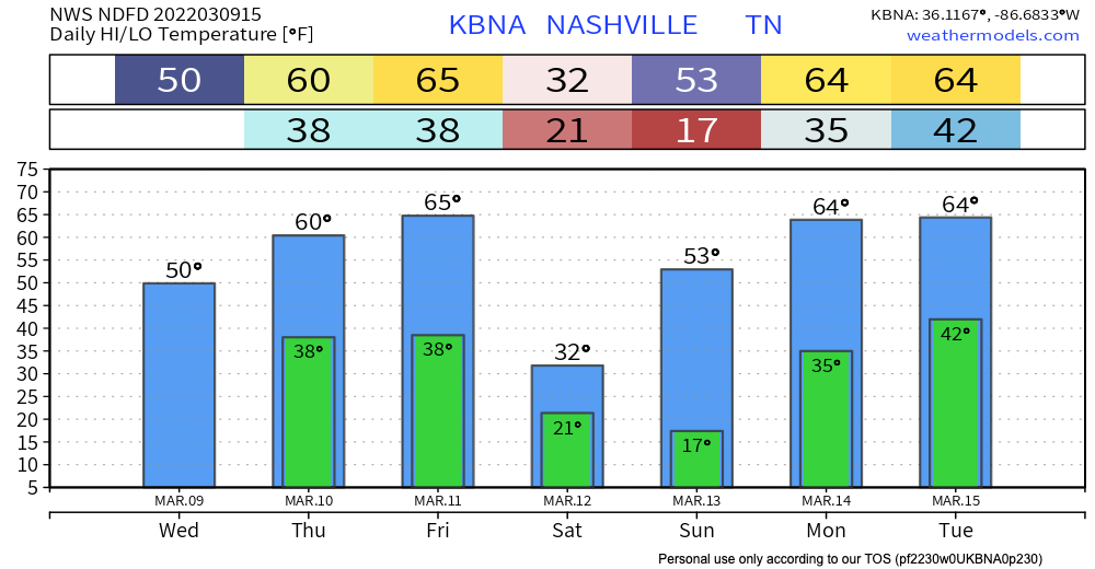
Shortlived break from the rain today. Chilly temps today and tonight. Most of the frozen precip expected to fall NW of us. HRRR thinks a little sleet could mix in early on… nothing impactful.
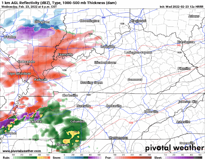
On and off rain showers start tonight and continue throughout the day tomorrow. Heaviest rainfall overnight tonight:
Storms are fed by instability. The question for tomorrow’s potential severe event: will there be enough storm food to fire up storms AND sustain themselves? CAPE values are relatively low, but recent model runs show a slight uptick (which could be just enough).

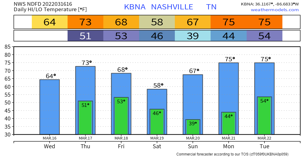
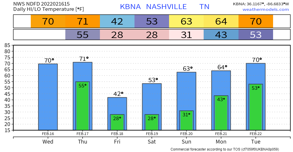
Mild highs today, even warmer Friday. Not record-breaking, but tomorrow’s highs are around 20 degrees above average. The comfy temps will be short-lived. Cold air is making a comeback this weekend. Turnaround of almost 30 degrees from Friday to Saturday!
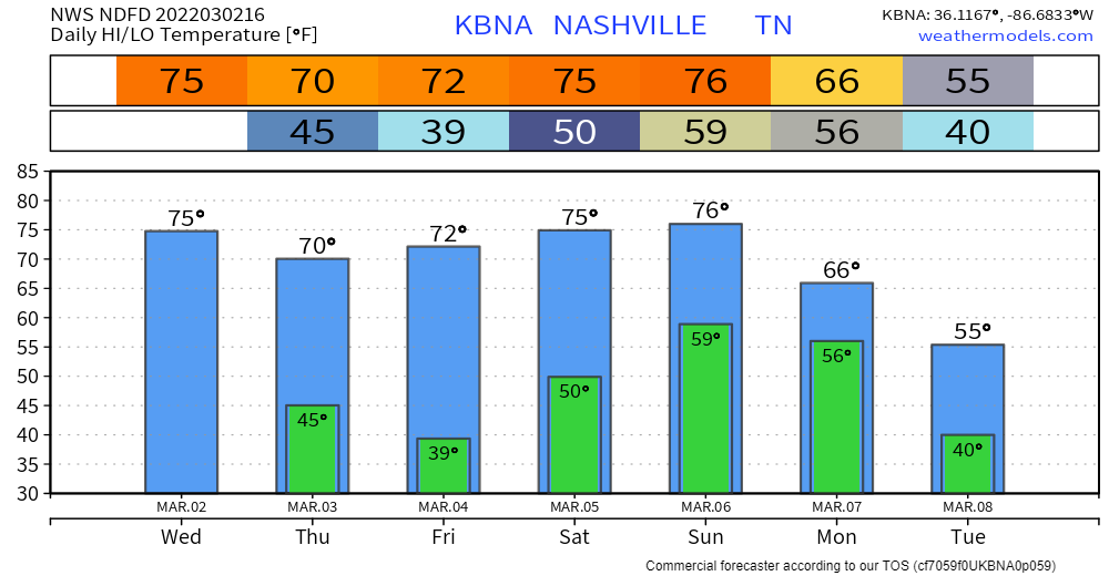
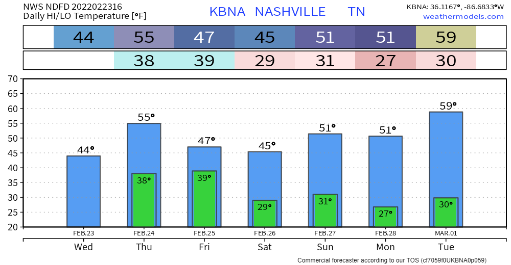
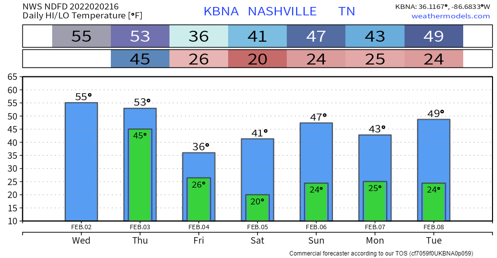
Mild, spring(ish) weather to look forward to the next couple days. High temps well above average. Mostly sunny and dry through Friday. Overnight lows in the mid 30s. Chart below can help with wardrobe decisions:
Widespread showers are already under way. On and off for the rest of the day. A (not long enough) break tonight before heavy rain Thursday. The meat of the system rolls through tomorrow morning through the afternoon.
You must be logged in to post a comment.