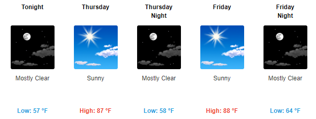
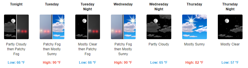
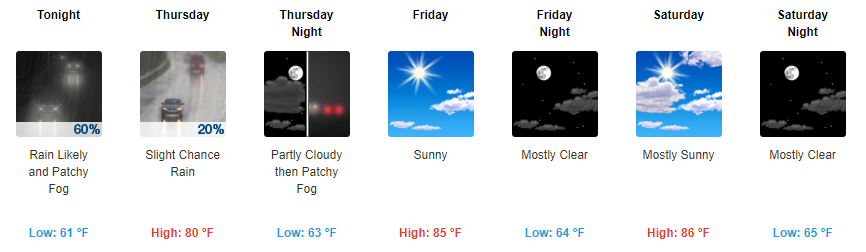
Highs in the 80s, Dry & Sunshine
High pressure remains well in control of our area and looks to stay that way through at least Friday. This will keep our temps above-average in the mid 80s with overnight temps falling into the upper 50s.

High pressure remains well in control of our area and looks to stay that way through at least Friday. This will keep our temps above-average in the mid 80s with overnight temps falling into the upper 50s.
Temperatures Today/Tomorrow
[av_textblock av_uid=’av-tp8utb’]
[cjtoolbox name=’Treg DONT DELETE’]
[/av_textblock]
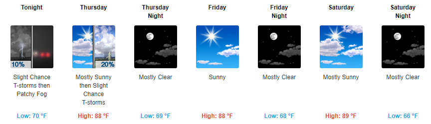
Starting tomorrow, our highs will jump into the low to mid 80s. Overnight temps this week will dip into the upper 50s to low 60s, so you may need a jacket in the evening and for the early AM commute.
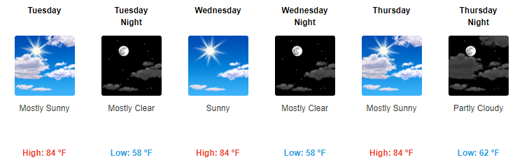
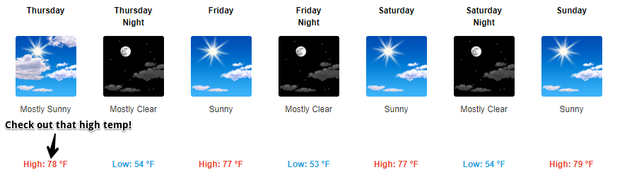
High pressure will remain in control over the foreseeable future with no rain chances in sight. While temps won’t be completely fall-like, they will feel a bit nicer with highs in the low 80s and overnight temps in the 50s. Tomorrow will by far be the coolest day with highs in the upper 70s.
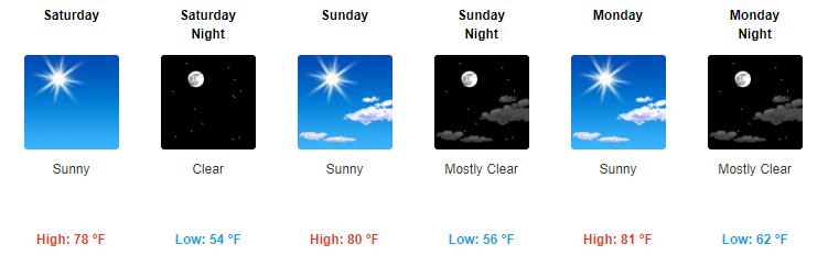
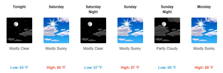
Starting tomorrow, expect for much cooler AND drier weather to return. Highs will stay in the upper 70s through the weekend with dew point temps backing down into the low-50s. It’s going to feel really nice.
Highs in the 90s. Dew point temps in the mid-60s. Sunshine during the daytime. And there really won’t be a whole lot of variation in our forecast for the first half of the week.
https://giphy.com/gifs/much-help-confused-3og0IM42WoeZ00VM7m
Really a whole lot of nothing looks to continue for the foreseeable future with our forecast. Current surface analysis over the country shows this pretty bland weather pattern here in Tennessee with a high pressure influencing our conditions.
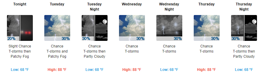
Rest of today appears to be a continuation of that “summertime feeling”. Highs will top off just below 90° with dew point temps cruising in the mid-60s. Popcorn afternoon showers are possible once again today, any shower that develops should die-off by the evening hours.
Starting today we will finally transition back into a sunshine filled period. With this sunshine will also come a spike in our temps with highs expected to reach into the upper 80s. Our dew point temps will be in the mid-60s through the weekend. It could feel a bit sticky, but it won’t be too bad.
Special shoutout to one of our readers, Sarah Szpak-Miller. Thank you to everyone who reads and loves our posts! We have eyes and ears everywhere.
https://giphy.com/gifs/gift-W80Y9y1XwiL84
Our dreary day will continue into tonight with on and off showers. Luckily, showers from the remnants of Irma will clear out during the overnight hours into tomorrow morning.
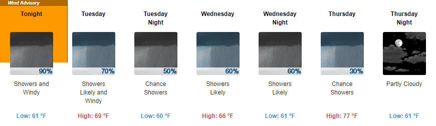
Irma is on the way and we will begin to feel the effects of Irma on our Middle Tennessee weather pattern. Irma, now a tropical storm, will continue to make its way north and westward through the remainder of today and into tomorrow.
You must be logged in to post a comment.