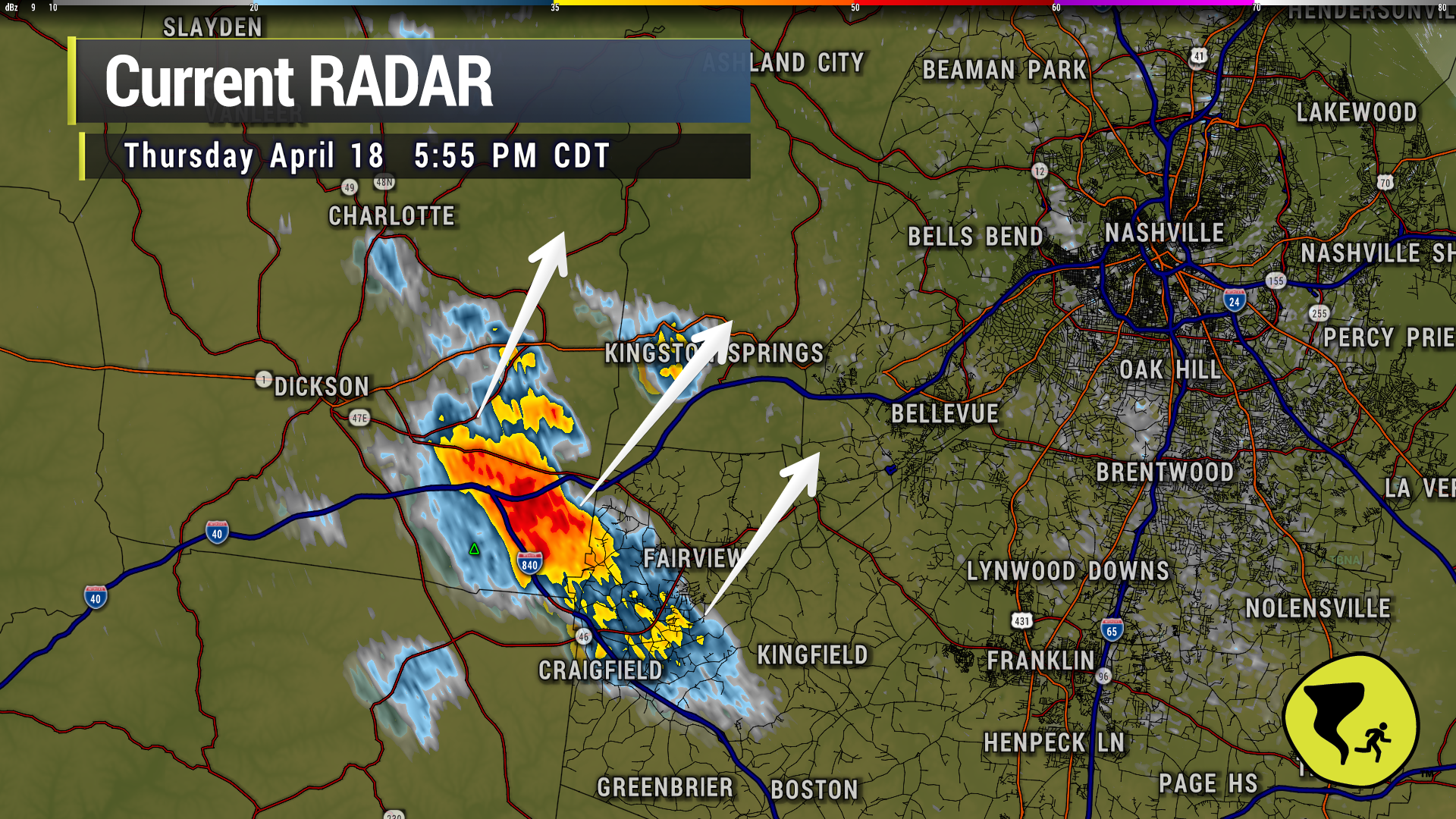

The core of this cell is trending more NNE than NE. Looks to miss Fairview and Bellevue and more toward Cheatham Co. Still…lightning will likely strike beyond the core of the storm. If you hear thunder, head indoors. 5:56 pm

The core of this cell is trending more NNE than NE. Looks to miss Fairview and Bellevue and more toward Cheatham Co. Still…lightning will likely strike beyond the core of the storm. If you hear thunder, head indoors. 5:56 pm
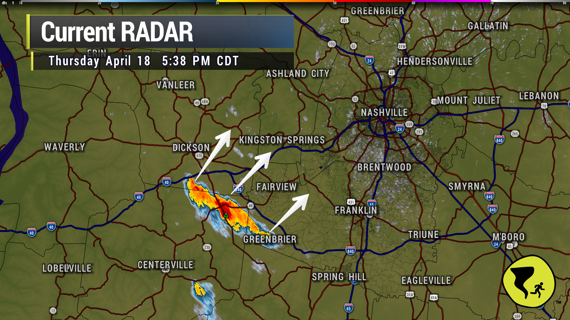
Storm has perked up entering western Williamson Co. Headed for Bellevue and perhaps Nashville W of 65 over the next hour….if it holds together. Lightning IS occurring. Head inside if you hear thunder. 5:39 pm
A couple of storms have popped up to our southwest as expected and will continue to throughout the evening. These storms could contain heavy rain, lightning, gusty winds and small hail.
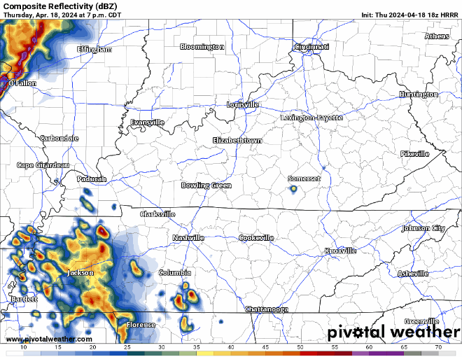
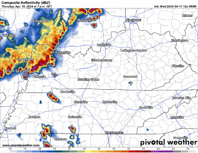
The HRRR model above advertises those evening storms coming from the SW, and then a line of weakening showers/storms coming thru in the early hours of Friday morning. Model guidance has been pretty consistent with thinking this line weakens a lot before it arrives, but still could contain some strong winds, small hail, and lightning. The tornado threat is very low, but it isn’t zero.
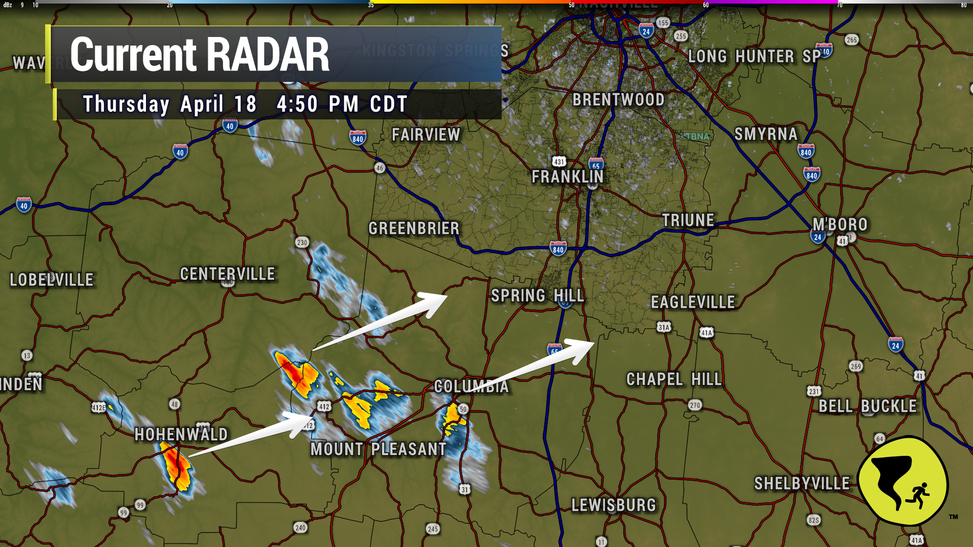
Coupla no big deal downpours moving NE through Maury Co. Could be in Spring Hill and Bethesda in the next 30 min or so. Might be lightning makers if they gain strength. 4:52 pm
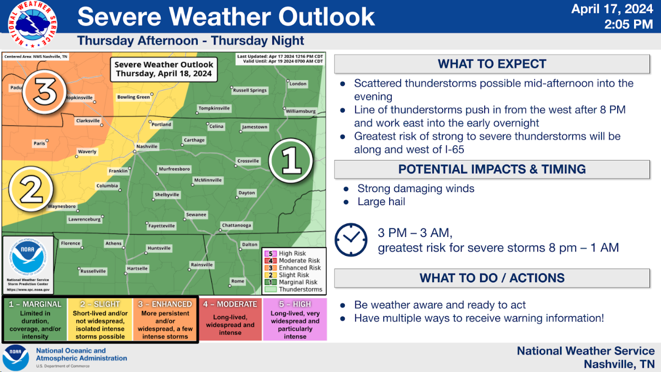
NWS: “We continue to expect a few instances of localized gusty winds and marginal severe hail with the early evening scattered storms. Later storms coming in from the west northwest after 10 PM will have better shear, so gusty winds and maybe a QLCS spinup tornado cannot be ruled out as the storms approach. But the late storms will weaken considerably as they push into our area and especially toward I-65.”
NWS: “We continue to expect a few instances of localized gusty winds and marginal severe hail with the early evening scattered storms. Later storms coming in from the west northwest after 10 PM will have better shear, so gusty winds and maybe a QLCS spinup tornado cannot be ruled out as the storms approach. But the late storms will weaken considerably as they push into our area and especially toward I-65.”
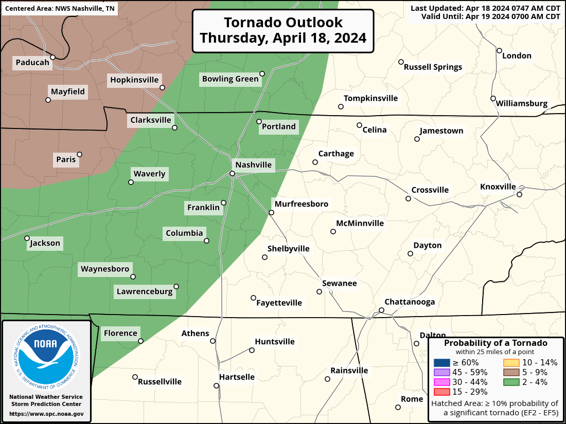
Storms expected this evening and tonight. Low tornado thread added.
Within 25 miles of you tonight, there is a 2% chance of a tornado occurring, a 15% chance of damaging wind occurring and a 5% chance of large hail.
Another very warm day is in store Thursday, high temperature expected to end up around 86°. Record high at BNA is 88°, could get close to at least tying.
Thursday evening into the overnight hours, a line of storms with heavy rain, lightning and gusty winds are expected drop down I-24, therefore nicknamed an “I-24 Special”, although it is debatable if they are actually special.
Storms likely Thursday night — Models think no storms today. The atmosphere would support severe weather today if storms could get going, but the last several runs show nothing happening.
But tomorrow/Thursday night a storm complex should drop down I-24 from Kentucky, aka an “I-24 Special.” These are usually dog stressors and noisemakers, with a lightning lottery.

Another very warm day to add onto to our string of other very warm days.
Wednesday and Thursday will follow suit with highs in the low to mid 80s. Friday will begin a weekend of some cooler temps, with highs in the 60s for the most part.
You must be logged in to post a comment.