Search Results for:
9:30am NWS & 11:30am SPC Updates: Severe Threat Remains
Watch the above banner for any Advisories or Warnings.
Expect a line (or a few small lines) of storms today. Main storm impacts will include:
- Damaging straight line winds.
- Heavy rain and perhaps localized flash flooding due to the slow movement and “training” of the storms.
- Isolated tornadoes.
- Multiple clusters of storms – not a classic “one line” of storms.
The severe development should begin along and near I-65, then move east. So, a storm may not become severe until they reach Davidson or Williamson Counties, then move east (where the severe risk is greater).
Noon-3PM ETA for Risk of Damaging Wind, Hail, Maybe a Tornado
The storm line itself is moving east very, very slowly. It weakened considerably overnight. This morning, the line is located between Memphis and Nashville. There are no watches or warnings in effect.
The storms inside the line are moving north-north-east.
As the line itself crawls east over Davidson & Williamson Counties, storms are expected to “regenerate,” move north-north-east inside the line, and likely strengthen into strong or severe thunderstorms. Our NWS:
THUNDERSTORMS WILL STRENGTHEN AFTER 8 AM THIS MORNING WITH THE ACTIVITY LIKELY APPROACHING SEVERE LEVELS BY 10 AM OR NOON ACROSS WESTERN AREAS OF THE MID STATE. THE SEVERE THREAT WILL THEN MOVE EASTWARD THROUGH THE DAY WITH THE THREAT REACHING THE PLATEAU BETWEEN 5 PM AND 8 PM. WE ARE STILL LOOKING AT DAMAGING WINDS BEING THE PRIMARY SEVERE WEATHER THREAT. HOWEVER...LOW LEVEL SHEAR APPEARS TO BE STRONG ENOUGH SO THAT ISOLATED TORNADOES CANNOT BE RULED OUT.
Damaging Winds, Isolated Tornado Risk, Heavy Rain: ETA 10am-3pm Thursday
Severe weather looks likely tomorrow.
WHEN?
The weather models still disagree. Our NWS is going with “anywhere between 10am and 3pm.” Best bet for us is “around midday.” However, the timing is “very uncertain.”

WAIT. DO YOU MEAN THOSE STORMS ALMOST IN MEMPHIS AT 9PM MAY TAKE MORE THAN 12 HOURS TO GET HERE?
Well, yeah. Have a look at the radar in Memphis as of 9PM tonight (Wednesday):
WHAT TO EXPECT
The Storm Prediction Center thinks there is a 30% of a severe weather event (winds > 58mph, and/or 1″ hail, and/or a tornado) happening within 25 miles of you.

This afternoon our NWS said:
- damaging winds main threat.
- isolated tornadoes possible.
- we do not expect a full blown severe weather outbreak or widespread damage.
- the storms may be more intense east of I-65, which would be after they pass by us.
Later this afternoon, our NWS added:
EXPECT TO SEE CONVECTION FIRE DOWN THROUGH ARKANSAS SHORTLY AND BEGIN TO WORK SLOWLY EASTWARD AND BE ALIGNED ALONG THE MISSISSIPPI RIVER AROUND MIDNIGHT OR 1 AM CDT. LINE WILL WORK EAST IN THE OVERNIGHT AND BE ALONG THE TENNESSEE RIVER BY 7 AM CDT WHILE WEAKENING. AM EXPECTING THE LINE TO REGENERATE OVER CENTRAL AREAS OF THE MID STATE LATE MORNING INTO THE AFTERNOON ON THURSDAY AND PROGRESS SLOWLY EASTWARD THROUGH THE AFTERNOON AND INTO THE EVENING. A FEW STORMS COULD BE SEVERE MAINLY EAST OF INTERSTATE 65 WITH MAIN THREAT BEING DAMAGING WINDS AND LARGE HAIL. BRIEF SPIN UPS ARE ALSO POSSIBLE.
Laura’s Article
Here’s an article from a loyal follower. You can find her blog at http://lauramcclellan.com/
Twitter + Tornado Warnings = BFFs
Custom artwork by yours truly
Note: This is what happens when there are no stock photos of a Twitter bird hugging a tornado. Am I expected to do all the work around here?
I’m a worrier by nature. I’m also a rule-follower. Therefore when the “National Weather Service has issued a tornado warning for Davidson County,” I take cover.
Thursday Storms: ETA + Hail? Damaging Winds & Tornadoes? Heavy Rain?
ETA
This afternoon our NWS updated its ETA. Storms are forecast to arrive between 8am and noon Thursday.

Hail?
Probably not much, if any. Our NWS:
WHILE THE FRONTAL SYSTEM TRAVERSES WESTERN TN AND APPROACHES MIDDLE TN ...SREF SEVERE PARAMETERS...CONVECTIVE AVAILABLE POTENTIAL ENERGY MORE THAN ANYTHING...PLUMMETS WITHOUT DAYTIME HEATING. THIS SEEMS TO BE A SHARED OPINION ACROSS THE MODELS. THIS WOULD CALM THE FEARS OF MANY IN THE WAY OF HAIL.
Thursday’s Squall Line ETA & “Will There Be Tornadoes?”
Storm Prediction Center (SPC)
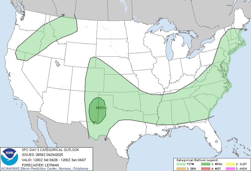
The SPC has included us inside their “SLIGHT” risk category for severe weather Thursday. The outlook map below begins at 7am Thursday. Given the fact we’re on the west edge of the outlook area, we can conclude the SPC thinks the squall line will arrive Thursday morning after 7am. 
National Weather Service (NWS)
Our National Weather Service office agrees. They think our ETA is Thursday morning:
IMPORTANT DIFFERENCES REMAIN BETWEEN MODELS CONCERNING CONVECTIVE TIMING WITH THE GFS MODEL REMAINING A CONSISTENT FAST OUTLIER. WE ARE TRENDING TOWARD THE SLOWER NAM AND EUROPEAN MODELS, WHICH WILL FOCUS STORM CHANCES IN THE LATE WED NIGHT TIME FRAME WEST...THURS MORNING I-65 CORRIDOR...THEN LATER IN THE AFTERNOON ON THE PLATEAU.
There Will Be (Severe?) Storms Thursday. We Don’t Know What Time.
Discussing Thursday’s severe weather this afternoon, our NWS said:
TIMING REMAINS QUITE UNCERTAIN FOR WHEN PRECIP ARRIVES ... LATE WEDNESDAY NIGHT OR THURSDAY...AND HAVE GONE WITH A BLEND OF THE TWO MODELS FOR NOW IN COORDINATION WITH SURROUNDING NWS FORECAST OFFICES. DESPITE LOW CONFIDENCE IN TIMING...THERE IS HIGH CONFIDENCE IN WIDESPREAD SHOWERS AND STORMS OCCURRING...
Squall Line Expected Sometime Thursday. Damaging Winds Likely. Few Tornadoes Possible
NWS: We May Have Severe Weather (A Few Tornadoes?) Thursday
During the afternoon discussion about Thursday’s storm potential, our NWS said:
THE SETUP LOOKS LIKE A QLCS EVENT FOR MID TN WITH THE POTENTIAL FOR A FEW TORNADOES. THERE ARE STILL A LOT OF UNCERTAINTIES REGARDING TIMING AND DETAILS...SO PLEASE MONITOR UPDATED FORECASTS AND OUR HAZARDOUS WEATHER OUTLOOK CLOSELY OVER THE NEXT FEW DAYS.


