
The storm line itself is moving east very, very slowly. It weakened considerably overnight. This morning, the line is located between Memphis and Nashville. There are no watches or warnings in effect.
The storms inside the line are moving north-north-east.
As the line itself crawls east over Davidson & Williamson Counties, storms are expected to “regenerate,” move north-north-east inside the line, and likely strengthen into strong or severe thunderstorms. Our NWS:
THUNDERSTORMS WILL STRENGTHEN AFTER 8 AM THIS MORNING WITH THE
ACTIVITY LIKELY APPROACHING SEVERE LEVELS BY 10 AM OR NOON ACROSS
WESTERN AREAS OF THE MID STATE. THE SEVERE THREAT WILL THEN MOVE
EASTWARD THROUGH THE DAY WITH THE THREAT REACHING THE PLATEAU
BETWEEN 5 PM AND 8 PM. WE ARE STILL LOOKING AT DAMAGING WINDS
BEING THE PRIMARY SEVERE WEATHER THREAT. HOWEVER...LOW LEVEL
SHEAR APPEARS TO BE STRONG ENOUGH SO THAT ISOLATED TORNADOES
CANNOT BE RULED OUT.
The best severe wx potential for us is from noon to 3pm today:

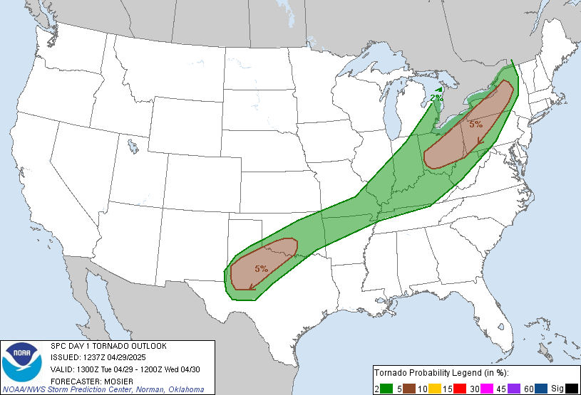
The Storm Prediction Center quantifies our risk. The 9am update includes a 2% chance of a tornado happening within 25 of you:
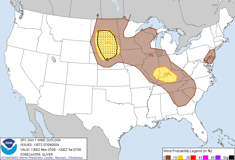
The chance of damaging wind occurring within 25 miles of you is 15%:
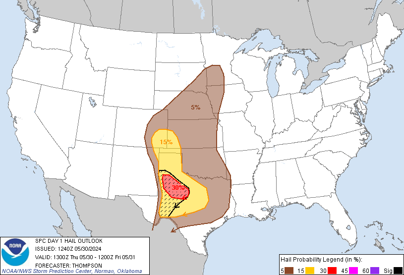
The chance of 1″ hail happening within 25 miles of you is 5%:
As for rain, the Weather Prediction Center estimates over 1.50″ today:
 Outdoor sports activities are looking mighty grim.
Even though this is a marginal severe weather event, please keep an eye on it through the day. We will be on a 9:30am conference call with the NWS this morning, and will pass along new information then. Check out the twitter feed on this page for more details throughout the day.
Categories: Forecast Blogs (Legacy)