

It’s been quite the lovely Labor Day weekend. Can’t totally rule out a stray shower tonight, but it looks unlikely.
Higher rain chances come around Tuesday.
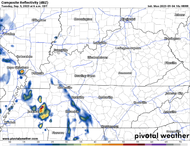
HRRR model (above) shows maybe some light showers to start the morning, followed by on/off rain/storms in the afternoon/evening. Not worried about severe weather, but some heavy rain, gusty winds and lightning are possible.
Wednesday we’ll have additonal rain/storm chances.
The Storm Prediction Center has outlooked basically west of I-65 with a 5% chance of severe weather within 25 miles. Specifics still have to be worked out, but generally damaging straight-line winds and hail would be the threats, not concerned about tornadoes. Timeframe looks afternoon/evening right now.
Rain chances and temps relax a bit as we hit the back of the week. Upcoming weekend shaping up to be splendid.
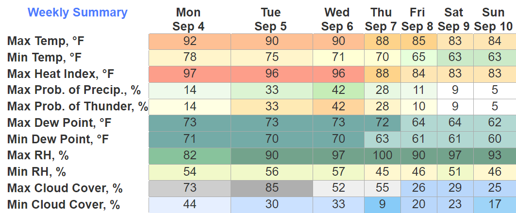
Quick References:
Weather changes constantly.
Follow @NashSevereWx on Twitter for any changes to this forecast.
Live coverage during tornado and severe thunderstorm warnings:

Look good.
Support the mission.

We are 100% community supported. No ads. No subscription fees. Keep it free for everyone.


Categories: Forecast Blogs (Legacy)
You must be logged in to post a comment.