
Plenty of sun propelled our temps all the way up to the mid 60s. Nice evening if going out to dinner.
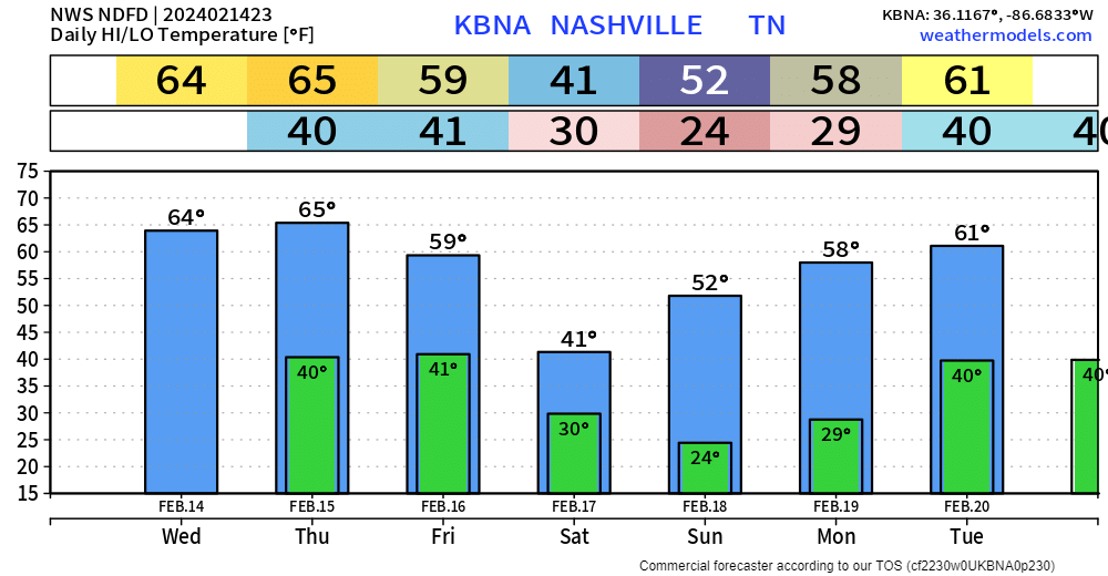
Tomorrow will be a near copy and paste of today. Sun and high temps back in the mid 60s.
Friday…not quite as nice.
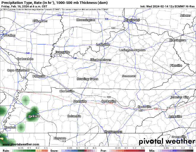
Euro model (above) shows:
- rain chances moving in around midday Friday
- chances will stick around thru Friday night
- “Overall the cold air looks to arrive after most of the precip with little to no snow accumulation expected…” – NWS Nashville
- not expecting a repeat of the other night with this system…
Saturday, we dry out but stay chilly, highs only expected to make it into the low 40s. We’ll cover quickly as we get into next week, but mornings will be chilly.
“A weak disturbance will move over the area late Monday into early Tuesday, possibly bringing a few rain showers. Otherwise, no major wx events are in sight.” – NWS Nashville
Categories: Featured Blog